
Phoenix: Exploring the Northern Polar Region of Mars PowerPoint PPT Presentation
1 / 25
Title: Phoenix: Exploring the Northern Polar Region of Mars
1
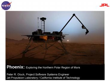
Phoenix Exploring the Northern Polar Region of
Mars Peter R. Gluck, Project Software Systems
Engineer Jet Propulsion Laboratory / California
Institute of Technology
2
Why Phoenix?
- FOLLOW THE WATER
- Analyze Martian ice (water)
- Could the region support life?
- Study Martian weather
- Key to human exploration
- In 2003, the Gamma Ray Spectrometer aboard the
Mars Odyssey spacecraft detects large quantities
of hydrogen just below the surface of Mars at the
poles - Water is the most abundant source of hydrogen on
planet Earth - Phoenix was conceived to determine if there is
water, and if so, how much there is and whether
it may ever have harbored life
3
Phoenix Partners
- Phoenix is a collaboration between
- The University of Arizona, Tucson, AZ
- NASAs Jet Propulsion Laboratory, Pasadena, CA
- Lockheed Martin Space Systems Company, Denver, CO
- With international contributions from
- The Canadian Space Agency
- The University of Neuchatel, Switzerland
- The Universities of Copenhagen and Aarhus,
Denmark - The Max Planck Institute, Germany
- The Finnish Meteorological Institute, Finland
4
Mission Phases
Cruise
Launch
Entry, Descent, and Landing
Surface
5
Destination
LaunchAugust 4, 200710 month journey of 422
million miles
DESTINATION Mars Northern Polar Region
EARTH ANALOGY
6
EDL Entry, Descent, and Landing
7
Telecommunication
Mars Express
MRO
Odyssey
- Communication with the Phoenix lander is via UHF
relay from one of three orbiting assets - Mars Reconnaissance Orbiter (MRO)
- Mars Odyssey
- Mars Express
- Several overhead passes from each orbiter each
day - Phoenix does not have a direct-to-earth
communcations capability after jettisoning the
cruise stage
8
Science Instruments
Robotic Arm (RA) JPL
Surface Stereo Imager (SSI) University of Arizona
Microscopy, Electrochemistry Conductivity
Analyzer (MECA) JPL
Thermal Evolved Gas Analyzer (TEGA) University of
Arizona
Robotic Arm Camera (RAC) Max Plank Aeronomie
Meteorological Package with scanning
LIDAR Canadian Space Agency
- On the surface, Phoenix operates six (!)
instrument packages in complex, coordinated
observations
9
Phoenix Software Challenges
- Multiple Operational Scenarios (Mission Phases)
- Single RAD6000 processor
- Fault Detection and Correction
- Autonomous Operation
- 170 million miles, 15 minute light-time
- Sleep Cycles
- UHF Relay
- Control Spacecraft Functions
- Attitude
- Commanding
- Communications
- Data Handling
- Power
- Propulsion
- Control Multiple Instruments
- Updateable In-Flight
- High Reliability
10
Mission Phases
11
Software Summary Platform
- Single RAD6000 processor
- Similar to PPC601
- Radation hardened for space use
- First used on Mars Pathfinder
- Last planned use on Phoenix
- Supplanted by RAD750
- 20 MHz clock speed
- 74 MB DRAM
- Additional FLASH memory
- Software Codebase in C
- VxWorks RTOS
- GreenHills compiler
- Software Architecture
- Multiple tasks with interprocess communication
- Can be updated in flight
12
Spacecraft Control
- Attitude
- Sun-pointing (Launch, Cruise)
- EDL deployments
- Gyrocompassing on surface
- Commanding
- Immediate and sequenced commands
- Communications
- X-band (Launch, Cruise)
- UHF (EDL, Surface)
- Data Handling
- CCSDS Telemetry Frames Packets
- Consultative Committee for Space Data Standards
- Overnight storage of critical data
- Power
- Cruise solar array (Cruise)
- Landed solar array (Surface)
- Battery (All)
- Propulsion
- Trajectory Correction Maneuvers (Cruise)
- Powered Decent (EDL)
13
Fault Detection Correction
- Operate autonomously for at least 3 days
- Keep the spacecraft safe
- Prevent damage to instruments or components
- Monitor FSW health
- Reboot system if suspect
- Switch to redundant components or systems
14
Autonomous Operation
- 170 million miles, 15 minute light-time
- No maintenance calls
- No real-time system monitoring
- Problems can only be overcome by swapping to
redundant systems / components or uploading new
FSW - Sleep Cycles
- Power constrained only operate during peak
daylight hours - Sleep at night to conserve power
- Shutdown and restore system
- Save data to non-volatile memory
- Restore data and execute appropriate commands
upon wakeup - UHF Relay
- Establish Proximity-1 link with orbiters at
appropriate times
15
Surface Functions
- Control Multiple Instruments
- MET, RA, RAC, SSI, MECA, TEGA
- Coordinated observations, for example
- RA scoops soil
- RAC images soil sample
- RA moves to delivery position
- SSI images RA position
- RA delivers to TEGA or MECA
- RAC images delivery
- TEGA / MECA perform experiments
- GOAL Deliver icy samples within 10 minutes to
minimize sublimation
16
Meteorology Package (MET)
- OBJECTIVE Monitor polar weather patterns
- Pressure-Temperature (PT) Experiment
- Three temperature sensors mounted on 1m mast
- One pressure sensor
- LIDAR
- Zenith-fixed orientation
- Two-frequency (green, IR) laser system
- Measures atmospheric opacity, reflectivity
- Detects overhead dust and clouds
- Coordinates with SSI atmospheric imaging
17
Robotic Arm (RA)
- OBJECTIVE Excavate and deliver soil to MECA,
TEGA - Aluminum / Titanium, 2.35 m
- Four joints
- Equiped with
- Scoop
- Scraping Blade
- Rasp
- Thermal and Electrical Conductivity
Probe (MECA) - RAC
- Coordinates with MECA, RAC, SSI, TEGA
18
Robotic Arm Camera (RAC)
- OBJECTIVE Image surface and
- soil deliveries
- Attached to RA forearm
- Provides LED illumination
- Red, Green, Blue
- Peers into RA scoop or at external targets
- Moveable focus from 11mm to infinity
- Resolution of 23 microns per pixel at closest
focus - Spirit Opportunity resolution was hundreds of
microns - Coordinates with RA, MECA, TEGA
19
Stereo Surface Imager (SSI)
- OBJECTIVE Context imaging and digital elevation
mapping - (depth perception)
- Two one-megapixel CCDs
- Twelve filters for each eye
- Includes color, infrared, and clear filters
- Perched 2 m above the surface at roughly human
height - Full 4-pi-steradian field-of-view
- 360-degree azimuth
- 180-degree elevation
- Coordinates with MET, MECA, RA, TEGA
20
Microscopy, Electrochemstry, and Conductivity
Analyzer (MECA)
- OBJECTIVE Determine soil
- composition and chemistry
- Four-in-one science kit
- Wet Chemistry Cells (4)
- Twenty-six electrodes measure pH, ions
- Optical Microscope
- Resolution of up to 2 microns
- Red, Green, Blue, and UV illumination
- Atomic Force Microscope
- Resolution of up to 100 nm
- Thermal and Electrical Conductivity Probe
- Three-pronged fork inserted into soil
- Located on the Robotic Arm
- Coordinates with RA, RAC, SSI
21
Thermal and Evolved Gas Analyzer (TEGA)
- OBJECTIVE Determine soil
- composition and chemistry,
- including quantity of water
- Eight Differential Scanning Calorimeters (Ovens)
- Measures material present by energy of phase
change - Can bake samples to 1000 C
- Mass Spectrometer
- Measures atomic masses and isotopes
- Coordinates with RA, RAC, SSI
22
Verification and Validation of Phoenix FSW (1 of
2)
- Analysis
- NASA Independent Verification Validation
- Requirements Analysis
- Software Analysis
- http//www.ivv.nasa.gov
- JPLs Laboratory for Reliable Software
- Static Analysis
- http//eis.jpl.nasa.gov/lars/
23
Verification and Validation of Phoenix FSW (2 of
2)
- Testing
- Functional Verification Testing
- Verifies software requirements
- System Verification Testing
- Validates system functionality
- Risk Reduction Testing (a.k.a. Stress testing)
- Additional validation of system
- Explore operational boundaries
- Testbeds
- Software-based (workstations)
- Hardware-based (embedded)
24
EDL Entry, Descent,and Landing
25
Questions
Recommended
