
Regional Geologic Controls, Geochemical Characteristics, and Thermal Infrared Signatures of Geotherm PowerPoint PPT Presentation
1 / 29
Title: Regional Geologic Controls, Geochemical Characteristics, and Thermal Infrared Signatures of Geotherm
1
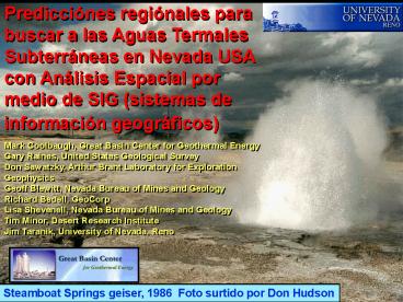
Predicciónes regiónales para buscar a las Aguas
Termales Subterráneas en Nevada USA con Análisis
Espacial por medio de SIG (sistemas de
información geográficos) Mark Coolbaugh, Great
Basin Center for Geothermal Energy Gary Raines,
United States Geological Survey Don Sawatzky,
Arthur Brant Laboratory for Exploration
Geophysics Geoff Blewitt, Nevada Bureau of Mines
and Geology Richard Bedell, GeoCorp Lisa
Shevenell, Nevada Bureau of Mines and Geology Tim
Minor, Desert Research Institute Jim Taranik,
University of Nevada, Reno
Steamboat Springs geiser, 1986 Foto surtido por
Don Hudson
2
Energía Geotermal se está Renovando en E.U.
- Precios Energicios estan incierto
- Estado de Nevada Renewable Energy Portfolio
Standard - 5 in 2003, 2004 15 by 2013
- 100 MWe de nuevos contratos se están
cumpliendo - Congreso
- Posible relieve de impuestos
Foto Chris Sladek
3
Great Basin Center for Geothermal Energy
Dr. Jane Long, Directora Dr. Lisa Shevenell,
Directora Associada
- University of Nevada, Reno
- Mackay School of Earth Sciences and Engineering
- Programa interdisciniplinaria en
Hidrología/Hidrogeología - Nevada Bureau of Mines Geology
- Nevada Seismological Laboratory
- Desert Research Institute
- División de Ciencas Hidrologicas
Beowawe, foto Jack Quade
4
Metas
- Acelerar adquisicion, organizacion, y conexion de
datos sobre recursos geotermales del Great
Basin. - Facilitar acceso rapido and facil a datos para
los interesados en el dessarollo de recursos
geotermales. - Fomentar investigaciones scientificas entre
academias y industrias para acelerar
aplicaciones. - Estimular conciencia publica sobre la energia
geotermal y sus ventajas de uso.
Foto Greg Arehart
5
SIG Geotermal
Sistemas Geotermales del Great Basin
sobrepuesto encima del modelo de elevación
colorido ? sistemas geotermicos Gris oscuro
T ? 160C Gris ligero T ? 100C ? Fabrica de
energía geotermal
1st Projecto Academico - Recoger datos -
Visualizar datos - Identificar
projectos Análisis Espacial - cuantificar
relaciónes - delimitar potenciales geotermales
6
Explotación de sistemas geotermales para la
produción de energía electrica en el mundo
Great Basin 585
170
23
16
785
20
547
Mexico
25
29
850
4
1,909
407
54
California 1,600
590
Capacidad instalado (MWe) en Azul (Cifras surtido
de IGA para 2000)
437
Niveles bajos de actividad volcanico en el Great
Basin les señalan a nuestras sistemas
geotermales como algo unico
Total 8,074
Adaptado de Dr. Greg Arehart
7
Dos Clases de Sistemas Geotermales (Koenig and
McNitt, 1983 Wisian, Blackwell, Richards, 1999)
Sistemas Geotermales Magmáticas -
asociado con vulcanismo silíceo muy joven
Sistemas Geotermales
Extensiónales
- asociado con fallas recientes y altos
niveles de corrientes caloríferos
regiónales
Hot Creek, Mammoth, CA.
Bradys Hot Springs, NV.
8
Newberry Crater
Sistemas Geotermales en Nevada y Great Basin, USA
Big Southern Butte
China Hat
Borax Lake
Medicine Lake
Roosevelt/ Cove Fort
Mammoth
Coso
Boundary of Great Basin
Current capacity 600 MWe
9
The Great Basin Many geothermal systems may
remain hidden Widespread high-temperature
geothermal occurrences, Extensive desert terrain,
Locally deep water table, Laterally-flowing
aquifers, Sand dunes
Hot Springs Mountains, Churchill County, NV.,
Desert Peak geothermal system Not all geothermal
systems occur along classic range-front faults
10
Trend Surface of Known Geothermal Systems
In terms of temperatures, geothermal resources
are unequally distributed in the state
11
- Active faults
- Earthquakes
- - Recent volcanism
- High heat flux
INDICACIONES GEOTERMALES
- Hydrothermal alteration
- Groundwater
- geochemistry
12
Quakes (NV Seismo Lab)
Young Faults (NBMG/USGS)
Young Volcanics (USGS)
Heat flux (SMU)
Statistical Methods Weights-of-Evidence Logistic
Regression Fuzzy Logic
Depth to Groundwater (NWIS)
PZ Carbonates (NBMG)
Boron, Groundwater (NWIS)
13
Increasing Favorability
7-Layer Density Function Model Weighted by heat
flux, earthquakes faults, volcanics, groundwater
chemistry, groundwater table, and Paleozoic
carbonate host rock.
Logistic Regression Map 5 Evidence Layers
Unaffected By Groundwater Phenomena
14
Contouring with 300 km range of influence
Hybrid Heat Flux - Strain Rate Map Heat Flux
Strain Rate (2nd Invariant of strain) darker
values indicate higher values of heat flux or
higher values of strain rate or both.
15
Relationship with northeast-trending structures
noted by Rowen Wetlaufer (1981), Koenig and
McNitt (1983), Ted DeRocher (verbal commun.)
16
Late Pleistocene and Younger Faults
Faults Compiled from State Maps
(from USGS DDS 41, J. Dohrenwend)
(from USGS DDS 41, D. Sawatsky)
Statistical preference of high-temperature
geothermal systems with northeast-trending young
structures was confirmed using Weights-of-Evidence
? 160C
17
Faults Compiled from State Maps
Weights of Evidence
Is it significant if 90 of geothermal systems
lie within 20 km of a fault?
What if 90 of the entire state of Nevada
(exclusive of geothermal systems) lies within 20
km of a fault?
? 160C
(from USGS DDS 41, D. Sawatsky)
18
Faults Compiled from State Maps
Weights of Evidence
Is it significant if 90 of geothermal systems
lie within 20 km of a fault?
divided by
What if 20 of the entire state of Nevada
(exclusive of geothermal systems) lies within 20
km of a fault?
W Ln ( 0.9 / 0.2 ) W- Ln ( 1 - 0.9 ) / (
1 - 0.2 ) Contrast ( W - W- )
? 160C
(from USGS DDS 41, D. Sawatsky)
Likelihood ratio
19
Cumulative Contrast Geothermal Systems with Faults
20
(No Transcript)
21
(No Transcript)
22
NV. UT.
CA. NV.
NV. AZ.
Continuous GPS velocities, eastern CA, western
NV, with respect to the Sierra Nevada-Great
Valley microplate. From Bennett et. al. flyer,
2000.
Holt, Kreemer, Stony Brook Davis, Bennett,
Harvard
23
Strain Rate Tensor estimated from GPS Velocities
Strain Rate field characterized by four
independent variables 1) Dilitation 2)
Rotation 3) Shear 1 4) Shear 2
24
Dominant Azimuth
Coherence
Calculations made with LinAnl
25
Rate of Extension Normal to Dominant Azimuth of
Faults
Strain Rate Scale in Units 1 mm per yr / 1000 km
26
Trend Surface of Geothermal Systems
27
(No Transcript)
28
The End
29
Statistical Applications Geothermal GIS
Bradys Hot Springs
N
Desert Peak
Upsal Hogback
Soda Lake
1) Quantification of relationships 2) Predictive
Maps
Recommended
