
Dedicated to some Australian leaders of world VLBI : PowerPoint PPT Presentation
1 / 61
Title: Dedicated to some Australian leaders of world VLBI :
1
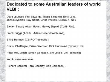
Dedicated to some Australian leaders of world
VLBI Dave Jauncey, Phil Edwards, Tasso
Tzioumis, Emil Lenc, John Reynolds, Ray Norris,
Chris Phillips (CSIRO ATNF), Steven Tingay,
Aidan Hotan, Hayley Bignall (Curtin Uni), Frank
Briggs (ANU), Adam Deller (Swinburne), Shinji
Horiuchi (CSIRO Tidbinbilla) Shami Chatterjee,
Brian Gaensler, Dick Hunstead (Sydney Uni) Peter
McCulloch, Simon Ellingsen, Jim Lovell (Uni
Tasmania) and Aussies overseas Richard
Schilizzi, Tony Beasley, Don Campbell,
2
What can VLBI do for you? Radio Astronomy in the
Public Interest John Dickey University of
Tasmania ASA Harley Wood Lecture 7 July 2008
Harley Wood ca. 1964 at home in the Sydney
Observatory
3
Ros Wood Madden, Harleys daughter, quoted in Two
People and a Place by Roslyn Russell
2008 http//www.rrms.com.au/
As a child it was a treat to go up the tower on
Saturdays to drop the ball with Dad when he was
on duty. He would carry one of the chronometers
so as to get the time exactly right, and we would
climb all the steps (more like ladders actually)
past the old dusty volumes of Observatory records
stored on the tower shelves When we reached the
top of the tower, the ball was powered upwards to
its highest point and, with a keen eye on the
chronometer, Dad would release the ball which
fell with a pneumatic exclamation at 1 PM sharp,
giving a couple of gassy bouncing sighs as it
came to rest at the bottom of its pole. Then
down we would climb together and go back into the
house for lunch.
4
- Outline
- History and Technical Development of
VLBI (Very Long Baseline Interferometry) - Applications to Astronomy and Geodesy
- Present and Future in Australia
5
VLBI became possible in the mid-1960s when
atomic clocks were available at reasonable cost
to radio observatories. It was suggested by
Matveyenko et al. (1965 Soviet Radiophysics 8,
461) and Slysh (1965, Soviet Physics Uspekhi 8,
852), but first attempted in Canada and the US in
1967 (Broten et al. Nature 215, 38, Bare et al.
Science 157, 189) and in the US by Kellerman,
Jauncey, and Cohen (Kellerman and Moran ARAA 39,
457) Intercontinental VLBI developed rapidly in
the next three years.
6
April 1967
7
May - August 1967
8
1969 - Green Bank to Sweden
1969 - Green Bank to USSR - Crimea
1970 - Green Bank to Tidbinbilla
9
- Early VLBI struggled with many technical
challenges - There were no accurate time transfer services,
so atomic clocks had to be carried from
observatory to observatory. - Recording bandwidths were limited by tape
recorder speeds and densities to a few MHz. - Correlation was compute intensive, requiring
special purpose hardware and thus long delays. - Telescope scheduling was ad-hoc and operations
depended on the good will of many contributors. - The number of baselines was small, so images
were low-fidelity and low sensitivity. - The locations of the telescopes themselves were
not known with sufficient precision (small
fraction of a l).
10
(No Transcript)
11
150 to 200 K
from Tom Clark, 2006, IVS - V2C conference
presentation
12
The 1980s saw the construction of dedicated VLBI
array telescopes in the Northern Hemisphere, such
as the US VLBA and the European EVN. Bandwidths
got broader as tape recorders got faster.
Recently disks have replaced tapes, and now
optical fibre data transmission (eVLBI) allows
real time correlation of the data collected from
telescopes across the world.
13
The greatest advance in VLBI in the 1990s came
with the launch of VSOP, the VLBI space
observatory program, by the Japanese space
agency, JAXA, in 1997. The orbiting telescope
worked with ground stations and ground antennas
for 6 years. JAXA plans to launch VSOP-2 in 2011.
14
Ap. J. Supp. 141, 311 (2002) Note that the first
eight authors are in Australian institutions!
15
2 milli arc seconds 50 pc at z 1.19
A typical image of a quasar at z1.2. This one
was known to have two bright components, plus
several others that come and go, some moving at
an apparent speed of 10 c (superluminal velocity)
probably as part of an expanding radio jet. Note
that the rest frame brightness temperature is 1.3
x 1012 K, near the inverse Compton limit.
16
A few more examples of recent VLBI accomplishments
, Galactic, extragalactic, and star formation
applications
17
Chatterjee et al. (2005 Ap J 630, L61) 2 year
project on the VLBA.
Pulsar B150855 VLBI distance 2.37 0.2 kpc,
proper motion vt 1083 100 km s-1
With such a strong kick velocity, due to an
asymmetric SN explosion and binary disruption,
this pulsar will surely escape the Milky
Way. Conclusion Galaxies leak neutron stars and
black holes.
18
Brunthaler et al. 2006 EVN conf.
19
- Reid and Brunthaler 2004
- Ap. J. 616, 872.
- This gives a value for the angular speed of the
LSR around the centre of the Milky Way Galaxy. - LSR 29.45 0.15 km s-1 kpc-1
- or vsun 24115 km s-1
- if R0 8.0 kpc
- The component in latitude
- is vsun 7.6 0.7 km s-1
- from Hipparchos
- vsun 7.17 0.38 km s-1
20
Computer simulation of accreting X-ray binary
21
Meanwhile, as VLBI evolved as a radio astronomy
technique, its power as a geodetic measurement
tool was also developed. VLBI is used to
construct a frame of reference, the International
Celestial Reference Frame (ICRF) that is used to
define the fundamental reference frame for
locations on the Earth, called the International
Terrestrial Reference Frame (ITRF). This is the
basis for positions given by GPS and other global
navigation satellite systems (GNSS). The World
Geodetic System most recently defined in 1984
(WGS 84) has precision of about 1 m. The ITRF
has precision about 10 cm, this is the ultimate
limit for GPS.
22
VLBI measurements of continental drift
http//lupus.gsfc.nasa.gov/vlbigallery.htm
23
- Precise measurement of continental drift, and
other fundamental geodetic processes, is best
done by a combination of several techniques - GPS and/or other satellite navigation
- calibration of satellite positions by laser
ranging - ultra-precise gravimetry, or gravitational
- acceleration measurement
- calibration of the datum, or geodetic reference
frame, by VLBI.
24
How does GPS work?
25
GPS provides location information by sending time
and ephemeris data on many different paths at
once.
26
Applications of GPS mobile phones are
multiplying!
Bus locations in East Bay, California from
http//www.nextbus.com/
27
To improve the precision of GPS and all other
global navigational satellite systems (GNSS)
requires more accurate definition of the
reference frame of the surface of the
earth. This is the mission of the International
VLBI Service for Astronometry and Geodesy (IVS).
28
Earth Gravitational Model - based on
perturbations in satellite orbits and sensitive
gravimeters. This defines the datum, or
reference surface of zero elevation, for defining
positions.
29
- Components of the International Earth Rotation
- and Reference Systems (IERS)
- VLBI by the International VLBI Service (IVS)
- Satellite measurements
- Satellite Laser Ranging (SLR)
- Global Positioning System (GPS)
- Doppler Orbit Determination and
Radiopositioning Integrated on Satellite (DORIS) - These measure
- UT1-UTC, polar motion, and celestial motion of
the pole (VLBI) and - short time variations of polar motion and UT1,
continental drift, sea level rise, (satellites)
30
UTas is a member of the International VLBI Service
The IVS is a collaboration of 29 radio telescopes
that keep track of the Earth Orientation
Parameters, numbers that tell how fast the earth
is rotating and which way the axis is pointing.
These are used to calibrate GPS and all
other satellite navigation systems.
31
Stations of the International VLBI Service
32
The International VLBI Service supplies precise
measurement of the rotation of the earth relative
to the celestial reference frame, an inertial
frame defined by the distant quasars and active
galaxy nuclei.
33
Motion of the earths polar axis (north) measured
on the sky, relative to extragalactic radio
sources. 1 mas 10-9 of a circle
(one 4-millionth of a degree) 3 cm on the
earths surface
34
(No Transcript)
35
get this data from http//hpiers.obspm.fr/eop
-pc/index.html
The length of a day varies by a few hundred
micro-seconds each day. This is partly
predictable, partly unpredictable.
36
(No Transcript)
37
Polar motion and day length variations can be
explained pretty well with physical models of the
Earths moment of inertia.
38
To bring Southern Hemisphere geodesy up to the
same precision as in the Northern Hemisphere the
Australian Research Council set up AuScope
(NCRIS 5.13)
Structure and Evolution of the Australian
Continent
Chief Investigator Michael Etheridge Project
Scientist Kurt Lambeck Geodesy Project Manager
Gary Johnston Universities involved ANU,
Curtin, Macquarie, Monash, Swinburne, Adelaide,
Melbourne, Queensland, Sydney, Tasmania,
WA Institutions CSIRO, Geoscience
Australia, State Geo. Surv. Queensland, WA, NSW,
NT, Vict., ACT, SA, Tas, , NASA
39
seismic and MT imaging budget 8M
5M virtual core library
3 8 geochemical analysis
3 39 geospatial
framework 17
48 VLBI SLR GNSS Gravity simulator
8
11 grid
6 3
40
Under AuScope, three new 12m antennas will be
built in Australia (UTas) and a new correlation
facility will be built to handle the data (Curtin
Uni). The AuScope array will be hugely
significant for southern hemisphere geodesy, and
thus for all applications of satellite navigation
and positioning that require precision lt 10
cm. It will also be an immense improvement to
our astronomical VLBI capability
41
U Tas Radio Telescopes are the Backbone of Very
Long Baseline Interferometry in Australia
42
- The Four Element LBA, with
- Parkes
- Narrabri (1 elt)
- Mopra
- Tidbinbilla
128 mas at 5 GHz
FWHM 16 mas
43
U Tas Radio Telescopes are the Backbone of Very
Long Baseline Interferometry in Australia
44
- The Six Element LBA, with
- Parkes
- Narrabri (1 elt)
- Mopra
- Tidbinbilla
- Hobart
- Ceduna
128 mas at 5 GHz
FWHM 8 mas
FWHM 8 mas
45
Katherine
Yarragadee
46
- The Eight Element LBA, with
- Parkes
- Narrabri (1 elt)
- Mopra
- Tidbinbilla
- Hobart
- Ceduna
- Yarragadee
- Katherine
128 mas at 5 GHz
FWHM 5 mas
47
Observing a synthetic source at ? -88o with
UVCON
peak flux ratio 0.37 total flux ratio 0.034
50 mas at 5 GHz
as seen with the new array
as seen with the 6 element array
as seen without the UTas telescopes
48
Things are not so nice at declination -45o
4 element array
6 element array
8 element array
49
Recent Progress
In addition to the AuScope array, New Zealand is
constructing one 12m telescope to be dedicated to
VLBI for geodesy and astronomy.
Principal Investigator Sergei Gulyaev Auckland
University of Technology
contract for first antenna signed by UTas
February 2008 contract for three H masers signed
by UTas June 2008 building permit for first
antenna granted June 2008
50
The three IVS stations at high southern latitudes
regularly operating today.
51
The six IVS stations at high southern latitudes
regularly operating in 2011.
52
Oleg Titov (Geoscience Australia) 2008 Proc.
General Meeting IVS
53
Conclusion VLBI is making great progress in
Australia. This will support our bid for the SKA.
Hobart 26m
Ceduna 30m
54
(No Transcript)
55
(No Transcript)
56
(No Transcript)
57
(No Transcript)
58
This is part of a project for geodetic research
funded under NCRIS 5.13
Structure and Evolution of the Australian
Continent
Chief Investigator Michael Etheridge Project
Scientist Kurt Lambeck / Paul
Tregonning Project Manager Gary
Johnston Universities involved ANU, Curtin,
Macquarie, Monash, Swinburne, Adelaide,
Melbourne, Queensland, Sydney, Tasmania,
WA Institutions CSIRO, Geoscience
Australia, State Geo. Surv. Queensland, WA, NSW,
NT, Vict., ACT, SA, Tas, , NASA
59
seismic and MT imaging budget 8M
5M virtual core library
3 8 geochemical analysis
3 39 geospatial
framework 17
48 VLBI SLR GNSS Gravity simulator
8
11 grid
6 3
60
Conclusion The AuScope array will operate 50
time for geodesy. The rest of the time will be
available for other research, provided extra
operations and capital costs are covered This
will be a huge improvement in the LBA
capabilities, particularly for bright sources and
for astrometry.
61
(No Transcript)
Recommended
