
Multilayered, interdisciplinary mapping of a wilderness watershed: "The Big Onion" PowerPoint PPT Presentation
1 / 30
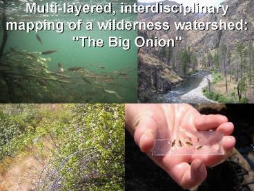
Title: Multilayered, interdisciplinary mapping of a wilderness watershed: "The Big Onion"
1
Multi-layered, interdisciplinary mapping of a
wilderness watershed "The Big Onion"
2
The Big Onion Part 1
Colden Baxter Ecologist
Jeremy Monroe Fisheries biologist
Joe Ebersole Fisheries biologist
Joe Giersch Invertabrate ecologist
Jason Beck Bats
Jen Pierce Geomorphologist
Kate Dwire Botanist
Christian Torgersen Landscape Ecologist
3
The Big Onion project goals
- To generate a spatially continuous biophysical
map of the watershed - To bring together a multi-disciplinary team to
identify important biophysical patterns - To integrate ecosystem-level research in the
watershed
4
Preliminary Geomorphic Mapping How does
geomorphology influence the stream channel and
riparian area?
- Channel gradient (slope)
- Channel clast size
- Talus input
- The presence and elevation of stream-side
terraces - Lithologically-driven changes in nutrient
availability - Sediment input from tributaries
- Channel confinement
5
Big Creek study reaches
6
Confluence to Gorge
- Channel gradient 0.015
- Steep and confined
- Bedrock channel and limited floodplain
- Significant talus input
- What does that mean?
- Stream horizontal position fixed
- Stream is unable to transport large boulders
- Generally decreased pool habitat
- Limited hyporheic flow
- Limited floodplain habitat
7
Cabin Creek
- Channel gradient 0.006
- Wide alluvial channel
- Extensive floodplain and terraces
- Likely fault controlled at lower end
- What does that mean?
- Stream migrates horizontally
- Stream can transport its sediment during bankfull
flows - Rapid planform change
- Increased pool habitat
- Enhanced hyporheic flow
- Extensive floodplain habitat
8
Preliminary geomorphic mapping
9
Changes in stream gradient by reach
10
Approx. alluvial border and talus input by reach
11
Clast size distributions confluence reach
12
How does geomorphology mesh with ecology? Total
macroinvertebrate density/square meter by site
Gorge
Cave Creek
Taylor ranch
13
Stay tuned for fish data!
14
Low (Holocene) terraces of Big Creek
- Terraces are former floodplains
- Presence of terraces indicates downcutting
- Preservation of terraces provides riparian
habitat and reduces talus input into channel
15
Low (Holocene) terraces of Big Creek
- Low terraces fall into three categories based on
height above the channel - Approx. ages based on comparable dated terraces
in the S.F. Payette - 1.5 m terrace (500-1000 yrs old)
- 4-5 m terrace (4,000 yrs old)
- 10 m terrace (6-8,000 yrs old)
16
Influence of low terraces on channel habitat
- Low terraces characteristic of alluvial reaches
(channel can adjust) and are associated with
increased riparian vegetation, decreased talus
input to channel, likely increased hyporheic
flow, and changes in habitat types (pools, riffle
distribution)
17
High terraces of Big Creek
- High terrace surfaces 150-60 meters (500 to
200 ft) above the current channel of Big Creek
indicate some past interval of vertical channel
stability and alluviation, followed by incision. - Given the current channel is deeply incised into
bedrock, these high surfaces pose some intriguing
questions. - Are terraces related to climate change? (e.g.
increased sediment loads during past glacial
episodes), - To tectonics (regional changes in base level)?,
- To local changes in base level (e.g. landslides,
dam construction)? - High terraces are also found on the Middle Fork
Salmon River (Meyer and Leidecker, 1999), the
highest of which is 110 meters above the current
channel. The 110 m terraces (370 ft) are
estimated to be between 0.4 and 1.1 million years
old.
18
Cougar Creek terraces as seen from Soldier Bar.
Note slope of upper terrace/fan complex. Note
sloping bedrock exposed in cut (with fill on top?)
19
Soldier Bar Evidence of past channel-blocking
landslides?
20
Evidence of past landslide dammed lakes?
- Just downstream of the confluence of Big Creek
and the Middle Fork Salmon, Meyer and Leidecker
(1999) have linked a landslide scarp to upstream
deposits of fine-grained lake sediments which
date to 14,500 cal yr BP. - The inferred maximum elevation of the lake was
3620 ft, which would have flooded Big Creek up
to the vicinity of Burnt Creek. - Lake sediments exposed by Bighorn Sheep diggings.
- On Big Creek below Snake Creek, Bighorn Sheep
were observed digging at light colored
fine-grained sediments at 3620 ft elevation. - Other lake deposits have been found in the Big
Creek area (Lifton, MA thesis ISU).
21
Whats next?
22
(No Transcript)
23
(No Transcript)
24
(No Transcript)
25
Reach classification I have defined four reaches
between the confluence of Big Creek and the MF
Salmon and the upper end of the Cabin Creek
alluvial valley based on the following
criteria 1) Alluvial vs. bedrock channel 2)
Channel gradient 3) Presence and absence of low
alluvial terraces and floodplain 4) Input of
talus boulders into stream channel 5) Channel
confinement (relates directly to above
factors) The reach characteristics are summarized
in Table 1 below. Table 1. Summary of reach
characteristics
26
(No Transcript)
27
(No Transcript)
28
(No Transcript)
29
Benthic sampling site data
30
(No Transcript)
Recommended
