PowerPointpresentatie PowerPoint PPT Presentation
1 / 25
Title: PowerPointpresentatie
1
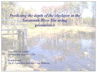
Predicting the depth of the claylayer in the
Savannah River Site using geostatistics
Scas 620, Dr. Lembo Wednesday, may 2nd,
1.30 Karin Rebel, Ph.D. Candidate Soil and Crop
Sciences
2
Outline of the talk
Introduction
Methods
Modeling process
results
discussion
3
Introduction
Ph.D. project Phytoremediation of Tritium
4
Phytoremediation is an emerging technology that
uses either naturally occurring or genetically
engineered plants to remediate contaminated
soils, sediments and water.
Phytoremidiation will be used to reduce the
discharge of tritium from the plume on the
Savannah River into Four Mile Branch.
The system is a combination of hydraulic control
and enhanced evapotranspiration. Tritium
contaminated water is collected in a pond, moved
to a location upgradient of the discharge point,
and used to irrigate plants.
5
My part
- Make a spatial dynamic model of
- the irrigation,
- the soilwater balance,
- the water uptake,
- the evaporation.
Problem Sand over Clay gtgt Lateral runoff
Large spatial variability
6
Hypothesis
The depth of the clay layer can be indicated by
the slope and the value of the DEM.
Assumption is that erosion is the main cause of
the difference in depth of clay layer.
7
Sample points with depth of the claylayer
8
Methods
Software used
Arcview
Arcview is a GIS, having to power to visualize,
explore, query, and analyze data geographically.
PCRaster
PCRaster is a computer program that brings
together environmental modelling and GIS. It
offers a powerful Dynamic Modelling language for
building iterative spatio- Temporal environmental
model, fully integrated in a GIS.
Gstat
Gstat is a computer program for geostatistical
modelling, Prediction and simulation. It is
incorporated in PCRaster.
9
Arcview
Convert to grid, export as ascii
gridclip
Dem
Dem small
Dem.asc
Convert to grid, export as ascii
soil
Soil.asc
Convert to grid, export as ascii
plot
Plot.asc
Export to PCRaster
10
PCRaster
col2map
X and Y coordinates of piezometers
Xypiez.map
asc2map
Dem.asc
Dem5.map
asc2map
Soil.asc
Soil.map
asc2map
Plot.asc
Plot.map
11
Gstat
Inverse distance
Calculates the value at a give location from the
values at sample points in the vicinity.
Variogram model
For the Kriging interpolation, semivariance
values are needed at all distances. Therefore a
variogram model needs to be fitted through the
sample variogram values.
12
Gstat
Ordinary Kriging
The Kriging interpolation uses a variogram model
of the spatial correlation between the
measurement values. For calculating the
predicted value at each prediction location,
Kriging assigns weight to the surrounding
measurements.
Stratified Kriging
Uses ancillary information in order to improve
the Kriging interpolation. It assumes that each
unit has its own specific spatial structure in
the variable to be mapped.
13
Gstat
Inverse distance
Dem.map
Dem5.map
Xypiez.map
Inverse distance
Invxy.prd
Ordinary Kriging
Making variogram model
Ordxy.prd
Stratified Kriging
Strxy.prd
14
Results
Contour of the Dem of the Savannah River Site
15
Contour DEM interpolated by Inverse Distance
16
Inverse distance weighting, using the clay depth
data points.
17
Variogram modeling
Go to Gstat to show the variogram
0.9 Nug(0) 400 Sph(40)
18
Ordinary Kriging, depth of the clay layer in
meter above sealevel.
19
Variances of the ordinary Kriging
20
Clay layer is meter below surface
21
Problem 18 point is not enough to make
the geostatistics work. Actually, for papers,
they ask at least 125 points.
- Problem solving at this moment
- use the inverse distance interpolation of the
- depth of the clay layer.
- select uniformly 40 points
- use these points to make a new variogram and a
- new Kriging model.
Future Plug in the numbers I collect in the
field this summer.
22
Points selected
23
New variogram basically a strait line, which
means that There was not relation between the
variance and the Distance of the numbers.
Therefore, I could not do my Kriging
interpolation.
24
Discussion
Amount of points is very important
Gridsize is very important
The slope and the value of the DEM may be a good
indicator for the depth of the clay layer.
25
Any Questions??

