
IFPS and GFESuite Tech Review an Interactive Forecast Preparation Technique PowerPoint PPT Presentation
1 / 35
Title: IFPS and GFESuite Tech Review an Interactive Forecast Preparation Technique
1
IFPS and GFESuite Tech Review an Interactive
Forecast Preparation Technique
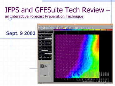
- Sept. 9 2003
2
I decided enough is enough! Ill take a
couple of months off and if I have an urge to
come back part time, it is possible. The lack of
science being put into operations is disturbing,
i.e., GFE and IFPS. MOS is doing better than the
forecasters!
-38-year NWS Veteran
3
National Weather Service Modernization Components
- Office Reorganization into WFOs
- Improved Satellites (GOES-NEXT)
- Doppler Radar (NEXRAD)
- New Forecaster Workstations (D2D)
- New Forecast Paradigm (IFPS/GFESuite)
- New Forecast Products (National Digital Forecast
Database - NDFD)
4
What is IFPS/GFESuite?
- An interactive graphical forecast preparation
system for producing routine forecast products in
various formats. - Currently in operational use by all NWS WFOs.
- Data source for the National Digital Forecast
Database (NDFD)
5
Paradigm Shift From Typing Text to Interacting
with Grids
Pre-IFP Technique
6
How does IFPS/GFESuite work?
- A 7-day digital forecast database is established
at each WFO - Forecasters interactively modify the contents of
the database according to the latest observations
and model guidance. - NWS text, tabular, voice, and graphical products
are generated from the database. - The database itself is provided as an NWS product
to customers and partners.
7
Differences between IFPS and GFESuite
- IFPS operational system in NWS, consisting of
components from FSL and MDL - GFESuite major component of IFPS, developed by
FSL, provided to NWS.
8
Components of GFESuite
Strictly uses grid approach
Products
Ingest/DB
GFE Editors
Spatial Editor
Temporal Editor
Grid Manager
D2D AWIPS Model Data
9
GFESuite Development Approach
10
GFESuite Development Approach (Rapid Prototyping
Project)
- Quick turnaround of software
- 6-8 week cycle typical
- Frequent interaction with forecasters
- Workshops
- Listservers
- Software evaluations
- Mature software delivered to NWS for nationwide
IFPS deployment
11
GFESuite Architecture
- Languages and Systems
- Python / C
- Linux / PCs
- Very flexible and tailorable
- Smart Tools, Initialization, Database
- Incorporation of local models
- Product Generation
- FSL provides infrastructure, field extends system
capabilities to meet their needs
12
GFESuite Staff
- Current staff level 3.8 1
- Responsible for
- Software development
- User and System Documentation
- Training
- Testing, Quality Assurance
- Software Packaging
- Field Support
13
Methodology of Forecasting on Grids
14
What is being Forecast?
- Temporal resolution 1-3 hours
- Public weather elements
- T, Td, RH, Sky, PoP, Wx, QPF, Wind, MaxT, MinT,
WindGust, SnowAmt, - Fire Weather elements
- LAL, Haines Index, Transport Wind, Mixing Height,
Stability, CWR, InvBurnOffTemp - Marine weather elements
- Icing, Wave Height, Swell Height/Direction/Period
- Local Custom weather elements
15
What is being Produced?
- Text Products
- Marine, Fire Weather, Public, Custom
- Narratives, Tables, Custom
- Graphical Products
- Available on local web pages
- Gridded Products
- Available through the National Digital Forecast
Database (NDFD) in GRIB2 format
16
Three-Step Forecast Process
Initialize Forecast Database
17
Forecast Methodology
- Derivation of Surface Fields from Models
18
Overview
- What
- Provides a first guess for the forecast
- Derives surface weather conditions from model
fields - Why
- Forecasts require surface elements not available
in model - Forecasts require higher spatial/temporal
resolution than available from model
19
Derived Surface Temperature
Raw model Data at 80km
2 meter Temperature
Surface Temperature
20
Forecast Methodology
- Preparing and Editing the Forecast
21
Forecast Process
22
Forecast Process
Derive Surface Elements From Models
Set Up
Review Previous Forecast
Copy Selected Forecast Grids From Derived
Edit
Simple Tools
Smart Tools
Consistency Checking
Generate Products
Publish to Official Database
Graphics
Text
Digital Data
23
Smart Tools
24
Smart Tools
Smart Tool
def Fog_SmartTool(T, Td, Wind, Wx) if T
- Td lt 2 and Wind lt 4 Wx Fog
return Wx
Modify
Numerical Models Observations Topography
Forecast Grids
25
Forecast Methodology
- Coordination/Collaboration
26
Coordination between WFOs
- Coordination between WFOs is more complicated
when forecasting on grids. - GFESuite provides Intersite Coordination
techniques to view proposed forecasts from
adjacent sites. - Chat Software is used to communicate intent
between offices. (commercial s/w)
27
Intersite Coordination on GFE
Forecast Area Of Responsibility
28
Chat Room Sample(12Planet)
29
Forecast Methodology
- GFESuite Product Production
30
GFESuite Product Suite
Gridded Database
Tiered Product Suite
31
High-end users Grids
- National Digital Forecast Database (NDFD)
- Data into local models, e.g., fire suppression
models - Detailed data for advanced users, e.g., power
companies
32
Graphical images for the local WFO
- Graphics and images can be overlaid
- For local office web pages.
- Generated directly from the grids.
- Configurable.
33
Experimental Meteograms
34
Zone Forecast Product (ZFP)
35
Area Forecast Matrix (AFM)
Recommended
