Nessun titolo diapositiva PowerPoint PPT Presentation
1 / 12
Title: Nessun titolo diapositiva
1
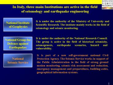
In Italy, three main Institutions are active in
the field of seismology and earthquake engineering
2
Emergency management
SIGE - Informative System for Emergency
Management and simulation scenarios
- After a seismic event it is very important to
recognise the dimension of the problem as soon as
possible. Particularly useful is the use of a
G.I.S. - In case of an earthquake, of magnitude 5 or more,
an automatic procedure is immediately activated
by SSN to produce data, maps, and information
concerning the epicentral area - On the basis of attenuation relations , several
ground motion parameters (intensity, PGA, PGV,
spectral values) are calculated for each
municipality within a radius of 100 km from the
epicenter. These values are used to give a
preliminary evaluation of the damages and losses - Several maps and data, giving a complete
description of the main features of the stricken
area are transmitted, within one hour, to the
Civil Defence Department
3
Emergency management
- MAPS OF THE EPICENTRAL AREA
- event localization
- historical epicenters in the area and
seismogenetic zones - isoseismal of the historical earthquakes
- strong-motion and seismometric networks
- expected values of macroseismic intensity
(attenuation from the epic.) - expected values of PGA, PGV, and spectral
acceleration (attenuation from the epic.) - resident population
- population density
- distribution of dwellings in different
vulnerability classes (A, B, C - MSK) - dwellings built before the enforcement of the
building code - hospitals per municipalities
- classrooms in primary and secondary schools
- risk industries
- landslide vulnerability
- road and railway network, lifelines
- expected structural damage (collapsed,
uninhabitable and damaged dwellings, damaged
surface, monetary loss) - expected number of casualties (fatalities and
homeless)
4
Emergency management
SIMULATION SCENARIO OF THE UMBRIA MARCHE
EARTHQUAKE September 26, 1997 Epicenters of
historical earthquakes (MCS scale) and
seismogenetic zones.
5
Emergency management
SIMULATION SCENARIO OF THE UMBRIA MARCHE
EARTHQUAKE September 26, 1997 Expected PGA
(g) values
6
Emergency management
SIMULATION SCENARIO OF THE UMBRIA MARCHE
EARTHQUAKE September 26, 1997 Percentage of
buildings constructed before the enforcement of
the building code
7
Emergency management
SIMULATION SCENARIO OF THE UMBRIA MARCHE
EARTHQUAKE September 26, 1997 Number of
expected uninhabitable dwellings.
8
Emergency management
SIMULATION SCENARIO OF THE UMBRIA MARCHE
EARTHQUAKE September 26, 1997 Number of
expected homeless population.
9
Emergency management
UMBRIA MARCHE EARTHQUAKE September 26, 1997 Real
values verified on field and values predicted by
the scenario
The values relative to the number of victims are
strongly overestimated, whereas the number of
homeless, unusable dwellings and monetary loss
are closer to the real values. This is probably
due to the fact that the strongest shock (Ms5.9)
happened at 11.40 a.m. and was preceded by a
weaker shock (Ms5.5) at 2.33 a.m., giving to the
people the possibility of running out of their
homes. It's also interesting to note that the
effective number of unusable dwellings is higher
than the number of homeless people, due to the
fact that this figure includes any kind of houses
(rural, industrial, commercial activities, etc.)
many of whom uninhabited. Considering the amount
of uncertainties, in hazard, vulnerability, an
loss assessment, the aim of this scenario
evaluation was just to provide the order of
magnitude of damages and losses expected in
different parts of the Italian territory.
Improvements in hazard and vulnerability
assessment, estimation of losses to facilities
and lifelines, evaluation of indirect losses and
induced phenomena, will be the subject of future
investigations.
10
Emergency management
DAMAGE SURVEY AND SAFETY ASSESSMENT
- Procedure
- residents ask the Major for survey
- Operative Center send technical teams
- technicians assess buildings damage safety
- Major decides on the buildings evacuation and
provisional safety works
11
Emergency management
DAMAGE SURVEY AND SAFETY ASSESSMENT
12
S.S.N. EMERGENCY MANAGEMENT support activities
for the Civil Protection
- non-stop availability (24h) for emergency
response - preliminary scenary of the stroken area in 1h
- coordination with National Geophisic Inst.
Eartquake Nat. Res. Group - coordination with fire brigades, prefects
local authorities - first emergency team on field in 6-24 h in case
of magnitude 5 or more - further emergency teams and mobile monitoring
network on field in 24h - preliminary damage report in the same day of
alert - technical support to local authorities for
operative centers management, damage surveys and
safety assessment of buildings - emergency funds damage cost assessment
- general report in one month

