IRBLEM Model PowerPoint PPT Presentation
Title: IRBLEM Model
1
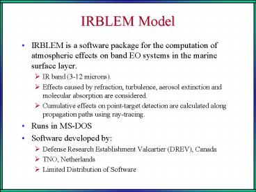
IRBLEM Model
- IRBLEM is a software package for the computation
of atmospheric effects on band EO systems in the
marine surface layer. - IR band (3-12 microns).
- Effects caused by refraction, turbulence, aerosol
extinction and molecular absorption are
considered. - Cumulative effects on point-target detection are
calculated along propagation paths using
ray-tracing. - Runs in MS-DOS
- Software developed by
- Defense Research Establishment Valcartier (DREV),
Canada - TNO, Netherlands
- Limited Distribution of Software
2
Input Parameters (22)
- Pressure (mbar)
- Air temperature (C)
- Relative humidity ()
- Wind speed (m/s)
- Wind direction (deg)
- Mean wind speed over last 24 hours (m/s)
- Water temperature (C)
- Wave height (m)
- Visibility (km)
- Solar radiation (w/m2)
- Air mass parameter (1-10)
- Precipitation rate (mm/h)
- Precipitation type (0 No weather 1 Rain 2
Drizzle 3 Snow 4 Fog)
- Neutral drag coefficient CDN(10) abU10N
this is 'a' 1000 - Neutral drag coefficient " "
this is 'b' 1000 - Neutral stanton number, CHN(10) 1000
- Neutral dalton number, CEN(10) 1000
- Mean wavelength (um)
- Height of the pressure sensor (m)
- Height of the air temperature sensor (m)
- Height of humidity sensor (m)
- Height of the wind speed sensor (m)
3
- Output
- Dozens of output options
- Vertical profiles CN2, optical refractivity,
aerosol extinction. - Ray tracing plot
- Image resolution
- Maximum path radiance in the marine surface layer
as a measure of the background radiation.
4
Cape St. George, 19/1519 UTC Sep 98 Case ID 001
Geometrical Sight
Tair 34.5 C Wind 4.1 m/s SST 32.6 C
RH 67.3 P
1003.3
5
Cape St. George, 23/1151 UTC Jul 98 Case ID 002
Geometrical Sight
Tair 27.6 C Wind 1.7 m/s SST 26.6
C RH 78.4 P
1012.8
6
Cape St. George, 19/1416 UTC Oct 98 Case ID 003
Tair 28.7 C Wind 1.8 m/s SST
30.25 C RH 68.3
P 1009.8
Beginning of Mirage Zone Maximum Inter
Vision Range (MIVR) Geometrical Sight
7
CN2 Output from IRBLEM
PowerShow.com is a leading presentation sharing website. It has millions of presentations already uploaded and available with 1,000s more being uploaded by its users every day. Whatever your area of interest, here you’ll be able to find and view presentations you’ll love and possibly download. And, best of all, it is completely free and easy to use.
You might even have a presentation you’d like to share with others. If so, just upload it to PowerShow.com. We’ll convert it to an HTML5 slideshow that includes all the media types you’ve already added: audio, video, music, pictures, animations and transition effects. Then you can share it with your target audience as well as PowerShow.com’s millions of monthly visitors. And, again, it’s all free.
About the Developers
PowerShow.com is brought to you by CrystalGraphics, the award-winning developer and market-leading publisher of rich-media enhancement products for presentations. Our product offerings include millions of PowerPoint templates, diagrams, animated 3D characters and more.

