INTER PowerPoint PPT Presentation
1 / 20
Title: INTER
1
INTER
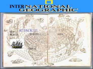
ATTACK!!!!
NEW WORLD
EUROPE
ASIA
AFRICA
2
TECHNOLOLGY STIMULATES EXPLORATION
3
- Technology of Exploration
- 1) cartography improved by using grids
- 2) compass - Chinese
- 3) astrolabe - Arabs
4
- 4) Triangle shaped lateen sails (Arabs) helped
ships sail against the wind - 5) multiple masts made travel faster
- 6) rudders at stern made them more maneuverable
5
- 7) In the 1400s, the Portuguese added cannons
and rifles to create the caravel.
6
EXPLORATION ROUTES THE QUEST OF GOD, GOLD AND
GLORY
7
Portuguese Exploration
8
- Armed with new navigational technology, the
Portuguese were the first Europeans to venture
into the Atlantic in search for a water route to
the Asia and India.
9
Prince Henry of Portugal (1394-1460) was called
the Navigator not because he went to sea himself,
but rather because he encouraged exploration in
the early 15th century. He brought together
mapmakers mathematicians and astronomers to study
navigation. (His explorers discovered the Azores,
Madeira Islands, and Cape Verde Islands)
10
Bartholomew Dias was the first explorer to sail
around the tip of Africa (1488) setting the stage
for future navigations.
Cape of Good Hope
11
In efforts to go beyond his predecessor, Vasco Da
Gama (1497) sailed around Africa to be the first
European to reach India by boat.
12
Spanish Exploration
13
King Ferdinand and Queen Isabella of Spain backed
Italian navigator Christopher Columbus. Columbus
believed that he could reach India by sailing
west. He left Spain in August of 1492 with 3
ships.
14
Columbus and his men were the first Europeans to
set foot on the New World (Bahamas) but Columbus
believed he was off the coast of India.
15
Maps of the time did not show any landmass
between Europe and Asia. In 1507 Italian
explorer (Sailing for Spain) Amerigo Vespucci
suggested that Columbus had discovered a New
World.
16
In 1519 Ferdinand Magellan (Portuguese) sailed
for Spain to find a western route to Asia.
17
Near the tip of South America, Magellan passed
through the strait into the South Sea. Magellan
renamed it the Pacific Ocean because its waters
were so peaceful.
18
Magellans ships reached the Philippines where
Magellan was killed. The surviving crew escaped
and sailed for Spain. In 1522 the last ship
arrived at Spain completing the first
circumnavigation of the globe.
Killed in the Philippines
19
- Line of Demarcation
- Portugal and Spain wanted to protect their claims
in the Americas. In 1493 they asked the Pope for
help. He drew a an imaginary line running down
the middle of the Atlantic from the North to
South Pole. - Spain would have control of all lands to the west
of the line Portugal would control lands to the
east of the line.
20
1494 Spain and Portugal signed the Treaty of
Tordesillas moved the line farther west.

