Topographic Maps PowerPoint PPT Presentation
Title: Topographic Maps
1
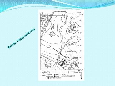
Sample Topographic Map
2
2-D
3-D
3
Why are Topographic Maps Useful?
- Building a home
- Landscaping
- Hiking
- Fishing
- Camping
- Planning a highway
Who uses Topographic Maps?
- Military
- Construction Workers
- Geologists
- Farmers
- Hikers
- Campers
4
Gradient
- Another way to express slope is gradient.
- Gradient is the average slope of a particular
- area on a map.
- The formula for gradient is
- Change in field value
- Distance
5
(No Transcript)
6
The formula for gradient can be found on page 1
of your ESRTs Field value is whatever the
isolines on the map are measuring. Distance is
the actual distance between 2 points given using
the map scale.
7
Example
Gradient change in field value
Distance
B
Gradient 400 m 200 m
2 miles
A
Gradient 200 m
2 miles
Gradient meters mile
1 2 Miles
Elevation in meters
100
8
Letters A, B, C, D, and E on the topographic map
shown below represent locations on Earth's
surface. Letters K, L, M, and N are locations
along Copper Creek. Elevations are measured in
meters.
Calculate the gradient between points B and C on
the topographic map shown and label your answer
with the correct units. Be sure to show all your
work, including proper units. Express your answer
to the nearest tenth.
9
Calculate the gradient between points B and C on
the topographic map shown and label your answer
with the correct units. Be sure to show all your
work, including proper units. Express your answer
to the nearest tenth.
Change in field value Distance
Gradient
m km
50 m 10 m 2km
40 m 2km
m km
G
20
20.0
NOT DONE YET
PowerShow.com is a leading presentation sharing website. It has millions of presentations already uploaded and available with 1,000s more being uploaded by its users every day. Whatever your area of interest, here you’ll be able to find and view presentations you’ll love and possibly download. And, best of all, it is completely free and easy to use.
You might even have a presentation you’d like to share with others. If so, just upload it to PowerShow.com. We’ll convert it to an HTML5 slideshow that includes all the media types you’ve already added: audio, video, music, pictures, animations and transition effects. Then you can share it with your target audience as well as PowerShow.com’s millions of monthly visitors. And, again, it’s all free.
About the Developers
PowerShow.com is brought to you by CrystalGraphics, the award-winning developer and market-leading publisher of rich-media enhancement products for presentations. Our product offerings include millions of PowerPoint templates, diagrams, animated 3D characters and more.

