
Plano Catastral New Amsterdan, Henry D.Tyler, 1642 PowerPoint PPT Presentation
Title: Plano Catastral New Amsterdan, Henry D.Tyler, 1642
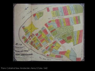
1
Plano Catastral New Amsterdan, Henry D.Tyler, 1642
2
Plan de New Amsterdam, Jacques Cortelyou,
1665-1670
3
Plan de New Amsterdam, T.Maerfchalckm, 1763
4
Plan de New John Montresor, 1766
5
Mapa de la Ciudad de New York, John Randel, 1811
6
Mapa de la Ciudad de New York, David Longworth,
1817
7
Mapa de la Ciudad de New York, Conneticut y Long
Island, John Randel, 1821
8
Mapa de la Ciudad de New York, Matthew Dripps,
1852
9
Mapa de Manhattan y Brooklyn, Samuel Mitchell,
1890
10
Mapa de líneas de ferry y tren, R.D.Servoss, 1894
11
Mapa Evolución New York 1642, 1755, 1782, George
E. Waring JR. 1886
12
Delirious New York, Rem Koolhaas
13
Coney Island
14
Rockefeller Center
15
Dalí y Le Corbusier
Recommended
