Watershed drainage basin catchment - PowerPoint PPT Presentation
1 / 19
Title:
Watershed drainage basin catchment
Description:
along a stream or river. carries most of the H2O water that goes from ... (1) lithology and soils infiltration (2) topography -- how fast overland flow occurs ... – PowerPoint PPT presentation
Number of Views:1371
Avg rating:3.0/5.0
Title: Watershed drainage basin catchment
1
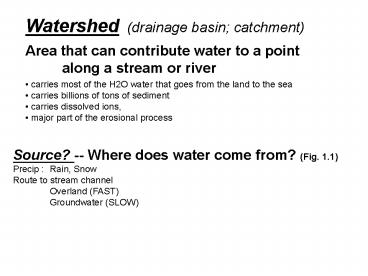
Watershed (drainage basin catchment) Area that
can contribute water to a point along a stream
or river
- carries most of the H2O water that goes from the
land to the sea - carries billions of tons of sediment
- carries dissolved ions,
- major part of the erosional process
Source? -- Where does water come from? (Fig.
1.1) Precip Rain, Snow Route to stream channel
Overland (FAST) Groundwater (SLOW)
2
Route of water to stream channels overland flow,
GW
Fig 1.1
3
GW recharge
Fig 1.1
GW discharge
4
Hydrograph -- tool used to evaluate stream
response to precipitation continuous record of
discharge plotted against time Q
Discharge stream flow volumetric flow
rate Units of discharge variable LT (e.g.,
m3/sec, gallons/day, acre-feet/yr) U
Current Velocity Linear rate of flow
(m/s) Flow Q or U
5
Stream Order
As order of stream ?s, Q and u ? gradient
? channel dimensions (width and depth) ?
(to accommodate incr Q)
6
Hydrograph following a rainstorm Ppt occurs
runoff infiltration to stream Rising limb,
Peak with some lag, Recession limb Baseflow
- Small stream vs. Large river response time
- Urban vs. Forested streams
7
Factors influencing shape of a hydrograph (1)
lithology and soils infiltration (2)
topography -- how fast overland flow occurs (3)
vegetative cover (4) type of precipitation
(rain vs. snow) (5) stream size
8
Streams are very dynamic if you change any
one of these, another one will change
- width
- depth
- slope
- flow resistance
- sediment size
- sediment load
- velocity
- discharge
9
Flashy vs. Stable streams
The shape of the hydrograph tells us a lot about
watershed characteristics and biological
potential of the river. Flashy stream -- one
whose hydrograph responds quickly to heavy
rainfall --gt More extremes, both high and
low Stable stream -- one with more sluggish
response (more GW flow) --gt Less variable
environment
See figure in Poff and Ward
10
Effects of Urbanization on Stream Flow
Imperviousness Surface run-off so water gets
to stream faster Water flow and energy Lower
flows during summer
11
Urban stream note even though there is a
forested buffer, there is severe channel
incision thus the desire to restore (regrade)
so many urban streams
12
Paint Branch Unrestored Downstream Reach 1-27-03
13
Hawlings River future restoration site 1-27-03
legacy sand deposits on inside Of channel -
from 100 years of agriculture (see field to
right above floodplain_
14
Hawlings River future restoration site 1-27-03
were standing on the former floodplain
15
Retention Ponds
16
How do we measure Q? 1) Time to fill a bucket
2) Use equation Q A
U m3/s m2 m/s So, for a river
cross section, Q W D U
w
u
d
17
Consider relationship between U and Q If the
X-sec area of stream changes, how does that
change U? Continuity of flow Q1 Q2 Q3
- Why is current so important ecologically?
- erosion force on organisms
- sediment particle size (faster flows ? larger
particles) - delivery of nutrients, gases, etc.
18
Spatial variability in flow
Fluids equations based on ideal channels!!
real channel
Ideal channel
try drawing flow lines on this stream where
velocity is shown by thickness of line an
direction by orientation
19
- Flow vs. depth draw a velocity profile
- shape of curve governed by
- no slip condition (bottom does not move)
- U increases to free-stream velocity at
- some distance above bottom
- bottom provides friction
Boundary Layer logarithmic layer can we
extrapolate this down to where the bugs are?
Now go to Word document.


