
Autonomous Underwater Vehicles - PowerPoint PPT Presentation
1 / 35
Title:
Autonomous Underwater Vehicles
Description:
Autonomous Underwater Vehicles – PowerPoint PPT presentation
Number of Views:10771
Avg rating:5.0/5.0
Title: Autonomous Underwater Vehicles
1
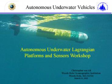
Autonomous Underwater Vehicles
Autonomous Underwater Lagrangian Platforms and
Sensors Workshop
Christopher von Alt Woods Hole Oceanographic
Institution Woods Hole, MA 02536 March 24, 2003
2
Outline
- Background
- History
- Current Status
- The Future
WHOI Fast Fish (A. Bradley)
3
Autonomous Under Vehicles
- Driven by a propulsion system
- Controlled and piloted by an onboard computer
- Maneuverable in three dimensions
- Support spatial and time series measurements
- Normally provide superior quality data
- Support multiple vehicle operations
- Can insure adequate spatial and temporal sampling
- Support investigations of spatial and temporal
coherence
4
Comparison with other Lagrangian Platforms
- Benefits
- Control of survey
- Adequate power for most sensors
- Adequate power to continuously sample
- Drawbacks
- Limited endurance 8 - 50 hours
- Higher platform costs
- Lower number of platforms less access
5
Benefits of AUVsWater column measurements
- Stop and float requires ballast control
- Actively loiter
- Constant altitude above the bottom
- Constant pressure or layer of interest
- Sea saw or saw tooth sample pattern
- Seafloor surveys acoustic or optical
6
Time series measurements
Over 500 km mapped in 100 hours.
7
San Luis Bay Spatial Time Series
REMUS transect
M. Moline California Polytechnic State University
8
Bioluminescence Sensor
Developed by Mark Moline at Cal Poly, Cyril
Johnson, Jim Case at UCSB
9
San Luis Bay Weekly Deployments
.
M. Moline California Polytechnic State University
10
Monterey Bay Spatial Time Series
.
M. Moline California Polytechnic State University
11
August 20, 2002
M. Moline California Polytechnic State University
12
CC Technologies Hugin Vehicle380 sq-km region
13
Temperature and Sound Speed Data
14
HISTORY
15
Odyssey MIT Sea Grant
- Developed in the early 90s
- Operational 94
- Six vehicles developed
- Characteristics
- Displacement 160 kg
- Survey speed 1.5 m/s
- Max depth 6 km
- Endurance 6 hours
- Notable missions
- AOSN missions docking
- Mission depth 1.4 km
- Mission duration 3 hours
16
ABE - Autonomous Benthic Explorer
- Developed in the early 90s
- Operational 94
- Completed 80 science dives
- Characteristics
- Displacement 680 kg
- Survey speed 0.75 m/s
- Max depth 5 km
- Endurance 34 hours
- Notable mission 1996
- Mission depth 2.2 km
- Mission duration 30 hours
17
International Submarine Ltd
- Thesues
- Developed early 90s
- Operational 94
- Characteristics
- Displacement 8,600 kg
- Survey speed 2 m/s
- Max depth 1 km
- Endurance 100 hours
- Most notable mission 1996
- Deployed 190 km of fiber optic cable on the
seafloor (500 m) under ice - Mission distance 365 km
- Mission duration 50 hours
18
Naval Oceanographic Office UUV Program
- Draper UUVs
- WHOI Tracking System
- Penn State- Seahorse
- Semi-Autonomous Mapping System
- UUV Fest
19
Southampton Oceanographic Center Autosub
- Developed early 90s
- Operational 98
- Characteristics
- Displacement 1,700 kg
- Survey speed 1.5 m/s
- Max depth 1.6 km
- Endurance 144 hours
- Notable information
- 271missions/750 hours/3596 km
- Deepest mission 1 km
- Longest mission 50 hours
Offered 2.6 m pounds in 1998
20
Commercial Services CC Technologies, Inc.
- Developed late 90s
- Operational 00
- Characteristics
- Displacement 8,600 kg
- Survey speed 2 m/s
- Max depth 3 km
- Endurance 40 hours
- Most notable missions
- System mapped 17,702 km
- Mission depth 3 km
Kongsberg Simrad HUGIN Vehicle - Norway
21
Status 2003
22
Adaptive SamplingAdaptive Mission Planner (AMP)
- The AMP is a separate brain installed on the
vehicle - AMP has the ability to take control of the
vehicle and provide it with external navigation
and control commands - Vehicle takes over if AMP tells it to do
something dangerous - During normal operations, the vehicle
- Executes a pre-programmed mission
- Navigates from waypoint to waypoint
- AMP
- On board algorithm adaptively modifies plan based
on inputs received during the mission from its
sensors
23
Conventional Appraoch
Conc --gt
0 min Time ( as the UUV conducts its mission)
---gt 24 min
24
Adaptive Plume Following
Spatial Map
Plume Tracing
25
Automated Target DetectionHuman in the loop
4. Acoustic modem on vehicle transfers data to
HSV-1 via an RF link
3. Vehicle CPU Assembles message with target
snippet
1. Vehicle surveys area with sidescan sonar
Modem Buoy With RF Link
2. On Board CAD/CAC autonomously scans sonar
files and identifies targets
HSV 1
5. Target data is analyzed on laptop
26
Redirection of Reacquisition Vehicle
Image snippets sent back, displayed
Reacquisition vehicle is directed to survey
targets with high scores from CAD/CAC
The survey mission is sent to the vehicle via the
acoustic modem and RF link - the vehicle
interprets this message and performs the mission.
Operator creates redirection survey on REMUS VIP
27
Human in the loop Redirection Mission with two
vehicles in the water
- SCM vehicle performs survey
- Reacquire vehicle loiters
- CAD/CAC system passes targets to HSV
- Reacquire vehicle receives new mission and exits
loiter location - SCM vehicle continues the survey seeking another
target
28
REMUS 6000
- Stand-alone 6 km rated self contained system
- Transportable - one ISO container
- Productive 3 10 times current survey rates
- Affordable - 1 M/vehicle
- Multiple vehicle operations (Two vehicles may be
stored in one container.)
29
2,500 m Test Area
30
Mission 13 12nm Redirect
Rim - 2,250 m Base - 3,875 m Depth 1,625
m Transect 20,000 m Slope 4.6 deg
Vehicle Transect
31
Descent Down the North Kaibab Trail
Rim 2,512 m Colorado River 739 m Depth
1,773 m Trail Length 22,000 m Slope 4.6 deg.
Bright angel point
32
Future
33
Benefits of AUVsShip based deep water operations
- Increase survey speeds
- Precise feature following
- Acoustic communication
- Uplink sensor data
- Redirect mission or reconfigure sensors
- Superior data quality
- Portability
- Cost effective 40 to 60 savings
34
CC Technologies, Inc.
- Yearly support costs 14 million
- Ship, software engineers, consumables, parts and
depreciation. - Adequate utilization main problem not enough
business to support the capabilities of the
system. - Offering 50 days of AUV time per year for 60k/day
35
Cross Shelf and Shelf Break System
Recommended
CrystalGraphics Presentations


