Forest GIS fGIS - PowerPoint PPT Presentation
1 / 19
Title:
Forest GIS fGIS
Description:
Design maps with pre-defined layer symbology, or use advanced ... View maps in 3D. Map live GPS positions from any connected GPS unit with NMEA output (beta) ... – PowerPoint PPT presentation
Number of Views:231
Avg rating:3.0/5.0
Title: Forest GIS fGIS
1
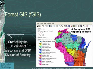
Forest GIS (fGIS)
- Created by the University of Wisconsin and DNR
Division of Forestry
By Rich Friedman GIS Supervisor City of Farmington
NOTE This image, and many of the images in this
presentation taken from the Help File and
www.digitalgrove.net
2
This image taken from www.digitalgrove.net
3
Supported File Formats
This image taken from the help file
4
fGIS Features
- Create and edit point, line and area shapefile
objects and their associated data attribute
tables. fGIS also edits and writes MIF, DXF, DLG
GML vector layers. - Buffer point, line or area objects at any
designated radius or width - Select an area object and fill it with either a
random or ordered grid of points - Design maps with pre-defined layer symbology, or
use advanced layer properties to define your own.
5
fGIS Features (continued)
- Copy and paste shapefile objects from one layer
to another - Designate the direction and distance of the next
leg of a line or polygon with the COGO-like
Traverse Tool - Split a polygon or line into separate units by
drawing a line with the Split Shapes Tool - Clip Shapefiles to the boundaries of a polygon
layer - Merge multiple shapefiles into a new one
6
fGIS Features (continued)
- Customize map properties including line width and
color, area fills, label fonts and positions,
image transparency, thematic rendering of data - Measure areas and distances. fGIS reports
distances and areas in English units (feet, miles
and acres) and metric units. Area and perimeter
measurement fields can be added to data tables
and updated automatically - Display data at user-specified scales
7
fGIS Features (continued)
- View maps in 3D
- Map live GPS positions from any connected GPS
unit with NMEA output (beta) - Extract geo-referenced images of selected
portions of a screen display - Export part of a vector layer and save it as a
new file - Manage large data sets organized in dBase tables
with the "Load Library Layer" utility
8
fGIS Features (continued)
- Join dBase and Access tables to shapefile
attribute tables - Create point shapefiles from comma delimited text
files with xy coordinates - Convert Geographic WGS84 coordinate shapefiles to
and from worldwide UTM zones and Wisconsin
Transverse Mercator
9
fGIS Features (continued)
- Print the map with three flexible output options
- Simple Print command will add a map title,
subtitle, footer and the scale to the page - Send Map to Word command will send an image of
the view at a user specified resolution and scale
to Microsoft Word document - Export Image tool will send the map to a
technical illustration/page layout module called
Diagram Designer - add headers, legends, annotations and non-spatial
symbols from template palettes in the Diagram
Designer module - Save WMF files for use in publishing programs
10
Vector Layer Properties
Images from the help file
11
Raster (Image) Layer Properties
Images from the help file
12
Images from the help file
13
Database Explorer/Editor
If the shapefile attribute table contains any of
the following fields, their values can be
automatically updated with the Table/Update
Shapes Measurements Fields command Area Fields
Acres or Hectares Length/Perimeter Fields Feet,
Miles, or Meters Point Coordinate Fields X or Y
Images from the help file
14
Images from the help file
15
Images from the help file
16
The Buffer utility can also be used to create
buffers around multiple selected objects or all
the objects in a layer
Images from the help file
17
Images from the help file
18
Conclusions
- Great starter or simple data entry GIS package
- Ideal for use with laptops for field data
collection or for additional GIS seats in other
departments or remote locations - Good for use as a GIS data viewer
- Good Image/Vector File Support
- Strong Continued Development
- As in all free products, there are some risks
that development and support will disappear
19
fGIS Links and Support
- fGIS Home Page
- http//www.digitalgrove.net/fgis.htm
- List Serve/Forum
- fGIS Group at Yahoo.com


