
American Samoa Benthic Terrain Viewer - PowerPoint PPT Presentation
Title:
American Samoa Benthic Terrain Viewer
Description:
American Samoa Benthic Terrain Viewer – PowerPoint PPT presentation
Number of Views:102
Avg rating:3.0/5.0
Title: American Samoa Benthic Terrain Viewer
1
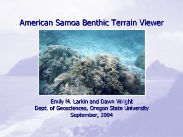
American Samoa Benthic Terrain Viewer
- Emily M. Larkin and Dawn Wright
- Dept. of Geosciences, Oregon State University
- September, 2004
2
The American Samoa Benthic Terrain Viewer
- Web-based GIS to allow more access to marine data
from American Samoa - What is a Web-Based GIS?
- A website that allows users to view geographic
data without GIS software. - The ONLY Samoan-language web-based GIS in
existence.
3
Why use a Web GIS?
- Natural medium for data distribution and display.
- User needs only a web browser to access data.
- Allows multiple levels of users to be served by
the same site. - General users can access information, perform
queries, analyses, and make maps. - Advanced users can download data and metadata
through the FBNMS GIS Data Archive and search for
more detailed information.
4
ASBTV Content
- Bathymetry (seafloor) layers obtained from
multibeam sonar surveys in 2001 and 2002 (Wright
et al. 2002 Wright 2002). - Benthic zone and structure layers derived from
bathymetry. - Terrestrial layersroads, island DEMs, villages.
- Supporting help and information pages with links
to find more information. - Link to American Samoa Coastal and Marine
Bibliographic Database
5
Benthic Zones Structures
- The seafloor can be classified into broad
categories called benthic zones and more detailed
categories called benthic structures - Benthic related to the seafloor (e.g. a benthic
animal is one that lives on the ocean floor) - 4 categories of zones flats, slopes, crests,
and depressions - 13 categories of structures
6
(No Transcript)
7
(No Transcript)
8
Fagaitua Bay Benthic Zones
Benthic Zones from ArcMap
Benthic Zones from the ASBTV
9
Zones/Structures and Biodiversity
- Benthic zones and structures cannot be tied to
specific habitat types or species at this time. - Karlson et al. (2004) found a link between
benthic zone and biodiversity in Indo-Pacific
coral reefs. - In general, sloped areas had higher biodiversity
than flat areas. - Their samples included American Samoa
10
Initial Display of the ASBTV
11
Samoan-Language Access
- Greater accessibility for those who may be more
comfortable in Samoan than in English - Same content as ASBTV
- O le Alititai o Amerika Samoa The Seafloor of
American Samoa - Challenges
- Not all scientific terms translate well into
Samoan (e.g. benthic structure) - ArcIMS does not like diacritical markse.g. Sue
(search) appears in the Mode frame as Sue (a type
of pufferfish)
12
O le Alititai o Amerika Samoa
13
What Still Needs Done?
- Error-checking the Samoan grammar
- Addition of final benthic zones for Vatia Bay
14
American Samoa Coastal Marine Bibliographic
Database
- A searchable bibliographic database listing
references related to American Samoa - Goes back to mid-1800s
- Searchable by keyword, author or area
15
ASBTV Site Links
- English
- http//scallywag.science.oregonstate.edu/website/A
mSamoa/viewer.htm - Samoan
- http//scallywag.science.oregonstate.edu/website
/Faasamoa/viewer.htm - American Samoa Coastal Marine Bibliographic
Database - http//astrolabe.csc.noaa.gov/American_Samoa/searc
h.asp - More information or questions
- larkine_at_science.oregonstate.edu
Recommended
CrystalGraphics Presentations


