
Electronics for Marine Navigation Equipments - PowerPoint PPT Presentation
Title:
Electronics for Marine Navigation Equipments
Description:
Looking for the leading marine service, Navigation Equipments providers in Dubai? Globally renowned brands for both onshore and offshore applications in Electronics, Printer Recording Paper, & Navigation Equipment & Recording papers – PowerPoint PPT presentation
Number of Views:81
Title: Electronics for Marine Navigation Equipments
1
Electronics for Marine Navigation Equipments
Navigating on the open water away from land has
always been challenging and very exciting.
Boating can be a very rewarding experience
provided your boat features the proper tools to
provide the complete safety. Good quality
marine navigation electronic equipment on board
ensures faster and safer boating.
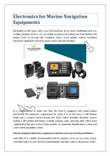
It is recommended to make sure that, the
boat is equipped with certain marine
electronics. The minimum requirement for safety
is to at least have a VHF Marine Radio and a
compass before leaving the shore. Other
desirable electronic devices include a GPS
plotter, fish finder or depth sounder, radar, and
auto pilot. Other more sophisticated but nice to
have items include an Automatic Identification
System and a networked navigation system Marine
navigation electronics equipment operation and
uses are discussed below Auto Pilot It is a
highly recommended tool for mariners set to go on
a long voyage. Auto Pilot helps to steer the boat
automatically and thus, relieves the person at the
2
helm from fatigue. Auto Pilot is of great
help for those that troll while fishing
controlling the boat way automatically,
allowing the captain to join and enjoy the
fishing. This tool is very helpful, as it allows
saving fuel by maintaining the boat on a steady
heading. Fish finder Those who fish for pleasure
or hire enjoy the help provided by a good fish
finder. The fish finder operates using SONAR. In
principle, the sonar works by sending a signal
down through the water column until it strikes
and object with ample mass to return a signal to
the devise, thus rendering an image on the
screen. Automatic Identification System It
is considered an important electronic tool
for marine navigation. It provides other boats
with your vital information as well as their
information to you such as the exact position
of the boat, longitude and latitude, Time
stamp, Rate of turn, Course over ground etc.
While the boat is on its way, the AIS show the
above data every 2 to 10 seconds, whereas when
the boat is anchored, the information is shown
every 3 minutes. Apart from providing
the above- mentioned information, it also
provides information about other boats or
ships concerning their dimension, location,
and type of the boat or ship. It is the
comprehensive electronic instrument for collision
avoidance. GPS Plotter The GPS system now takes
over the duty of the old Loran navigation
system. GPS signals are broadcast from
satellites all over the world that are
maintained by the US government. GPS can be read
in digital or map format. The preferred method is
on a plotter that is loaded with digital maps of
the area you are boating in. Most new VHF radios
now have the capability to broadcast your
location with a distress signal if connected to a
GPS Looking for the leading marine service,
Navigation Equipments providers in Dubai?
Globally renowned brands for both onshore and
offshore applications in Electronics, Printer
Recording Paper, Navigation Equipment
Recording papers More Info - https//aquamaristra
ding.com Article Source - https//aquamaristrading
.wordpress.com/2021/05/27/electronics -
for-marine-navigation-equipments/
Recommended
CrystalGraphics Presentations


