
Retrieval of smoke aerosol loading from remote sensing data - PowerPoint PPT Presentation
1 / 17
Title:
Retrieval of smoke aerosol loading from remote sensing data
Description:
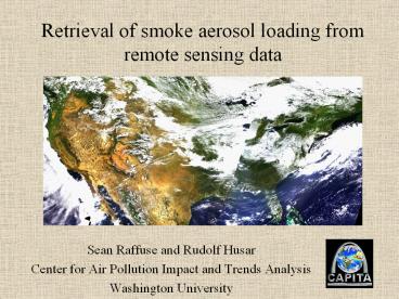
Retrieval of smoke aerosol loading from remote sensing data Sean Raffuse and Rudolf Husar Center for Air Pollution Impact and Trends Analysis Washington University – PowerPoint PPT presentation
Number of Views:86
Avg rating:3.0/5.0
Title: Retrieval of smoke aerosol loading from remote sensing data
1
Retrieval of smoke aerosol loading from remote
sensing data
- Sean Raffuse and Rudolf Husar
- Center for Air Pollution Impact and Trends
Analysis - Washington University
2
Overview
- Problem statement and goal
- Method
- Radiative transfer theory
- Aerosol map generation
- Summary
- Continuing work
3
Problem statement and goal
Problem
- Biomass burning contributes a significant
fraction of the anthropogenic aerosol - Wildfires and prescribed burns
- Slash-and-burn agriculture
- Crop waste burning
- The amount of aerosol generated by biomass
burning is not well quantified - No satisfactory tracer for biomass smoke has been
found - Ground and aircraft-based studies do not provide
adequate spatial coverage - Aerosols from smoke contribute to global cooling
- Quantification is needed to model global climate
change
Goal
To quantify the emission of smoke from biomass
burning as well as study its spatial and temporal
pattern
4
Method remote sensing of aerosol optical
properties
- Remote sensors deployed in research satellites
detect radiation from the earth and its
atmosphere - These sensors allow us to detect aerosols that
scatter and absorb light - We utilize the Sea-viewing Wide Field-of-view
Sensor (SeaWiFS) instrument on NASAs SeaStar
spacecraft - Polar-orbiting
- 1 km resolution
- Daily coverage
- 8 channels (6 visible, 2 near-IR)
5
Radiative transfer theory for aerosol-surface
co-retrieval
The sensed radiation is decomposed into
scattering and absorption by (1) gases, (2)
aerosols as well as reflection from the (3)
surfaces and (4) clouds. Air scattering and
surface/aerosol reflectance are assumed to be
additive, disregarding multiple scattering
effects.
6
Apparent surface reflectance, R
- The surface reflectance R0 objects viewed from
space is modified by aerosol scattering and
absorption. - The apparent reflectance, R, is R (R0 Ra)
Ta
Aer. Transmittance Both R0 and Ra are attenuated
by aerosol extinction Ta which act as a filter
Aerosol Reflectance Aerosol scattering acts as
reflectance, Ra adding airlight to the surface
reflectance
Surface Reflectance The surface reflectance R0
is an inherent characteristic of the surface
Apparent Reflectance R may be smaller or larger
then R0, depending on aerosol reflectance and
filtering.
Aerosol as Filter Ta e-t
Aerosol as Reflector Ra (e-t 1) P
R (R0 (e-t 1) P) e-t
7
Obtaining aerosol optical thickness from excess
reflectance
The perturbed surface reflectance, R, can be used
to derive the the aerosol optical thickness, t ,
provided that the true surface reflectance R0 and
the aerosol reflectance function, P are known.
The excess reflectance due to aerosol is R- R0
(P- R0)(1-e- t) and the optical depth is
As R0 increases, the same excess reflectance
corresponds to increasing values of t. Accurate
and automatic retrieval of the relevant aerosol P
is a difficult part of the co-retrieval process.
Iteratively calculating P from the estimated t(
?) is one possibility. t can be related to mass
loading by assuming physical and optical
properties.
8
Aerosol effects on surface colorandSurface
effects on aerosol color
The image was synthesized from the blue (0.412
µm), green (0.555 µm), and red (0.67 µm) channels
of the 8 channel SeaWiFS sensor. Air scattering
has been removed to highlight the haze and
surface reflectance.
9
Process for co-retrieval
- Generate daily total reflectance image with air
reflectance removed, R - Generate surface reflectance image, R0
- Subtract daily total reflectance image from
surface reflectance image to get aerosol optical
thickness, t - Filter t, removing clouds and other interferences
10
1. Daily reflectance image
- 2000-08-23 RGB image after preprocessing
- Preprocessing includes
- Conversion from L1a engineering values to L1b
scientific values (counts ? radiance) - Georeferencing
- Splicing
- Rayleigh correction
11
2. Generating the surface reflectance, part 1
- The surface image is the clean surface image
with all clouds, air, and aerosol removed - Daily surface reflectances are generated by
creating a composite image from the nearest 15
days - At each pixel, the cleanest daily value is used
- As aerosol and clouds both make the reflectance
brighter, the cleanest value is the one with the
lowest reflectance - Cloud shadows and other anomalous low values are
not used
12
2. Generating the surface reflectance, part 2
Uncleaned Surface Reflectance
- In 15 days, some locations are not cloud and
aerosol free - This results in leftover haze, and areas of
continual cloud cover - We use a small (15-day) time span to preserve
temporal surface change, such as in the fall - However, the blue channel remains fairly constant
over a longer time period - Leftover aerosol signal is subtracted from a
60-day blue minimum - Other channels are subtracted assuming a
wavelength dependence of t
Cleaned Surface Reflectance
13
3-4. Generating aerosol optical thickness (t)
- Aerosol optical depth (t) is then calculated from
the daily total reflectance (R) and surface
reflectance (R0) - Clouds are removed using several filters based on
the spectral characteristics of t - This image shows the blue channel (412 nm)
aerosol optical depth
14
Total reflectance and optical depth comparison
Haze
Smoke plume
Filtered clouds
15
Summary
- Biomass smoke is difficult to quantify
- No satisfactory tracers have been discovered
- Ground-based and aircraft studies do not provide
good spatial coverage - Aerosol optical thickness can be retrieved from
remote sensing imagery - With knowledge of particle physical and optical
properties, an estimation of mass loading can be
made - Size distribution, morphology, mixing regime
- Extincion coefficient, single-scatter albedo,
phase function
16
Continuing work
- Estimation of smoke fluxes
- Identify specific smoke plumes
- Divide map into location grids
- Use wind vector data to calculate flux through
the grids - These values are required for climatological
models - Data fusion
- Data from remote sensing and ground-based
networks are complimentary - Multiple data sets will be fused to improve
understanding
17
Thank You!
- R. Husar, F. Li, E. Vermote
- M. King, Y. Kaufman, D. Tanre, J. Martins, P.
Hobbs . . . - U.S. EPA
Recommended
CrystalGraphics Presentations


