Geostatistical PowerPoint PPT Presentations
All Time
Recommended
(elevation, oil spill, air pollution, a chemical in a lake) ... (prediction, error of estimation, quantile map, and probability map) The Geostatistical Analyst: ...
| PowerPoint PPT presentation | free to view
GSLIB (Geostatistical Software Library) Pacote de programas desenvolvido junto Universidade de Stanford (EUA), sob a dire o do Prof. Andr G. Journel.
| PowerPoint PPT presentation | free to download
Introduction to ArcGIS Geostatistical Analyst & Fragstats Represent the Data Explore the Data Using applied geostatistical methods to produce a ...
| PowerPoint PPT presentation | free to download
The semivariogram captures the spatial dependence between samples by plotting ... HUCs 2158 (grouped on similar hydrologic properties) ...
| PowerPoint PPT presentation | free to view
It has not been subjected to the Agency's review and therefore does not ... Lark (2000): M.O.M. vs M.L.E. for spherical with nugget. Is the Spatial Signal too weak? ...
| PowerPoint PPT presentation | free to download
The unknowns are sensitive to data gaps or flaws (Problem is ill-posed ... Cheney, M. (1997), Inverse boundary-value problems, American Scientist, 85: 448-455. ...
| PowerPoint PPT presentation | free to view
MCMC algorithms for geostatistical models are computationally intensive ... We have developed parallel algorithms to leverage the power of the TeraGrid in ...
| PowerPoint PPT presentation | free to view
The work reported here was developed under STAR Research Assistance Agreement CR ... Cressie, N., Frey, J., Harch, B., and Smith, M.: 2006, Spatial Prediction on a ...
| PowerPoint PPT presentation | free to download
Most common technique is geostatistics Special branch of statistics developed by George Matheron (1963) (Centre de Morphologie Mathematique).
| PowerPoint PPT presentation | free to view
Available ancillary data ... Dozen of types of ancillary data, many of which are ... without the use of ancillary spatiotemporal data, model selection using ...
| PowerPoint PPT presentation | free to view
Mapping locally complex geologic units in three dimensions: the multipoint geostatistical approach
| PowerPoint PPT presentation | free to view
Baltimore, MD June 24, 2002. by. Vikram M. Vyas*, David S. Kosson ... Exposure Measurement & Assessment Division, Environmental and Occupational ...
| PowerPoint PPT presentation | free to view
Mapping locally complex geologic units in three dimensions: the multipoint geostatistical approach
| PowerPoint PPT presentation | free to view
... ArcGIS Geostatistical Analyst 43 (42 ...
| PowerPoint PPT presentation | free to download
Application of Geostatistical Analyst in Spatial Interpolation. Fei Yan ... Ordinary kriging (trend removed) Ordinary cokriging (trend removed) ...
| PowerPoint PPT presentation | free to download
Predicting Water Quality Impaired Stream Segments using Landscape-scale Data and a Regional Geostatistical Model Erin Peterson Geosciences Department Colorado State ...
| PowerPoint PPT presentation | free to download
GIS for Environmental Science ENSC 3603 Class 24 4/9/09 * * * Geostatistical analyst GeoStor Data http://www.gis.state.ar.us/ Data Clearinghouse (Geostor) http://www ...
| PowerPoint PPT presentation | free to view
apportion the total value of the attribute for each source zone to target zones ... Geostatistical techniques create surfaces incorporating the statistical ...
| PowerPoint PPT presentation | free to download
winbugs for geostatistical model and CAR model. 1/sigma. 1/tau2. nugget. partial sill. 95% Posterior Interval. SMCMC n=644. SMCMC n=322. Winbugs n=322 (-.264, 2.735 ...
| PowerPoint PPT presentation | free to download
Colorado State University, USA. Dr. Jay M. Ver Hoef ... 2 blackwater sites. Geostatistical model unable to account for natural variability ...
| PowerPoint PPT presentation | free to download
... variability evaluation. Tom Hl sny, Martin Polka, Franti ek Durec, Elena Kr tka ... To analyse ground radon short and middle term temporal variability on ...
| PowerPoint PPT presentation | free to download
Core scale Each facies containes 25 periods ... of curves, one for each facies F1 and F2 ... the Core scale (fine) each facies is represented by two subtypes ...
| PowerPoint PPT presentation | free to view
... of U.S. Presidential Elections in Iowa ... Data sources: http://www.sos.state.ia.us/elections/results/ (1996/2000) ... Chosen model: Iowa. Why Iowa? ...
| PowerPoint PPT presentation | free to download
Characterization of tranport processes Diffusion/Dispersion/Advection Sorption on clay (based on foc?, ... Verdana MS P DTU_Environment[1] ...
| PowerPoint PPT presentation | free to view
Stat 592A Spatial Statistical Methods peter@stat.washington.edu pds@stat.washington.edu Course content 1. Kriging 1. Gaussian regression 2. Simple kriging 3.
| PowerPoint PPT presentation | free to download
True understanding of the spatial variability in the soil map is very limited. Distinct boundary (too continuous or sudden change) ...
| PowerPoint PPT presentation | free to download
The interaction between 3D Earth Modeling and Geostatistics ... Horizontal anisotropy ratios and ranges. Horizontal Wells. Horizontal variograms ...
| PowerPoint PPT presentation | free to view
Quantifying Scale and Pattern Lecture 7 February 15, 2005
| PowerPoint PPT presentation | free to view
GEOSTATYSTYKA Wyk ad dla III roku Geografii specjalno - geoinformacja Alfred Stach Instytut Paleogeografii i Geoekologii Wydzia Nauk Geograficznych i ...
| PowerPoint PPT presentation | free to download
Anadromous Waters Catalog (AWC) Large number of water bodies within AK ... 20,000 unidentified anadromous water bodies. Need spatially explicit, unambiguous ...
| PowerPoint PPT presentation | free to download
Groundwater data requirement and analysis
| PowerPoint PPT presentation | free to view
STAT 592A(UW) 526 (UBC-V) 890-4(SFU) Spatial Statistical Methods peter@stat.washington.edu www.stat.washington.edu/peter/592
| PowerPoint PPT presentation | free to download
Turning raw data into useful information. A collaboration between human and machine ... Machine does tedious, complex stuff. Early Spatial Analysis. John Snow, 1854 ...
| PowerPoint PPT presentation | free to download
Modeling Natural Fracture Networks Using Coupled Multi-Point ... Vert Well. Vert Well. Traditional Problem Fracture Placement in Numerical Simulation ...
| PowerPoint PPT presentation | free to view
This presentation was supported under STAR Research Assistance ... Metropolis ... Metropolis-Hastings algorithm: 2,000 iterations with 1,000 burn-in. 29 ...
| PowerPoint PPT presentation | free to download
Produce map of Table Rock field displaying location relative to political boundaries ... Depth useful for determining general structure of formation and degree ...
| PowerPoint PPT presentation | free to download
... and to zoom in rapidly from a global view to a local view ... Produces animated maps and display files for space-time data. ESRI Online Reference Materials ...
| PowerPoint PPT presentation | free to download
... and chemical transport properties in support of long-term ... Sediments is Highly Controlled by the Physical and Chemical Properties of the Sediments ...
| PowerPoint PPT presentation | free to download
... AL-Ramadan. Introduction to ... Dr. Baqer AL-Ramadan. With ArcEditor you can: ... Dr. Baqer AL-Ramadan. Each version of ArcGIS includes three applications: ...
| PowerPoint PPT presentation | free to view
Using Kriging and Interactive Graphics in Web-Based Application for Spatial-Temporal Trend Analysis of Ozone and Weather Systems in Central America
| PowerPoint PPT presentation | free to download
Modelling nonstationarity in space and time for air quality data Peter Guttorp University of Washing
| PowerPoint PPT presentation | free to download
Determining the Spatial Distribution of Benthos in the Western Arctic Ocean. Jon ... Source: http://www.aqd.nps.gov/ard/figure3.html. How Ordinary Kriging Works ...
| PowerPoint PPT presentation | free to download
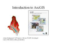
Introduction to ArcGIS. Acknowledgement: Dr Francisco Olivera ... How data are stored in ArcGIS. Components of ArcGIS ArcMap, ... bitmap images ...
| PowerPoint PPT presentation | free to view
Title: Measuring Soil Moisture Using the Soil Water Balance Equation and Spatial Interpolation of Meteorological Variables Author: Shanon M. Connelly
| PowerPoint PPT presentation | free to view
Control: The Plant is operated and controlled by DOE. ... Plant Features: DOE property boundary, TVA boundary , Secured DOE area. ...
| PowerPoint PPT presentation | free to view
versus geography as synthesis and spatiality. The geography behind the maps: ... A spatial structure for CHWs. The geography of HIV/AIDS: looking beyond the maps ...
| PowerPoint PPT presentation | free to view
Title: Can Contamination potential of ground water to pesticides be identified from hydrogeological parameters? Author: bdixon Last modified by
| PowerPoint PPT presentation | free to view
Marriage of Non-Linear Chaos Theory with Linear Stochastic Dynamics. ... Social compatibility issues. ... Field Kit test requires minimal training for staff ...
| PowerPoint PPT presentation | free to view
... kriging. where. and kriging variance. Parana data ... Parana data. Built-in geoR data set. Average rainfall over different years for May-June (dry-season) ...
| PowerPoint PPT presentation | free to download
A Workflow Approach to Designed Reservoir Study. Presented by Zhou Lei ... water Corey exponents, non-Darcy coefficient, aquifer size, anisotropy ration, ...
| PowerPoint PPT presentation | free to view
Analysis of variance. A space-time model. 9. Wavelet tools. Basic ... The prediction variance is. Some variants. Ordinary kriging ... kriging variance. An ...
| PowerPoint PPT presentation | free to download
Masked shrew (Sorex cinereus) was chosen as the representative receptor to ... The shrew has a relatively high metabolic rate and, thus, a larger foraging area ...
| PowerPoint PPT presentation | free to view
Quantifying spatial patterns. of transpiration in xeric. and mesic forests. Jonathan D. Adelman 1 ... Wyoming: xeric site, low-lying creek hilltop gradient ...
| PowerPoint PPT presentation | free to download
Challenges relating to spatiality of grid data - handling the grid net ... The precision of the spatial information of statistical data. ...
| PowerPoint PPT presentation | free to view
Most hotels and resorts will organize riding, but even if you are staying ... There are several Casinos and Resorts to visit while on the island. Of the most ...
| PowerPoint PPT presentation | free to download
Randomly arranged. Illustrated on directional trend. Features. are. We assume either: ... pattern is one of many possible arrangements of the population; or ...
| PowerPoint PPT presentation | free to view


