Landscape structure and characteristics of landscape boundaries - PowerPoint PPT Presentation
1 / 5
Title:
Landscape structure and characteristics of landscape boundaries
Description:
Determine characteristics of landscape boundaries in terms of ... 10 current PhD students in RS/GIS/Hydrometeorology. ICONE Infomation - University of Salford ... – PowerPoint PPT presentation
Number of Views:106
Avg rating:3.0/5.0
Title: Landscape structure and characteristics of landscape boundaries
1
Landscape structure and characteristics of
landscape boundaries
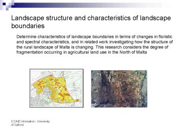
Determine characteristics of landscape boundaries
in terms of changes in floristic and spectral
characteristics, and in related work
investigating how the structure of the rural
landscape of Malta is changing. This research
considers the degree of fragmentation occurring
in agricultural land use in the North of Malta
2
Terrestrial laser scanning of vegetation structure
3-d laser scanner captures 2.5 million points in
3 minutes. Records x,y,z position and range.
0.005 degree angular resolution, narrow beam
width. Initial experiments are comparing
hemispherical photography and laser scanning for
gap fraction measurement.
3
Evaluation of Disaster Monitoring Constellation
data
- DMC is a constellation of five satellites
launched between 2002 and 2005 which provide
global coverage of a given point on the Earth on
a daily basis at a resolution of 32m. The
University of Salford has a time-series of 10
images during 2005 with which to monitor regional
phenological change. Baseline research is
required to analyse data quality and to compare
with other image data sources.
4
Research environment and facilities
- Dedicated postgraduate research facilities
- Access to networked and wireless computer
facilities - Specialist software includes Erdas Imagine,
ArcView, Matlab and others - Terrestrial laser scanner, ASD FieldSpec3, Delta
T SunScan, doppler infrared Lidar, mobile
environmental laboratory - 10 current PhD students in RS/GIS/Hydrometeorology
5
University of Salford ICONE contact details
Professor Mark Danson f.m.danson_at_salford.ac.uk Te
l 44 161 295 4038 Dr Richard Armitager.p.armita
ge_at_salford.ac.uk Tel 44 161 295 5646 School of
Environment and Life Sciences, Peel
Building, University of Salford, Manchester M5
4WT, UK Fax 44 161 295 5015 Web
www.els.salford.ac.uk


