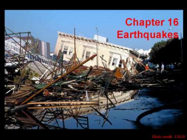
Chapter 16 Earthquakes PowerPoint PPT Presentation
1 / 42
Title: Chapter 16 Earthquakes
1
Chapter 16Earthquakes
Photo credit USGS
2
Effects of Earthquakes
- Tsunamis
- World Distribution of Earthquakes
- First-Motion Studies of Earthquakes
3
Soil Liquefaction - 1964 Nilgata, Japan
4
Surface Displacement - 1964 Alaska
5
Ground Rupture, 1906 Olema, CA
6
Fence Compression - Gallatin County, MT
7
Buckled Concrete - 1971 San Fernando, CA
8
Tsumani Generation
9
Tsunami Devastation - 1964 Alaska Earthquake
10
Tsunami Animation
11
Tsunami Wave Propagation Times
12
Earthquakes and Plate Tectonics
- Earthquakes at Plate Boundaries
- Subduction Angle
- Earthquake Prediction
13
different types of structures are associated with
each boundary type divergent/rifting
extensional (normal faulting) convergent/collisio
nal compressional (thrust faulting) transform/t
ranscurrent shear-dominated (strike-slip
faulting)
14
Earthquake Distribution
15
Relative Plate Motions and Boundaries
16
Frequency-Intensity-Magnitude Relations
17
Measuring Earthquakes
- Three distinct methods to measure earthquakes.
Two based on energy and one based on intensity. - Richter Magnitude Scale originally developed for
southern California. Log scale, which has no
upper bound. Small earthquakes may yield
negative values. Tends to be inaccurate at gt7
magnitudes. - Moment Magnitude Scale measurement of the amount
of work done during the earthquake. Based on rock
strength, area of rupture, and displacement
during event. - Modified Mercalli Intensity Scale based on the
damage associated with a particular event at a
particular location. Ranges from I (less damage)
to XII (more damage).
18
Earthquake First Motion Records
19
Focal Mechanisms
20
most subduction zones are in the Ring of Fire
(so-called because of volcanism) of the
Pacific
from http//www.geo.lsa.umich.edu/crlb/COURSES/2
70
21
Convergent Boundary Earthquakes
22
seismicity along subduction zones earthquakes
are shallow, intermediate, and deep but have
systematic location
related to subducting slab
note shallow adjacent to trench and deep
farthest away
from http//www.geo.lsa.umich.edu/crlb/COURSES/2
70
23
location of downgoing slab as it dives into
mantle is defined by seismicity
earthquakes occur along an inclined belt the
Wadati-Benioff zone reaches maximum
depth of 670 km
deep
intermediate
shallow
from http//www.geo.lsa.umich.edu/crlb/COURSES/2
70
epicenters location of earthquake rupture
projected to surface dip of slab leads to
observed seismicity patterns deeper farther
from trench
24
seismicity of subduction zones
all from http//www.pmel.noaa.gov/vents/coax/coax
.html
25
Divergent Boundary Earthquakes
26
earthquakes along mid-ocean ridge are
shallower than those along subduction zone
from http//www.pmel.noaa.gov/vents/coax/coax.htm
l
27
Transform Boundary Earthquakes
28
the western US is somewhat anomalous
note absence of deep earthquakes
from http//www.pmel.noaa.gov/vents/coax/coax.htm
l
29
San Andreas Fault System
San Andreas Fault System is composed of several
Distinct segments, which may rupture
independently. N. California segment
ruptured in 1906 San Francisco (gt8 M) and 1989
Loma Prieta (gt7 M) events. S. California segment
ruptured in 1857 Fort Tejon (gt7 M) and 1992
Landers/Big Bear (gt7 M) events. Central segment
near Parkfield is creeping and generates
frequent, Small events.
30
Shallow vs. Deep Subduction Earthquakes
Ocean-continent convergent margins have
earthquakes foci that extend to great
depths. Mechanism tend to change from extension
to compression downdip.
Continent-continent collision zones have broad
areas of of relatively shallow seismicity
31
670-km Boundary and Slab Events
32
Wadati-Benioff zones different dips in
different locations
where slab bends earthquakes related to
normal faults moderate depths earthquakes
related to thrusting along
plate interface
these most destructive
at greater depth earthquakes related to
normal faulting again slab may be stretched
depth to which slab extends is controversial
from van der Pluijm and Marshak, 1997
33
tomography (3D seismic)
blue is fast interpreted as slab
note continuity of blue slab to depths on
order of 670 km
slab is cold and thus can have earthquakes at
greater depths
from http//www.pmel.noaa.gov/vents/coax/coax.htm
l
34
Phase Changes and Slab Events
35
all from http//www.geo.lsa.umich.edu/crlb/COURS
ES/270
36
Variable Slab Angle
- Factors affecting slab
- dip angle include
- Slab age
- younger -gt hotter
- and more buoyant
- Coupling with upper
- plate
- Kinematics of plate
- boundaries
37
Diachronous Convergence Earthquake Events
38
Historical Earthquake Magnitudes
39
Eastern and Central US Seismicity
40
US National Seismic Hazard Map
Source USGS NEHRP
41
New Madrid Seismic Zone
Source Mattioli Jansma, NEHRP proposal
42
New Madrid Slip Rate vs. Recurrence Time
Source Mattioli Jansma, NEHRP proposal
modified from Newman et al. 1999

