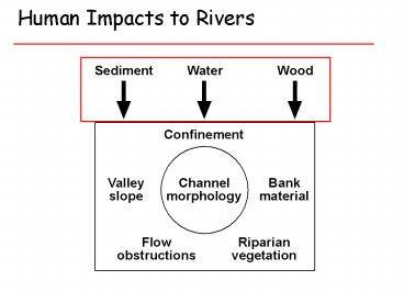
Human Impacts to Rivers PowerPoint PPT Presentation
1 / 46
Title: Human Impacts to Rivers
1
Human Impacts to Rivers
2
Human Impacts on Rivers dams channelizatio
n loss of woody debris/riparian forests
3
More than 80,000 dams affect gt 90 of the
nation's 5.8 million km of rivers.
4
Dams trap a higher proportion of runoff in drier
regions
5
U.S. Dam construction leveled of in 1980s at
almost a billion acre-feet
6
Timing of Dam construction varied regionally, but
was fastest between 1940 and 1980.
7
Hoover Dam
8
Timber crib dam in Michigan
9
Reservoirs often trap 40 to gt80 of the sediment
carried by large rivers, reducing the sediment
delivered to coastal environments despite
increased soil erosion in upland environments.
Impact of Humans on the Flux of Terrestrial
Sediment to the Global Coastal Ocean, James P. M.
Syvitski, Charles J. Vörösmarty, Albert J.
Kettner, Pamela Green, Science, v. 308, p.
376-380.
10
Humans increased annual sediment delivery to
rivers by 2.3 billion tons, from about 6.5
billion tons to almost 9 billion tons
11
Humans decreased annual sediment delivery to
oceans by 1.4 billion tons, from about 6.5
billion tons to about 5 billion tons
12
Less sediment reaches the coast in Asia and parts
of the Americas due to dam construction
13
Humans have simultaneously increased the sediment
transport by global rivers through soil erosion
(by 2.3 0.6 billion metric tons per year), yet
reduced the flux of sediment reaching the world's
coasts (by 1.4 0.3 billion metric tons per
year) because of retention within reservoirs.
14
Splash dams
15
(No Transcript)
16
(No Transcript)
17
Human Impacts on Rivers dams channelizatio
n loss of woody debris/riparian forests
18
Los Angeles River at Vernon
Los Angeles River at Canoga Ave.
19
California
Missouri
Connecticut
Illinois
20
Port of Seattle circa 1870 Lower Duwamish River
and estuary
21
Lower Duwamish River today
22
Human Impacts on Rivers dams sediment
input channelization loss of woody
debris/riparian forests
23
Extent of global forests
- Forests have covered about one-third of the
Earths land surface during the Holocene. - But the extent of forest cover has changed
substantially ...
Cameroon
Oregon
Amazon
24
- Few of the worlds forests retain frontier
conditions
25
Log jams were significant obstacles to navigation
and land development in the western U.S.
26
Army Corps of Engineers aggressively de-snagged
American Rivers
Thousands of snags were removed from Puget Sound
rivers between 1880 and the mid-20th Century
27
- LWD can control the formation of pools and bars,
and thereby channel reach morphology
28
- Greater wood loading leads to more pools
- For channels weve surveyed in Alaska and
Washington, a plane-bed morphology occurs only at
low LWD loading
29
- Log jams trap copious amounts of sediment and
aggrade entire reaches of channel.
30
How big does a log have to be in order to
influence a river?
31
The key member logs that anchor log jams tend
to have a diameter half the channel depth and a
length half the channel width.
32
(No Transcript)
33
Position in Channel Network
Valley jam
Queets River, Washington
Log steps
Meander jam
Bankfull bench
34
Effects of Wood in Rivers
1000
Valley Bottom
Water, Sediment Wood Routing
100
Reach Channel Switching Islands Sloughs
In-Channel Pools Cover Bank Complexity
Years
10
1
1
100
10,000
Spatial scale (meters)
35
Environmental History of Puget Sound Rivers
Two dominant types of river valleys Pleistocene
(glacial) and Holocene (fluvial)
Pleistocene (glacial) valleys were incised by
meltwater beneath the Puget Lobe glacier
36
Holocene (fluvial) valleys were incised by rivers
into the Puget Lowland after deglaciation
37
(No Transcript)
38
(No Transcript)
39
River at low point of floodplain
River perched above floodplain
40
(No Transcript)
41
(No Transcript)
42
Nooksack River
43
Nooksack River
Glacial valley
Fluvialvalley
44
mid 1800s
mid 1900s
1870s
2000
45
Skykomish River, 1917
White (now Green) River near Kent, 1906
46
(No Transcript)

