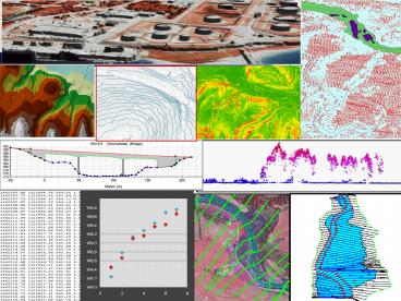
LiDAR Cross Section PowerPoint PPT Presentation
Title: LiDAR Cross Section
1
(No Transcript)
2
(No Transcript)
3
(No Transcript)
4
(No Transcript)
5
LiDAR Cross Section
6
The LAS format (v1.1)
7
LiDAR Point Cloud Data
X Y Z i
8
Digital Surface Model (DSM)
9
Digital Elevation Model (DEM)
10
(No Transcript)
11
DEM Interpolation
12
Void Areas in Grey
13
Sample Results
14
Intensity Values
Intensity Source Data
Intensity Raster
15
(No Transcript)
16
- Now that we are oriented to the data
- What about the APPLICATIONS!!!
17
(No Transcript)
18
Applications for The National Map
Lidar
Hydrology
Elevation Structures
Contours Land Cover
Orthoimagery
19
(No Transcript)
20
(No Transcript)
21
Vegetation in LiDAR
22
Habitat and Ecological Applications
23
FEMA Mapping How Bad Is It?
24
- Bare earth LiDAR
- X-Section extracted from DEM
- Section formatted for HEC-RAS input
- Section spacing based on geomorphology
25
(No Transcript)
26
- Water surface elevations mapped to DEM
- Flood extents validated against DEM
27
Towers Hubs Identified
28
Analysis of the Links
29
Identification of Shadows
30
Urban Example
31
Karst Example
32
(No Transcript)
33
(No Transcript)
34
(No Transcript)
35
(No Transcript)
36
(No Transcript)
37
(No Transcript)
38
(No Transcript)
39
(No Transcript)
40
Subsurface Saturated Flow Using LiDAR Terrain
Data
TIi ln( a / tan(b)KsD)
41
Variable Saturation Potential Using LiDAR
Terrain Data
42
Variable Saturation Potential Using LiDAR
Terrain Data
43
Variable Saturation Potential Using LiDAR
Terrain Data
44
TIi ln( a / tan(b)KsD)
LiDAR Data informs Best Management Practices to
improve water quality
45
Export Coefficient Modeling
N LN S
(EiNTIiNBIi)Ai i1
- BIi ln(S TDAi/tanBDAi)
- NBI fBI/BIi
TIi ln (ai/tanbi) NTI TIi/fTI
46
(No Transcript)
47
(No Transcript)
48
(No Transcript)
49
(No Transcript)
50
(No Transcript)
51
3-D Visualizations
52
(No Transcript)
PowerShow.com is a leading presentation sharing website. It has millions of presentations already uploaded and available with 1,000s more being uploaded by its users every day. Whatever your area of interest, here you’ll be able to find and view presentations you’ll love and possibly download. And, best of all, it is completely free and easy to use.
You might even have a presentation you’d like to share with others. If so, just upload it to PowerShow.com. We’ll convert it to an HTML5 slideshow that includes all the media types you’ve already added: audio, video, music, pictures, animations and transition effects. Then you can share it with your target audience as well as PowerShow.com’s millions of monthly visitors. And, again, it’s all free.
About the Developers
PowerShow.com is brought to you by CrystalGraphics, the award-winning developer and market-leading publisher of rich-media enhancement products for presentations. Our product offerings include millions of PowerPoint templates, diagrams, animated 3D characters and more.

