
Integrated Water Resource Services - PowerPoint PPT Presentation
1 / 21
Title: Integrated Water Resource Services
1
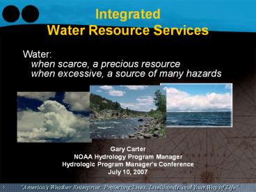
IntegratedWater Resource Services
Water when scarce, a precious resource
when excessive, a source of many hazards
- Gary Carter
- NOAA Hydrology Program Manager
- Hydrologic Program Managers Conference
- July 10, 2007
2
Current Water News
The nation's second-largest city is missing
nearly a foot of rain for the year counted from
July 1 to June 30. Just 3.21 inches have fallen
in downtown Los Angeles in those 12 months,
closer to Death Valley's numbers.And it's much
the same all over the West, from the measly snow
pack and fire-scarred Lake Tahoe in the Sierra
Nevada to shrinking Lake Powel.
As of 3 pm Tuesday, July 3, there were over 50
river forecast points at, or forecast to reach
flood stage, in Texas and Oklahoma, and several
others in the Central and Northern Plains. Many
area lakes were closed due to high water well
above pool levels and most were either releasing
water or had water flowing over spillways.All 77
Oklahoma counties and at least 37 Texas counties
remained under a State of Emergency.
3
Enhancing the Communication of Flood Risk
- Customers are telling us they.
- are familiar with NWS flood severity categories
- find them useful
- do not want changes to the existing flood
severity indices - need communication of flood risk to be enhanced
by use of inundation graphics (maps)
- "The problem for our emergency responders during
flooding is that we rush over our floodplain maps
but they are basically a 100 year storm event
that rarely informs the expected flooding from a
particular storm event"
4
Flood Inundation Forecast Demonstration Projects
- Provide Web Access to 17 North Carolina Flood
Forecast Inundation Map Libraries at NWS forecast
points by October 2007 (NOAA/USGS partnership) - Hurricane Katrina Supplemental Funds are being
used to create an additional 30-35 libraries in 5
Gulf Coast States (NOAA/FEMA Partnership)
5
Challenge Water Resource Stewardship
Water is essential for the health and well-being
of society. It serves many needs and offers
significant benefits that require careful,
balanced management
- Public Safety (River Floods, Flash Floods, Debris
Flow) - Flood Control
- Water Supply
- Power Generation
- Drought Mitigation
- Recreation
- Agriculture
- River Commerce
- Ecosystem Health
Likely impacts of global warming
- frequency and pattern of hot days and nights over
most land areas - frequency and pattern of extreme precipitation
events and resulting flooding over most areas - extent of areas affected by persistent drought
6
NOAAs National and Regional Priorities
These programmatic priorities are at the
intersection of
Hazard Resilient Coastal Communities
Integrated Ecosystem Assessments
Required Geographic Specificity
Integrated Water Resource Services
Stake- holder Demand, Visibility
Corp- orate, Strategic Priorities
Region-specific Priorities and Existing
Commitments
NOAA is using a new approach for execution
priorities during FY 2007-2008, reflecting
regional partnerships
7
Priority Area Task TeamIntegrated Water Resource
Services Gary Carter (lead)
- Roger Pulwarty (Research)
- Marty Ralph (Research)
- Robin Webb (Research)
- Kevin Kelleher (Research)
- David Palmer (Research)
- Scott Cross (Satellites)
- Dick Wagenmaker (Weather)
- Dave Brandon (Weather)
- Pedro Restrepo (Weather)
- Peter Gabrielsen (Weather)
- Jawed Hameedi (Oceans)
- Mary Erickson (Oceans)
- John Stein (Fisheries)
8
NOAA's CapabilitiesWater Prediction and Services
- Satellites and Environmental Data
- Water surface conditions
- Land cover/land use
- Climate variability and change
- Oceans
- Water and biological monitoring
- Estuarine models
- Research
- Earth system models
- Environmental observing systems
- Great Lakes inflows, water levels, and water
quality - Fisheries
- Ecological and socio-economic assessments
- Habitat conservation and restoration
- Weather
- Weather, water, and climate monitoring and
prediction - Forecasting infrastructure and service delivery
- Hurricane storm surge forecasts
Ocean Ecosystem Indicators of Salmon Marine
Survival in the Northern California Current
9
NOAA's Role Water Forecasts for Decision Makers
Water Management
Drought Mitigation Flood Control Public Safety
(Flash Floods, Debris Flow) Water Supply River
Commerce Power Generation Agriculture Recreation E
cosystem Health
Weather and Climate Information Temperature Preci
pitation Wind,
Water Information
Hydrology and Water Resource Modeling
Summit to the Sea Decision Support Tools
Socioeconomic Sciences
10
StrategyEstablish Paradigm for Integrated Water
Resource Services
Outreach/Communications Sea Grant
Extension Regional Climate Centers RISAs NOAA
Service Offices Evaluation Measures Unified Web
Portals
Deliver Integrated Information and Products to
Inform Planning and Decision Making
- Develop Enhanced Applications
- Drought and Flood Forecasts
- Water Temperature Soil Moisture Forecasts
- Estuary Water Level and Salinity Forecasts
- Links to Ecological/Biological Forecasts
- Early Warning Decision Support Tools
Regional Integrated Sciences and
Assessments (RISA) lOOS Regional
Associations NOAA Service Offices Sea Grant
Extension Ecosystem Managers Water Managers Local
Agencies
Engage and Listen To Our Customers
Community Hydrologic Prediction
System Interagency Fish Passage Models Community
Inundation Models Community Estuary Models
Advance and Integrate Hydrological and
Ecological Monitoring and Modeling
Hydromet and Climate Testbeds High Resolution
Hydrologic Model Water Quality Model Estuary/Water
shed Model Ecological Impacts
11
Long-range Objective Summit to the Sea Water
Information System
Downstream Migration ? River Flow ? Water
Temperature ? Dam Operations
Freshwater Spawning/Rearing ? Snowpack ? Air
Temperature ? Nutrients
Estuary/Early Ocean ? Water temperature and
turbidity ? Nutrient Availability and Quality
12
Water Forecasting Business Models
- Historically, organizations and groups
- Worked independently
- Shared data via phone, email, fax, ftp
- Had a lack of timely information
- Developed their own unlinked systems
- Duplicated efforts
- Used disparate tools and processes
The new approach strives for data flowing among
linked algorithms across organizational
boundaries Open architecture that is flexible
enough to utilize existing applications and
services
HistoricalApproach
New Approach
13
Community Hydrologic Prediction System (CHPS)
CHPS uses a service-oriented architecture
allowing a more modular design than any existing
forecasting environment
Manage forecasting workflows
Provide access to models
Algorithm Services
Control Services
Collect and provide observation and forecast data
to models, processes and users
Data Services
Manage access to models and data
Display Services
Security Services
Visualize models and data
14
CHPS Pilot Projects
- Leverages Flood Early Warning System (FEWS) in UK
developed by Delft Hydraulics - Test system uses FEWS for infrastructure
- Non-operational pilots initiated in October 06
and successfully demonstrated in April 07 - NWRFC for Santiam River in Oregon
- NCRFC for portions of Red River and Buffalo River
in North Dakota/Minnesota - Includes Delfts unit hydrograph model, snow
model, channel routing model, hydraulic model,
reservoir routing model, and OHDs Sac-Soil
Moisture Accounting model with heat transfer
15
Water Management Challenges in Northern California
Oroville Dam
Sacramento River (26,000 sq. miles) Feather River
(5,923 sq. miles) Yuba River (1,340 sq.
miles) Water Management Challenges Watersheds
are large Much unregulated flow Significant
rainfall and snowmelt Long and variable water
travel times Combined natural and engineered
systems Several agencies involved in managing
water
New Bullards Bar Dam
16
January 1997 - Californias Largest Flood on
Record
- 30 inches of rain over three days, affecting more
than 30 of the 58 counties in California - Levee breaches in the Sacramento, Feather, and
San Joaquin Rivers - Over 120,000 people forced to leave their homes
with 24,000 residences damaged or destroyed - 2,000 businesses destroyed, resulting in 1,200
disaster unemployment claims - Damages totaled over 2 billion, including
- 500 million to repair highways and public
transportation - 200 million in public facilities damage
- 300 million in flood control facilities
- 300 million agricultural damage
- Among the river basins hit the hardest
- Feather
- Sacramento
- Yuba
Feather River in Yuba County
Flood statistics and response derived from the
Governors Flood Emergency Action Team, Final
Report, May 10, 1997
17
Response to Californias Largest Flood
- A Flood Emergency Action Team held meetings with
hundreds of Californians affected by the flood
and presented a final report to the Governor of
California in May 1997 - Their findings recommended
- Enhanced emergency response capabilities
emphasizing coordination among federal, state,
and local agencies - Expanding support for computer-based flood event
systems to ensure they are operational, with
proper maintenance and staff, as well as
extending access to local government entities
currently without access - Improved flood plain management and flood control
systems - The citizens of California demanded and voted for
improvements - Costa-Machado Water Act of 2000
18
Organizations Working Together on this Initiative
cc
NOAA (NWS/CNRFC) Forecasts stream flow and
reservoir inflow throughout the watershed US Army
Corps of Engineers Sets policy for flood
operations California Department of Water
Resources (DWR) Operations Control Office
Operates the Oroville Reservoir DWR Division of
Flood Management Works cooperatively with CNRFC
in forecasting Yuba County Water Agency Operates
the New Bullards Bar Reservoir
19
Forecast-coordinated Water Management is Critical
DWR
YCWA
Oroville Reservoir
River basins are interconnected Water management
decisions are felt throughout the system Greatest
benefit occurs when water management operations
are coordinated
New Bullards Bar Reservoir
Feather River Flow
Yuba River Flow
Marysville, CA
These rivers have produced flows above the
channel capacity of the leveed stream between
Yuba City and the confluence with the Sacramento.
This section breached in both 1986 and 1997.
20
Integrated Forecasting System for Real-time
Forecast Coordination
- Linking existing components, including the
National Weather Services River Forecast System
(NWSRFS) and the Army Corps reservoir simulation
model ResSim via CHPS architecture
US Army Corps of Engineers developed the ResSim
model
NWSRFS
ResSim
Yuba County Water Agency and Department of Water
Resources, use NWSRFS forecasts and ResSim to
manage the reservoirs
Reservoir Operator
21
Community-based Partnership for Water Forecasting
- ResSim demonstrates the first implementation of
CHPS - Leveraging partner capabilities leads to vast
systemic improvements - Objectives
- Common understanding and improved communications
- Link organizations that are advancing hydrologic
research - Deliver well-applied technology for a higher
degree of real-time interagency collaboration - Demonstrate the enhanced productivity of a One
Government approach - Collaboration yields cost-effective outcomes
- Increased public safety
- Enhanced levels of flood protection
- Better water management
Recommended
CrystalGraphics Presentations


