
CAN WATERSHED MODELS THE NEXT GENERATION INFORM POLICY AND PROJECT DESIGN - PowerPoint PPT Presentation
Title:
CAN WATERSHED MODELS THE NEXT GENERATION INFORM POLICY AND PROJECT DESIGN
Description:
CAN WATERSHED MODELS THE NEXT GENERATION INFORM POLICY AND PROJECT DESIGN – PowerPoint PPT presentation
Number of Views:32
Avg rating:3.0/5.0
Title: CAN WATERSHED MODELS THE NEXT GENERATION INFORM POLICY AND PROJECT DESIGN
1
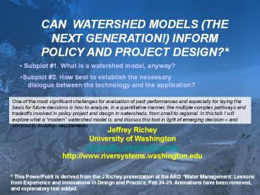
CAN WATERSHED MODELS (THE NEXT GENERATION!)
INFORM POLICY AND PROJECT DESIGN?
- Subplot 1. What is a watershed model, anyway?
- Subplot 2. How best to establish the necessary
- dialogue between the technology and the
application?
One of the most significant challenges for
evaluation of past performances and especially
for laying the basis for future decisions is how
to analyze, in a quantitative manner, the
multiple complex pathways and tradeoffs involved
in policy project and design in watersheds, from
small to regional. In this talk I will explore
what a modern watershed model is, and discuss
this tool in light of emerging decision and
community building- requirements.
Jeffrey Richey University of Washington jrichey_at_
u.washington.edu http//www.riversystems.washingto
n.edu
This PowerPoint is derived from the J Richey
presentation at the ARD Water Management
Lessons from Experience and Innovations in Design
and Practice, Feb 24-25. Animations have been
removed, and explanatory text added.
2
WHAT DOES A TASK MANAGER CARE ABOUT?
A basin task manager must address a set of
issues directly pertinent to the livelihood of
the basin they are responsible for. Better tools
can lead to better decisions.
- How does land use intensification affect
watershed functions, from micro-scale to in
large-scale drainage basins? - How are far field effects on people living
downstream linked to changes in total and
seasonal water yield? - How are crop yields related to soil moisture?
- What impacts do upstream reservoirs and
irrigation have on downstream flow? - What controls sediment yield, from landslides to
sediment export? - How is water quality reflective of landuse?
- How are fisheries impacted by changes in landuse
and flow (and harvest)? - What does it cost, relative to the gain, -
economically, socially, institutionally?
3
The issues a basin task manager are frequently
made up of the intersection of multiple elements.
For example, how does climate interact with the
history of landuse and soils, to produce surface
water flows, which in return support water and
biotic resources? That is, the manager must be
able to understand complex interactions.
4
POPULATION lt-gt ENVIRONMENT
A critical element in basin analysis is the
ability to represent population pressures in a
geospatially-explicit, biophysical manner on
specific elements of the landscape.
5
Can a WSModel help you, as a Project/Policy
Practitioner/Task Manager, resolve these issues
(aka, why should you, be interested?)
The reason why a watershed Task Manager should be
interested in watershed models is that such a
model provides a very powerful means for
integrating diverse information, and the
communities of people behind the information.
Essentially, a WSModel is a numeric and
quantitative Commons, which builds on the
legacy of knowledge, with the goal of
harmonizing watershed function for
multiple users
- Process of creating the model
provides an integration of data from multiple
sources (of interest to many) - Provides an instrument for a
(quantitative) analysis of complex interdependent
problems - Provides a means for intelli
gent interpolation for sparse data. Also,
provides the basis for
cross-scale/upscaling analyses. - Provides a foundation for
scenarios
6
So what IS a watershed model? A
WSModel is, quite simply, an abstraction of our
cumulative under- standing of (all) the
components of a watershed (usually expressed as
a computer model). The most robust models now
are spatially-explicit and process based. (but
devil in the details. "All models are wrong, but
some are useful." G.E.P.Box (1979), Robustness
in Statistics)
e.g., DHSVM (Distributed Hydrology
Soil Vegetation Model) Micro/Mesoscale
Landscape/Hydrologic Model (high to moderate
resolution)
e.g. VIC (Variable Infiltration
Capacity) Meso/Macroscale Landscape/Hydrologic
Model. (moderate to large-scale resolution)
A very important aspect of the DHSVM and VIC
class models is that they are based on first
principles mechanics, and not statistics. This
means they are much more robust than more
traditional models, and can be used more reliably
for changing conditions.
7
Physical Template Time/Space Scale Foundation
A geospatially-explicit, dynamic landscape model
is built by first constructing the physical
template, or detailed GIS-data layers of the
topography, river networks, and ,soils of a
drainage basin (that are typically invariant with
respect to the time scale of the model), and then
adding vegetation (which may change seasonally or
inter-annually)..
8
Surface Climatology Forcing
The model is then forced by the surface
climatology (winds, temperature, solar radiation,
relative humidity, precipitation). The provision
of these data fields is a challenge, and can come
from observational networks and/or climate
models.
Temperature
Winds
Cliff Mass
9
Precipitation/Surface
Precipitation is then expressed on the land
surface, as the surface distributions of mositure
regimes (as computed by the guts of the
hydrology model). In this example, a 3-day snow
storm produces a characteristic response on the
ground. The excess of soil moisture then
produces runoff to a stream channel.
10
Virtual Scaled Basin Cyber-infrastructure
A reality of this generation of watershed models
is that the information required to support them
and the information calculated from them are
extensive, and complex. Careful attention has to
be paid as to how the overall information flow is
executed. Our group is now developing a Virtual
Scaled Basin cyber-infrastructure, to facilitate
such applications.
11
Mae Chaem basin 4000 km2, NW Thailand
We will now look at example applications, in
Southeast Asia. An important consideration is
being able to track processes that may occur at
a particular site or small basin, and track it
downstream, often 100s or even 1000s of
kilometers away. This can be done in a scaling
model framework. The initial application here is
to a small steep basin in NW Thailand (where
there are multiple issues between stakeholders in
the highlands and in the lowlands).
12
The DHSVM landscape/hydrology model was used to
simulate discharge as a function of topography
and changes in land cover (Rattanaviwatpong et al
in review). That the model works so well, in a
relatively data-sparse environment, is indicative
of the robustness of the overall construct.
13
CONVERSION OF FORESTS TO CROPS
While is not the intent here to go over the
details, the model was used to evaluate changes
in the water regime, as function of different
scenarios in landuse.
14
SCALING, from a Small Watershed to Far-Field
Effects in Large Systems
MEKONG
We will now examine the scaling up, to larger
regions, with an application to the Mekong. While
technically not in the Mekong, the principle is
to be able to follow the water from a small basin
to the ocean. For this large-scale application,
the DHSVM model hands-off to the VIC more
macroscale mdoel.
15
VEGETATION CLASSES .of interest to many, for
multiple purposes
One of the critical data layers that is required
is the vegetation not only what class it is,
but, more specifically, what are the biophysical
attributes of the vegetation that effect the
movement of water. A corollary advantage of
producing such data is that there are many users
interested in such data, for many different
applications. Hence building such data layers is
an excellent means of establishing communication
between diverse groups.
16
The first requirement is to establish the
rainfall regime over the basin, (based on
interpolation from multiple stations. While
reasonable overall, sparseness of gauges can
limit specific sites.
17
MEKONG DISCHARGE 1979 -2000 (m3/s monthly)
The Mekong discharge was computed for the period
1979-2000 (Cabral et al in review). Where the
model doesn't do well is most likely due to
weaknesses in the rainfall data. That the model
does do as werll as it does is indicative that
the we understand how the hydrologic cycle of the
basin functions, to a quite reasonable degree.
This means we can use them to dissect the
details of different water years, in different
parts of the basin.
18
An intermediate product average monthly soil
moisture saturation ( maximum water content)
- Implications for flooding prediction weeks out
- Implications for drought prediction weeks out
An interesting side-benefit of these models is
that they can be used to analyze specific
components of the hydrological cycle, not just
water discharge at a point. This has great
heuristic value.
19
EFFECT OF DAMS ON FLOW
With the natural hydrologic cycle explained, we
can go on to analyzing the consequences of
changes in land use and landcover. Here the
effects of several of the dams on flow are
analyzed.
20
Land Cover Scenarios (Tributaries)
Here the effects of different landuse regimes on
discharge are examined for specific tributaries.
21
Land Cover 100 MEKONG BASIN
In looking now at the effect of landcover change
on the water movement of the basin as a whole, we
can see several specific patterns. Overall, the
primary effect is that removal of vegetation
increases flow (because of reduced losses to
evapotranspiration0, while increasing vegetation
would decrease flow. That there is little change
in flow with complete vegetation removal reflects
the fact that there is very little vegetation now
present (outside of crops).
22
Model results can be used to diagnose, to a high
degree of precision, the overall dynamics of the
Mekong (and other) river basins. Analysis of past
records (e.g. 1979-2000) gives us the robust
basis for now-casting (e.g., will there be a
drought or flood in 3 weeks) and future scenarios
analysis (what would happen with different
options for development, superimposed with
climate change?).
Mekong River Commission Secretariat, Vientiane
23
What does it take to make the Watershed Models
(the Next Generation) practical to Project and
Policy Practitioners?
- Proof that it works, (and is better than
current practices), and can be readily
implemented - Willingness to engage in new practices. And
education goes both ways! - ..
Overall, results to date show that this new
generation of watershed modeling, both the tools
themselves and the communities brought together
to execute the models, are very powerful. The
next step is to bring these tools into practice.
Recommended
CrystalGraphics Presentations


