
Section 2 China Urbanization and Process - PowerPoint PPT Presentation
1 / 49
Title:
Section 2 China Urbanization and Process
Description:
Section 2 China Urbanization and Process 1.The assessment of actuality of China urbanization 2.The study of urbanization developing type in the east of China – PowerPoint PPT presentation
Number of Views:205
Avg rating:3.0/5.0
Title: Section 2 China Urbanization and Process
1
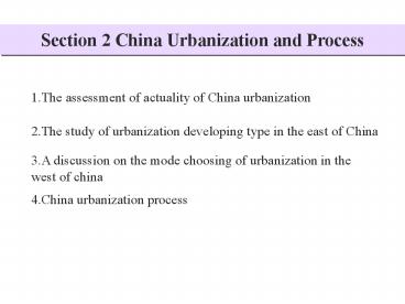
Section 2 China Urbanization and Process
1.The assessment of actuality of China
urbanization
2.The study of urbanization developing type in
the east of China
3.A discussion on the mode choosing of
urbanization in the west of china
4.China urbanization process (Read New China's
Cities 50 years of development )
Academic Report Political Reallocation and
Growth of China Cities
2
1. The assessment of actuality of China
urbanization
1.1 Urbanization level
Urbanization level indicatorThe ratio of
non-agricultural population to total
population() Thinking and cognition
Urbanization is a complex social process in a
specified regional spacial system. It includes
the centralization of population and
non-agricultural activities in the city
environment at different scales, and the region
advancing process in which the rural landscape
changes into urban landscape.
Urbanization course and forming mechanism should
not only be studied on the ratio of
non-agricultural population to total
population,but also the space expanding from city
to countryside.
3
1.2 China integrative urbanization level
assessment index system
Thinking
Urbanization Level Index Original Data Type /Unit Year
Non agricultural population in city Statistical data of 663 cities 2000
Population density in the cities Statistical data of 663 cities 2000
Area of built-up region Statistical data of 663 cities 2000
Land integrative roadway capacity index Digital map-line according to 14,500,000 China communication map 2000
City light index RS Image-Pixel 1998
Urbanization Tupu
Experience
Model
Integrative level
(Ministry of Civil Affairs Project,2003)
4
Index 1
Urban Population of China (2000)
Non agricultural population (Thousand)
5
Index 2
Population Density of China(2000)
Population Density (person/sq.km)
6
Index 3
Built-up Region of Cities in China (2000)
Area of Built-up Area(sq.km)
7
Land Integrative Roadway Capacity Index
Index 4
Land Integrative Roadway Capacity Index (no
dimension)
8
Index 5
Spatial Distribution of Urbanization in China
(1998)
Index of Lamplight
(According to Zuoli,2003)
9
Integrated Urbanization Level Index
Integrated Urbanization Level Index (no
dimension)
10
1.3 Regional Assessment of Integrated
Urbanization Level
- Principle of regionalization
- Based on the map of integrated urbanization level
index - Keep the integrality of the county boundary.
- According to the distribution of population,
that is Hu Population Line Hei He - -Teng Chong line,dividing China into to parts
the Southeast and the Northwest. - In the area of high urbanization level,
according to the rule of - city agglomeration and communication corridor,
gain the city agglomeration, - coastal city band, coastal city band and
industrial city corridor. - Divide China integrative urbanization level into
5 levelsvery strong urbanization, - strong urbanization, moderate urbanization,low
urbanization and very low urbanization.
11
Regional Assessment of Integrated Urbanization
Level
12
Regional Assessment Characteristics of China
Integrated Urbanization Level
Urbanization level parameter Strong urbanization (city agglomeration) High urbanization (coastal city band) Middle urbanization (industrial city corridor) Low urbanization (urbanization growth area) Weak urbanization (urbanization develop area)
Include county statistical unit() 19.58 4.32 25.43 33.79 16.87
Include cities () 42.08 8.14 26.70 17.65 5.43
Include county area() 10.79 2.83 24.94 40.09 21.34
Nonagricultural population in cities() 58.24 5.51 24.26 10.30 1.69
Area of built-up area() 52.46 6.65 26.62 11.96 2.31
Light index 0.20 0.12 0.08 0.03 0.01
Land integrative roadway capacity index 12.65 9.18 10.00 6.25 3.04
Integrative urbanization level index 8.27 5.60 4.13 1.92 0.82
13
2. The study of urbanization developing type in
the east of China
taking North-South Transect of Eastern China as
example
2.1 Correlation analysis of urbanization level
?????
?????
Time(year)
Non agricultural population in city
Trend of area of built-up
region
14
Basic cognitionThe correlation coefficient
between nonagricultural population and the area
of built-up area is 0.994,thus the two have high
relativity. The change of area of built-up area
is a little later than the change of population,
and the changing velocity and range of the two
are obviously different.
????????
????????
Time(year)
?????
Nonagricultural population
The changing velocity of area of built-up area
15
2.2 Urbanization level index system
Single Index
Statistic Relationship Index
Developing Type Index
Index System of Urban Developing Type
ATotal population of the city, refers to the
total size of the city BNonagricultural
population in the city, refers to the size of
nonagricultural population and activities.
CUrbanization level index, refers to the ratio
of nonagricultural population to total
population CB/A,refers to the urbanization
level according to the transition of
population DArea of built-up area, refers to the
size of landscape and land use. PThe changing
velocity of nonagricultural population, and the
change between two years is a changing velocity
P(Bt Bt-1)/Bt-1,refers to concentrating
velocity of population, and thus the velocity of
urbanization SThe changing velocity of area of
built-up area, the changing velocity of the size
of the land use in city by year S (Dt -
Dt-1 )/Dt-1,refers to the expanding velocity of
landscape from city to countryside (In all the
index above, t refers to the data of the same
year,t-1 refers to the year before that year)
16
2.3 Model of urbanization level(Xu Xia etc,2001)
From two point of view-nonagricultural
population and area of built-up area, the basic
features of urbanization are described by the
annual changing ratio between the two.
(St St-1 ) / St-1
CTI (Pt
Pt-1)/Pt-1 TokenThe changing ratio of
nonagricultural population to area of built-up
area is the growth rate of nonagricultural
population per built-up area,reflecting the ratio
of area of built-up area to nonagricultural
population changing velocity, and could be summed
up as six changing types (table).
17
2.4 Division of urban developing type index
CTI P S The meaning of each type Type number
gt1 gt0 gt0 Land expanding I
lt 0 lt 0 Function division II
lt1 gt0 gt0 Function III
gt0 0 Restriction IV
lt0 0 Sudden change V
1 The two equals The two equals Stable VI
18
2.5 Distribution of urban developing type
Legend
other
19
Distribution of urban developing type index
within NSCT
20
Document
Speed of Shenzhen
Urbanization comparison between Shenzhen and
Beijing
Shenzhen 1979
Shenzhen economic zone 1980
Baoan County
Short-staying population growth rate In 1980 is
3.6, while in 1999 is 70.46
Urbanization level In 1980 is 23.8, in 1999 is
93.9
World Miracle-Speed of Shenzhen,average
urbanization level growth rate is 7.5 per year
while GDP and average GDP per person are 39.1
and 21.9.
21
1 000 billion
yuan
1 000 billion
yuan
Per Capita GDP
GDP and Per Capita GDP Level of
Shenzhen(1980-1999)
Per Capita GDP
According to Xu Xiaoli,etc
GDP and Per Capita GDP Level of Beijing(1980-1999)
22
Ratio of primary industry
Ratio of secondary industry
Ratio of tertiary industry
Industrial Structure Change of Shenzhen
Ratio of primary industry
Ratio of secondary industry
Ratio of tertiary industry
According to Xu Xiaoli,etc
Industrial Structure Change of Beijing
23
Beijing
Shenzhen
Comparison of Urbanization Level between Beijing
and Shenzhen(1979-1999)
According to Xu Xiaoli,etc
24
3. A discussion on the mode choosing of
urbanization in the west of china
3.1 Particularity of natural conditions and
viewpoints of urbanization
- Because of the particularity of natural
conditions in the west, the west could not expand
the medium and large cities fast as the east,
also, being in the different stage of
urbanization, construction of small towns should
be important.
Basic perspective
25
Two perspectives
- One is developing medium and large cities
- Developing large cities has more advantages
large city tends to save the rare land resources,
have more size benefit, and be easy to control
and manage the ecological environment problems.
The other is developing small towns In
small towns, systemic right inequality could not
easily happen, which be propitious to the
security of country and the stability of
society. There is much experience on the
construction of small towns as the foundation.
Due to close geo-relation, peasants could enter
small towns at the cost of lower mental cost.
The develoment of small towns could connect the
markets of city and country quickly and, and then
advance the development of second/third industry
in the country, which absorb large amount of
labor, and increase the income of peasants.
26
Comment
- The two both neglect the influence of natural
condition and environment on urbanization, the
different stages of urbanization in different
areas, especially the particularity of the west
in the process of urbanization.
First of all, natural condition and people
distribution have significant limits on the
construction of urban system and urbanization. In
the west, there are 12 provinces, and the total
area is 6,850,000 km2 as the 71.4 of the whole
country. The population is 364,000,000, as the
28.6 of all.
Secondly,the west is on the different stage of
urbanization compared with the east, thus their
task are not the same. Urbanization includes
rural urbanization, besides the development of
towns themselves, that is, town-urbanization.
27
3.2 The main limits of urbanization in the west
Limit of market
Limit of ecological
environment
- Because of the environment problems caused by the
change of macroeconomic forms and the development
of township enterprises, the urbanization of the
west could not be forced by the development of
township enterprises.
28
3.3 Urbanization in the west needs large capital
and ecological industries
The west should select ecological industries
using its advantages. The non-polluting
industries lead to the economic development,
realizing ecological construction industry,
eco-industrial development and combining
industry with ecology.
The west should develop ecological industry with
the help of large capital. Owning to the
particularity of ecological environment and the
limit of economies of scale, this kind of
industry is inappropriate in small-scale
production.
29
Case of ecological industry in the westInner
Mongolia Yi Li Group
Arid land
Village
Capital(Mirabilite)
30
Case of ecological industry in the westInner
Mongolia Yi Li Group
Natural licorice
Urbanization
Capital(Ecology)
31
3.4 Urbanization should consider ecological and
education migrants
- The particularity of the urbanization in the west
is also revealed by the important position of
ecological migrants and education migrants.
Education migrants (Common education,population-st
udent entering city)
Ecological migrants (ecology-disaster peak
dangerous area population transfer)
32
3.5 Urbanization in the west is the product of
natural history process
- This is a process of nature history, could not be
accelerated or decelerated.
How does the west advance urbanization?
33
4. China urbanization process (Read New China's
Cities 50 years of development )
- CommendedNew China's Cities 50 years
of development - National Bureau of statistics urban society
survey corps, Xinhua Press,1999 - Structure Introduction
- An overview of urban development
- Urban focus and comments
- Town statistics(Part1
1949-1988Part2 1989-1999) - Main indicator to explain
- Featuresintegrated, information, data,
intrumental - Spatial analysis with the combination
of dot and face (cities, provinces,
east-central-west) - Key recommendations P3-8Basic data of the China
urban develop situation - P50-5850 years recalling and comments of the
process of urbanization
Increased consciousness of using yearbooks
34
- The basic data of the development of China
cities - 1)Ranged by provinces(1949-1998)
The change of quantity,scale and regional
distribution of cities for 50 years
1. Developing situations of cities in
China(arranged by provinces,1949-1998)
Unit number
Total Beijing Tianjin Hebei Shanxi Inner
Mongolia Liaoning Jinlin Hei
Longjiang Shanghai Jiangsu Zhejiang Anhui Fuj
ian Jiangxi
35
Shandong
Henan
Hubei
Hunan
Guangdong
Guangxi
Hainan
Chongqing
Szechwan
Guizhou
Yunnan
Tibet
Shaanxi
Gansu
Qinghai
Ningxia
Sinkiang
36
2)Ranged by level of administrative grade
(1949-1998)
Total
City of vice provincial level
Municipality
Year
City of district level
City of county level
37
(No Transcript)
38
City of district level
City of county level
Total
Municipality
City of vice provincial level
Year
39
3)Ranged by regions (west, central,
east)(1949-1998)
Eastern China
Central China
Western China
Total
Year
40
(No Transcript)
41
Eastern China
Central China
Western China
Year
Total
42
4)Ranged by the scale of population(1949-1998)
Big city
Middle city
Small city
Year
Total
Metropolis
43
(No Transcript)
44
Structure
50 years review and comments of the
process of urbanization
Structural change and overall trends of
urbanization
1.Growing urban population 2.Growing
urban nonagricultural population 3.Growing
number of cities 4.City regional
expansion 5.City itself developing to
higher level
Stage of urbanization
1949-1957Begin to develop 1958-1965Instable
developing 1966-1978stagnating developing1978
to nowstable and rapid developing
Comments of urbanization(questions and
comments)
45
Read
Non Agricultural Population in Cities(ten
thousand persons)
Figure 1. Change Trend of Urban Population of
China from 1949 to 1997
46
Non Agricultural Population in Cities(ten
thousand persons)
Huge Large Middle Small
Read
Figure 2. Non Agricultural Population Increasing
Tendency of Different Scale Cities(1949-1996)
Non Agricultural Population in Cities(ten
thousand persons)
Eastern Central Western
Figure 3. Population Increasing Tendency of
Different Regions
47
Read
Proportion of Non Agricultural Population for
that of the whole country()
Figure 4. Change Tendency of Urbanization Level
of China(1949-1997)
48
City Numbers
Read
Figure 5. Change of City Numbers(1949-1997)
Huge Large Middle Small
City Numbers
Figure 6. Change of City Numbers of Different
Scales(1949-1997)
49
Read
Eastern Central Western
City Numbers
Figure 7. Alteration of City Numbers of
Eastern,Central and Western China(1949-1997)
Recommended
CrystalGraphics Presentations


