Airnow PowerPoint PPT Presentations
All Time
Recommended
... will help the public make good health- based decisions about their daily activities ... Particles are a significant health problem. Affect different groups ...
| PowerPoint PPT presentation | free to download
www.airnow.gov www.airnow.gov www.airnow.gov www.airnow.gov www.smogcity.com www.airnow.gov www.airnow.gov www.airnow.gov www.airnow.gov www.smogcity.com High and low ...
| PowerPoint PPT presentation | free to view
Improving Real-Time AIRNow Maps Using Data Fusion Prepared by: Patrick H. Zahn and Clinton P. MacDonald Sonoma Technology, Inc. Petaluma, CA Scott A. Jackson
| PowerPoint PPT presentation | free to view
AIRNow: Real Time Air Quality Air Quality Workshop for Teachers Date Name of Speaker Health Effects of Air Pollution Air pollution affects everyone Aggravates lung ...
| PowerPoint PPT presentation | free to download
Plot the correlation as a function of the distance between the two stations, Error Statistics ... A 4D-Var data assimilation test shows similar effect as OI ...
| PowerPoint PPT presentation | free to view
AIRNow Mapper: EPA's New Air Quality Mapping System
| PowerPoint PPT presentation | free to view
Tailoring AIRNow to Fit Your Air Program
| PowerPoint PPT presentation | free to view
Automated features (rotating web cams, timed stories) Coming Soon. New Features ... Web cam. 4 pollutants. forecast. We Need Feedback! Anytime: News items / features ...
| PowerPoint PPT presentation | free to download
Data Quality Issues with Continuous PM2.5 and AIRNow. Lewis Weinstock ... weinstock.lewis@epa.gov. PM2.5 Mapping is Growing ... 305 Active U.S. Monitors ...rapidly...
| PowerPoint PPT presentation | free to download
AQI maps? Issues surrounding both of these new developments ... National forecast maps. State/local forecasts, Northeast map, NOAA model guidance ...
| PowerPoint PPT presentation | free to download
Title: AIRThen, AIRNow, AIRTomorrow Author: test Last modified by: User Created Date: 1/6/2003 4:03:33 PM Document presentation format: On-screen Show
| PowerPoint PPT presentation | free to download
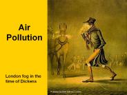
Air Pollution London fog in the time of Dickens Air Pollution Resources Air Quality Index (AQI) http://airnow.gov Fleming and Kaplan, History of the Clean Air Act ...
| PowerPoint PPT presentation | free to download
b= 1. c= 36,837. d= 5. n= 36,998. CMAQ = 34.5 0.63(AIRNOW) Max. 1-hour O3. 7 July 30 September ... CMAQ = 35.1 0.62(AIRNOW) a b. c d. a= 3276. b= 149 ...
| PowerPoint PPT presentation | free to download
the map. Click on the 'See Archives' icon. Ozone Mapping Archives. for the East Coast (North Carolina northwards to Maine) http://www.epa.gov/cgi-bin/airnow.cgi ...
| PowerPoint PPT presentation | free to view
Model Forecasts, Obs. Evidence. Models. Decisions. Event ... Plymouth St. Weather Center. EPA AirNOW. NASA GSFC Giovanni. NASA. NOAA NGDC HMS. NOAA NGDC HMS ...
| PowerPoint PPT presentation | free to view
7 updates/day. EPA & West Coast DCC's. merge. 125 Forecast Cities ... and ... Goal: Improve accuracy of next day PM2.5 AQI forecast during large aerosol events ...
| PowerPoint PPT presentation | free to view
040312. The Plymouth State Surface Met data are now registered in DataFed as SUR_MET. Surface Met data from Plymouth University. Jim Koermer ...
| PowerPoint PPT presentation | free to view
FASTNET Event Report: 040705July4Haze, July 6, 2004 July 4, 2004 Aerosol Pulse Event Summary by the FASTNET Community Please send PPT s or comments to Erin ...
| PowerPoint PPT presentation | free to view
Drastically reduce the waiting time for states to obtain air quality data. Many Thanks ... the Exchange Network, we will have 1 schema that works for everything. ...
| PowerPoint PPT presentation | free to download
... monitoring personnel, and the public, in constructing apps that advance ... International Information Services International analog to Gateway, will be ...
| PowerPoint PPT presentation | free to view
Credit cards. All cards have a magnetic strip with an agreed-upon 'schema' for storing your ... Eliminates custom data flows and formats between States and EPA ...
| PowerPoint PPT presentation | free to download
Getting information from the Internet is not a privilege for the next generation, ... Web 2.0: Facebook, MySpace, Twitter, YouTube, and on and on. New administration ...
| PowerPoint PPT presentation | free to view
Nitrogen oxide can combine with ozone to reform nitrogen dioxide, ... of NO2, O3 and aldehydes ... this to see the effects of weather And human activities on ozone ...
| PowerPoint PPT presentation | free to download
GSI aerosol and gases data assimilation
| PowerPoint PPT presentation | free to download
Earth Science Information Partners Air Quality Cluster TechTrack Agile Data Integration Infrastructure Informing Public Air Quality Data AQ Compliance
| PowerPoint PPT presentation | free to view
This is a Demo of a Distributed Software Application: Analysis of a Canadian Smoke Transport Event
| PowerPoint PPT presentation | free to view
Air Quality Index (AQI) Susan Lyon Stone stone.susan@epa.gov Overview About the AQI EPA outreach Major media outreach Future directions EPA s AQI Clean Air Act ...
| PowerPoint PPT presentation | free to download
Aaron Sims. The Environmental Modeling Center at MCNC @ the ... 48-hour 45km-scale forecasts (Eastern 2/3 of US) 24-hour 15km-scale forecasts (NE, SE, Texas) ...
| PowerPoint PPT presentation | free to download
The FASTNET Project Presented by: Sean Raffuse1 Rudy Husar2 Rich Poirot and Gary Kleiman3 1Sonoma Technology, Inc. 2Center for Air Pollution Impact and
| PowerPoint PPT presentation | free to view
If a visitor clicks 1 page every 9 minutes, that is one visitor session. ... Session length is the elapsed time between their first request and their last request. ...
| PowerPoint PPT presentation | free to view
Establishing Representative Background Concentrations for Quantitative Hot-Spot Analyses for Particulate Matter Adam N. Pasch1, Ashley R. Russell1, Leo Tidd2, Douglas ...
| PowerPoint PPT presentation | free to download
The Impact of Lateral Boundary Conditions on CMAQ Predictions over the ... Scientific Applications International Corporation, Camp ... and Paula M. Davidson ...
| PowerPoint PPT presentation | free to download
During Summer, Will More USG Days Be Dominated by Ozone or PM2.5? ... shift from an ozone-dominated summer season to a. PM2.5-dominated summer season for about ...
| PowerPoint PPT presentation | free to download
High Winds, Corcoran and Bakersfield, California ... The SJV APCD makes a good case that high winds and high PM10 occurred in Corcoran & Bakersfield ...
| PowerPoint PPT presentation | free to view
... vast amounts of Earth science remote sensing and model ... How can I learn more about Air Quality Applications of NASA Earth Science data and Giovanni ? ...
| PowerPoint PPT presentation | free to view
The Great Midwestern PM2'5 Episode of February 2005
| PowerPoint PPT presentation | free to view
Visualizing California's Wildfires from Space. Tropospheric NO2. UV Aerosol Index ... Southern California Wildfires ... Southern California Wildfires. Aerosol ...
| PowerPoint PPT presentation | free to view
DataFed.net Large Collection of Projects, Data & Web Tools. Where's 'Start' ... dv =30. All US sites, SO4 =15. Areas upwind of all sites for Highest dv ...
| PowerPoint PPT presentation | free to view
MANE-VU Status Report on CATT and FASTNET R. Poirot, VT DEC, 9/30/04 CATT: Combined Aerosol Trajectory Tools FASTNET: Fast Aerosol Sensing Tools ...
| PowerPoint PPT presentation | free to view
REASoN Project to link NASA's data, modeling and systems to ... Pane 11,12: GOCART, NAAPS Models of smoke Smoke forecast. 1. 10. 2. 4. 5. 8. 7. 6. 3. 9. 12 ...
| PowerPoint PPT presentation | free to download
Title: PowerPoint Presentation Author: mszager Last modified by: leeuwen Created Date: 2/7/2002 6:00:07 AM Document presentation format: On-screen Show (4:3)
| PowerPoint PPT presentation | free to download
Data Catalogs: Aerosol, Fire, Maps, Meteorology, Emissions, Images, Events. Data Viewer: ... South-Central California is large Source of High NO3 in West ...
| PowerPoint PPT presentation | free to view
Agricultural Smoke Detection with Satellite and Surface Sensors
| PowerPoint PPT presentation | free to view
You can reach our panel of best FUE Hair Transplant surgeons in Chandigarh for a quick query through email or call and we will be pleased to offer you with a free consultation about hair transplantation.
| PowerPoint PPT presentation | free to download
Version 2 developed for flexibility of exchange. ESAR compliant. Revamped structure ... New system for dissemination: AQS Data Mart. Prevent competition for resources ...
| PowerPoint PPT presentation | free to download
Impacts of background ozone production on Houston and Dallas, TX Air Quality during the TexAQS field mission R. Bradley Pierce1 (GOVERNMENT PRINCIPAL INVESTIGATOR ...
| PowerPoint PPT presentation | free to download
Glory - Aquarius - OSTM - GPM - Landsat-type mission. Earth System ... Air Quality Surface Characteristics, Sept. 2005. Diver Visibility with Navy/NRL, 2004 ...
| PowerPoint PPT presentation | free to view
NCEP Air Quality Forecast System Upgrades for the Summer 2005 Jeff McQueen, Pius Lee, Marina Tsildulko, Geoff DiMego Bert Katz, Geoff Manikin and Sarah Lu
| PowerPoint PPT presentation | free to download
A way to quickly locate your colleages at other air agencies ... Helps you quickly research outreach 'challenges' and solutions ...
| PowerPoint PPT presentation | free to download
It's Not Just About Weather Anymore. Jen Carfagno. The Weather Channel ... by The Weather Channel. The Weather Channel Radio. Newspapers - USA Today. Interactive ...
| PowerPoint PPT presentation | free to download
TAYLAND http://www.otc.ie/article.asp?article=243 TAYLAND BREZ LYA 1,5 - 2 8 5 6,5 7,5 4,5 2,8 4 3 1,5 Fiyat de i imi ...
| PowerPoint PPT presentation | free to view
Her children. MapGen a quirky young mapping program, responsible for the ozone movies ... Let all partners perform advanced queries on the database, ...
| PowerPoint PPT presentation | free to view
Kenneth J' Craig, Neil J'M' Wheeler, Stephen B' Reid, Erin K' Gilliland, and Dana Coe Sullivan
| PowerPoint PPT presentation | free to download
... trees used in analysis of REIP vs. Ozone for all NH schools. ... Point (REIP) values for New Hampshire, Massachusetts, Maine, Connecticut and Vermont 1991-2005. ...
| PowerPoint PPT presentation | free to view


