Ngvd29 PowerPoint PPT Presentations
All Time
Recommended
MLLW (Mean Lower Low Water): The mean of the daily lower low water over a 19 year ... Velocity effect on pressure (unquantified, but expected to be 0.05 m) ...
| PowerPoint PPT presentation | free to view
Use the Chi-square statistics test. Obtain maximum flow values for 25, 50, and 100 years ... Gage datum 128.64 feet above sea level NGVD29. RESULTS. Graphics of ...
| PowerPoint PPT presentation | free to download
MANNING'S N VALUES ASSICITED WITH LANDUSE LAYER AND FLOODPLAIN INUNDATION MODELING USING ArcGIS ... Gage datum 280.16 feet above sea level NGVD29. h = 33.38 ft. ...
| PowerPoint PPT presentation | free to view
HARN. HARN - NW Indiana. Existing A & B Order Station. Types of ... NAD 83(97 HARN) Other. Unknown. Questionnaire. 4. What vertical datumn do you use? NGVD29 ...
| PowerPoint PPT presentation | free to view
USGS-GA. USGS-FL. SRWMD. Georgia. Florida. Flood. Forecast. Points in the. Suwannee River ... 1928 - Earliest Documented Flood ...
| PowerPoint PPT presentation | free to view
Session: GP52A-02 Decade of Geopotential Research III Use of G99SSS to evaluate the static gravity geopotential derived from the GRACE, CHAMP, and GOCE missions
| PowerPoint PPT presentation | free to download
... September 1986 National Water Level Observation Network ... MLLW of a 19 yr series diffs are due to shallow waters and ... to where the acoustic sensor ...
| PowerPoint PPT presentation | free to download
Session: GP52A-02 Decade of Geopotential Research III Use of G99SSS to evaluate the static gravity geopotential derived from the GRACE, CHAMP, and GOCE missions
| PowerPoint PPT presentation | free to download
Map Projections (1/2) Francisco Olivera, Ph.D., P.E. Center for Research in Water Resources University of Texas at Austin Overview Geodetic Datum Map Projections ...
| PowerPoint PPT presentation | free to view
NGS/NRL/GSFC joint airborne gravity and LIDAR mission in Golf of Mexico region ... GRAVITY-LIDAR COLLECTION MISSION. Future Plans: ...
| PowerPoint PPT presentation | free to download
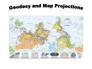
Title: Geodesy and Map Projections Author: Jude A. Benavides Last modified by: rgordon Created Date: 1/28/2004 8:29:42 PM Document presentation format
| PowerPoint PPT presentation | free to view
CE 394K.2 Hydrology, Lecture 3 Water and Energy Flow Literary quote for today: If I should die, think only this of me; That there's some corner of a foreign field
| PowerPoint PPT presentation | free to download
Is this a good map of the Earth? How about this? The Answer It depends A good map is one that is being successfully used for its intended purpose and was ...
| PowerPoint PPT presentation | free to download
Momentum Manning and Darcy eqns. Energy conduction, convection, radiation ... Darcy's equation. Hydraulic conductivity. Hydrologic Processes (Porous medium flow) ...
| PowerPoint PPT presentation | free to download
GIS in Water Resources Review for Midterm Exam Data Models A geographic data model is a structure for organizing geospatial data so that it can be easily stored and ...
| PowerPoint PPT presentation | free to view
Title: NATIONAL SPATIAL REFERENCE SYSTEM Author: DAVE DOYLE Last modified by: Mark W.Huber Created Date: 11/10/1997 9:52:36 PM Document presentation format
| PowerPoint PPT presentation | free to download
Preparing for Storm Surge and Inundation Effects Building in Resiliency
| PowerPoint PPT presentation | free to view
Mounted in Cessna 337 twin-engine aircraft. System and aircraft jointly owned by FIU/IHC ... Extracting zonal statistics within polygons. Summarize Zones tool ...
| PowerPoint PPT presentation | free to view
... Cartography. 2 ... Harry Williams, Cartography. 7. Bench marks are bronze disks, usually ... Harry Williams, Cartography. 10. Contours: imaginary lines of ...
| PowerPoint PPT presentation | free to download
Example: What is the length of a 1 increment along. on a meridian and on a parallel at ... Parallels converge as poles are approached. Horizontal Earth Datums ...
| PowerPoint PPT presentation | free to download
Logan: (42 N, 112 W) Length on Meridians and Parallels. 0 N. 30 N. Df. Re. Re. R. R. A. B. C ... Example: What is the length of a 1 increment along. on a ...
| PowerPoint PPT presentation | free to download
Overview of Datums Commonly Used in Michigan and the National Spatial Reference System
| PowerPoint PPT presentation | free to download
A 'good' map is one that is being successfully used for its intended purpose and ... WGS84 (World Geodetic System of 1984) uses GRS80, almost the same as NAD83 ...
| PowerPoint PPT presentation | free to view
Two Points. Single Point. Geographic Coordinates (f, l, z) ... Geographic coordinates (decimal degrees) Projected coordinates (length units, ft or meters) ...
| PowerPoint PPT presentation | free to download
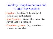
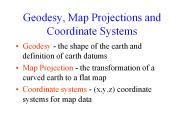
Geodesy, Map Projections and Coordinate Systems ... Texas Centric Mapping System - a statewide coordinate system for Texas. Coordinate System ...
| PowerPoint PPT presentation | free to download
Zone of cells. Themes or Data Layers. Vector data: point, line or polygon features ... Two fundamental ways of representing geography are discrete objects and fields. ...
| PowerPoint PPT presentation | free to download
Map Projection - the transformation of a curved earth to a flat map ... GPS location of Mabel Lee Hall. Geographic Coordinates (f, l, z) ...
| PowerPoint PPT presentation | free to download
A geographic data model is a structure for organizing geospatial data so that it ... Catchments are a tessellation of the landscape through a set of physical rules ...
| PowerPoint PPT presentation | free to download
Geoid is a surface of constant gravity. Topographic surface. Ellipsoid. Sea surface ... Elevation is measured from the Geoid. Standard Vertical Geodetic Datum ...
| PowerPoint PPT presentation | free to view
FLOOD RISK INFORMATION OPEN HOUSE. April 2006. Welcome & Introduction ... Concerns for methodology in BFE or floodway computations. COMMENTS. Errors in street names ...
| PowerPoint PPT presentation | free to view
GIS in Water Resources Midterm Review David Maidment, David Tarboton and Ayse Irmak ...
| PowerPoint PPT presentation | free to download
Rupert Brooke, English poet, 'The Soldier' (he died in WWI and is buried on the island of Skyros in Greece) ... Take a watershed and extrude it vertically into ...
| PowerPoint PPT presentation | free to download
Geodesy and Map Projections Geodesy - the shape of the earth and definition of earth datums Map Projection - the transformation of a curved earth to a flat map
| PowerPoint PPT presentation | free to view
National Oceanic and Atmospheric Administration. Image credit:: AP Photo/Rick Bowmer. Recent studies by the NOAA's NGS, in partnership with LSU, indicate the state's ...
| PowerPoint PPT presentation | free to download
Conformal: maintains angular relationships and accurate shapes over small areas. ... Shape - local angles are shown correctly (Lambert Conformal Conic) ...
| PowerPoint PPT presentation | free to view
Geodetic and Tidal Vertical Datums
| PowerPoint PPT presentation | free to view
Measurement station (spatial) National Hydro Data Programs. National ... Tracking Analyst Display. DEM Based Watershed and Stream Network Delineation Steps ...
| PowerPoint PPT presentation | free to download
Elements of the National Spatial Reference System
| PowerPoint PPT presentation | free to view
Get additional grant funds from FEMA update flood maps. Contract GPS Height Mod projects by county. NCGS perform leveling concurrent with GPS ...
| PowerPoint PPT presentation | free to download
H - C/G ; G - 980.6294 gals (Normal gravity at 45 degrees latitude as defined in 1955) ... ADJUSTMENT (DENOTED AS 'POSTED') BECAUSE OLDER DATA DID NOT FIT WITH ...
| PowerPoint PPT presentation | free to view
Arizona Geographic Information Council 2002 AGIC Conference
| PowerPoint PPT presentation | free to view
Outline. mapping: data acquisition. coordinate systems and transformations ... World geodetic system WGS84 ... Albers Equal Area (conic): USGS national map ...
| PowerPoint PPT presentation | free to view
National Spatial Reference System NORTH AMERICAN VERTICAL DATUM OF 1988 (NAVD 88) SEMINAR January 15, 2003 Catskill, New York Edward J. McKay OUTLINE Vertical Datums ...
| PowerPoint PPT presentation | free to view
The National Spatial Reference System (NSRS) is that component of the National ... GEOCENTRIC /- 3 to 4 CM. MODELS FOR PLATE TECTONICS. STATION VELOCITIES ...
| PowerPoint PPT presentation | free to view
GEOTECH 2004 Workshop 3 LIDAR Bob Ryan, CP, PLS
| PowerPoint PPT presentation | free to view
Enhancing the Communication of Flood Risk Through Inundation Mapping
| PowerPoint PPT presentation | free to view
... PERSONNEL HAVE PERFORMED PILOT STUDIES TO DETERMINE HOW TO BEST ... by users for crustal motion studies, adjustments, latest official heights, and descriptions ...
| PowerPoint PPT presentation | free to view
LORS Exisiting Conditions' and Future With Operations Modified' alternatives ... LORS-FWO is the future with operations modifications' project alternative ...
| PowerPoint PPT presentation | free to view
... reference as often used with the Space Shuttle, or a non-Earth planetary body, ... Where the Data Consumer specifies an alternative SRF, this 'SRM check utility' ...
| PowerPoint PPT presentation | free to view
Introduction to Geographic Information Systems and Sample Applications


