Sinuosity PowerPoint PPT Presentations
All Time
Recommended
What does this word mean? SINUOSITY B Is how straight a river has been or potentially could be. A Is the curving nature of a river s course. C Is the pattern of ...
| PowerPoint PPT presentation | free to view
... River, the bedrock and underlying lithologies through most of the valley is ... general the resolution of the underlying lithology is not good enough to see if ...
| PowerPoint PPT presentation | free to view
Sinuosity, Meander wavelength (Pattern) Slope (Profile) ... Measure bankfull width and discharge then calculate meander length and sinuosity ...
| PowerPoint PPT presentation | free to download
Sinuosity. Slope. Entrenchment Ratio. Channel Geometry. ER=2.5. ER=1.3 ... Sinuosity. Water surface slope. Channel materials 'D-50' FGM. Influence of Slope (S) ...
| PowerPoint PPT presentation | free to view
Is the sinuosity and width/depth ratio appropriate for the site (see Question 3) ... No, lateral stream movement is not associated with natural sinuosity ...
| PowerPoint PPT presentation | free to view
Classify and organize bypass reaches (river reaches ... Sinuosity (ratio of stream distance to valley distance) Water surface slope. Bed particle size ...
| PowerPoint PPT presentation | free to download
Carrying capacity / River sinuosity / Greenspan ... Test/Revise handbook with ESSP faculty. Redistribute content from existing, required, systems course ...
| PowerPoint PPT presentation | free to view
Commonly used to predict the magnitudes, volumes, and temporal patterns of flow ... the equations that account for lateral flows, off-channel storage, and sinuosity ...
| PowerPoint PPT presentation | free to view
Runoff, discharge and floods. Interannual/interdecadal variability ... Sinuosity - Costa et al. (JGR, in press) River network - Costa et al. (JGR, in press) ...
| PowerPoint PPT presentation | free to view
Use the scale on the map and a ruler! 5. Describe. sinuosity. from. to. from. to. and ... Are there more on one bank of the river than the other? ...
| PowerPoint PPT presentation | free to view
Comparison of Geomorphic Change in Two Flood Events on the Umatilla River, Oregon
| PowerPoint PPT presentation | free to download
Fluvial Geomorphology Environmental Hydrology Lecture 20 Fluvial Geomorphology Study of the role of running water in shaping the landscape Key concepts in fluvial ...
| PowerPoint PPT presentation | free to download
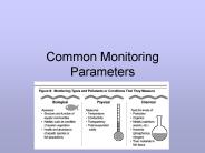
Common Monitoring Parameters Step 1 ... Benthic macroinvertebrates Metrics for biomonitoring data: ... type, diversity, embeddedness) Aquatic vegetation Riparian ...
| PowerPoint PPT presentation | free to download
Width of riparian buffer zone. Developed by: Richards, Reed, Ruzycki Updated: February 2004 ... Riparian Characteristics. Width of riparian zone. Buffer strip ...
| PowerPoint PPT presentation | free to download
... Types and Vertical Profile Models in Braided River Deposits: A Summary, in, Fluvial Sedimentology Memoir 5, Fluvial Facies Models, ...
| PowerPoint PPT presentation | free to download
Stream Order & Watersheds Watershed A ridge of high land dividing two areas that are drained by different river systems. The region draining into a river, river ...
| PowerPoint PPT presentation | free to download
Gravel Extraction as a Historical Economic Industry and its Morphological ... Digital orthophotos (2000) and aerial photos (1962) - georeferenced. ...
| PowerPoint PPT presentation | free to view
How have hydrologic controls on the Rio Grande effected the morphology of the river downstream of Brownsville? Chris Braun Controls of River Morphology Natural ...
| PowerPoint PPT presentation | free to download
Scientists are observing invasive crayfish displacing. indigenous crayfish in the Lake Mendota Watershed. ... This project assesses the relationship between crayfish ...
| PowerPoint PPT presentation | free to download
... depth) velocity = f(slope, roughness) River ... Rivers attempt to reach some equilibrium between erosive power of running water and resistance offered by bed ...
| PowerPoint PPT presentation | free to view
Geographic Information Systems GIS Analysis and Modeling 1. Geographic Analysis Geographic questions: where, when, why, and how The purpose of the analysis is to ...
| PowerPoint PPT presentation | free to download
OPEN CHANNEL FLOW * The next equation is the energy equation also known as Bernoulli s equation. This equation represents an energy balance between two points in a ...
| PowerPoint PPT presentation | free to view
... p q r s t u v w x y z { | } ~ ... 456789:CDEFGHIJSTUVWXYZcdefghijstuvwxyz GpSs tFTO ...
| PowerPoint PPT presentation | free to view
list characteristics used to describe floodplains. categorize channel types and patterns of streams. calculate the slope of a stream. ...
| PowerPoint PPT presentation | free to download
May or may not be top of bank, depending on whether or not the channel is incised. ... Photo: Geolgical Survey of. Newfoundland & Labrador. Longitudinal View. Profile ...
| PowerPoint PPT presentation | free to view
Stream Ecology: River Structure and Hydrology Unit 1: Module 4, Lectures 1
| PowerPoint PPT presentation | free to download
Watershed Delineation Delineating Watersheds Watershed (Catchment, Drainage Basin): A topographically delineated area drained by a stream system, or, the total land ...
| PowerPoint PPT presentation | free to view
Stream Ecology: River Structure and Hydrology Unit 1: Module 4, Lectures 1
| PowerPoint PPT presentation | free to download
Floods are a major cause of losses in the caribbean ... Caudal (m3/s) Profundidad normal (m) 660. 5.5700. 680. 5.6088. 780. 5.7610. 820. 5.8061. 860 ...
| PowerPoint PPT presentation | free to view
Harrisburg (200-500 ft) Somerville ( 200 ft) Peneplains of Mid-Atlantic. Schooley. Harrisburg. Somerville. Objections to the Davis Cycle. no intact peneplains exist ...
| PowerPoint PPT presentation | free to view
River response to deviations from equilibrium geometry of ... Annual Average Daily Sediment Concentration. 1.1. 1.9. 2.1. 4.6. 3.5. 4.1. 3.1. 2.6. 26 Subreaches ...
| PowerPoint PPT presentation | free to download
Depositional Environments and Sedimentary Facies * * Depositional Environments Areas of the Earth s surface where distinct processes generate specific geological ...
| PowerPoint PPT presentation | free to view
Fluvial Landforms. Channel Morphology. What variables control channel morphology? ... 1 - Beaverdam Creek, Gap Run, and Goose Creek flow eastward through the Blue ...
| PowerPoint PPT presentation | free to view
Clover Groff Run Stream Restoration Project
| PowerPoint PPT presentation | free to download
Stream Solute Dynamics: Hyporheic Processes
- Stream Solute Dynamics: Hyporheic Processes Lecture 18
Stream Solute Dynamics: Hyporheic Processes Lecture 18
| PowerPoint PPT presentation | free to download
... tOFsOTsOOpOOSOOtOOFOd OdFOFdFtdOSdOsdd ddtdFdOdfFdeTOtdtFftfFfOfdtfFfTfftfe TfOf ... O fddf f ef d f e ffef n n n n n n nn n C ...
| PowerPoint PPT presentation | free to view
For example the distinction between straight and meandering is based on ... Saltation, which occurs when particles are suspended in the stream for a short ...
| PowerPoint PPT presentation | free to view
... Strickland River System in Papua New Guinea has been profoundly influenced by ... SOME CALCULATIONS APPLIED TO THE FLY-STRICKLAND RIVER SYSTEM, PAPUA NEW GUINEA ...
| PowerPoint PPT presentation | free to download
Watershed and Rapid Geomorphic Assessment of Bay Brook and Centennial Brook ... Digital orthophotographs, aerial photos, and topographic maps. Terrain Navigator ...
| PowerPoint PPT presentation | free to download
Stream Geomorphic Assessment of Allen Brook. Jarrett Arthur, Amy Myers. Shea Hagy, Mike McDonald ... Lack of adequate riparian buffer zone ...
| PowerPoint PPT presentation | free to download
Low gradient streams typically appear slow moving and sinuous, and have less ... Slow. Bed Features. Step. Riffle. Run. Pool. Glide. W&L Wbkf. D 3 feet ...
| PowerPoint PPT presentation | free to download
Title: Riparian PFC What It Is And What It Is Not Author: sswanson Last modified by: lsaito Created Date: 11/25/2002 4:13:04 PM Document presentation format
| PowerPoint PPT presentation | free to download
Maps and photos-springs, irrigation, dams. Topographic-aquatic ... Plane table on tripod. Alidade. Measuring tape. Marking stakes. Brightly marked range pole ...
| PowerPoint PPT presentation | free to view
... ... 456789:CDEFGHIJSTUVWXYZcdefghijstuvwxyz GpSs tFTO ...
| PowerPoint PPT presentation | free to download
HYDRAULIC GEOMETRY OF MOUNTAIN RIVERS
| PowerPoint PPT presentation | free to download
CHAPTER 15: EXTENSION OF 1D MODEL TO INCLUDE BANK EROSION AND FLOODPLAIN DEPOSITION It was noted in the last chapter that rivers are different in many ways from ...
| PowerPoint PPT presentation | free to download
These pools and riffles have been. recently constructed. Trout Creek Restoration ... Trout Creek to stream. function. Take field measurements below. dam. Field ...
| PowerPoint PPT presentation | free to view
Methods and guidelines for the. rapid assessment of. biological ... Saprobic indices: - pollution impact. Diversity indices: - taxa richness - eveness / balance ...
| PowerPoint PPT presentation | free to download
American Burying Beetle. Mead's Milkweed. Red-spotted Toad. Redbelly Snake. RRAS RIVERWORKS RAPID ASSESSMENT SYSTEM. Morphological Data ...
| PowerPoint PPT presentation | free to view
Physical Layout of Pigeon Creek ... about the physical aspect of Pigeon Creek: ... We learned that Pigeon Creek has a overall score of 52 out of 114 which means ...
| PowerPoint PPT presentation | free to view
Development of Aquatic Ecosystem Models
| PowerPoint PPT presentation | free to download
Assessing scales of thermal influence in alluvial floodplains using Relative ... Lithology. Vegetation. Interim Results. Implications ...
| PowerPoint PPT presentation | free to download
Title: PowerPoint Presentation Last modified by: Peter Li Created Date: 1/1/1601 12:00:00 AM Document presentation format: On-screen Show Other titles
| PowerPoint PPT presentation | free to view
Provide recreation. Provide electricity. Existence of lotic systems depends on: ... Three types: Perennial or permanent rivers. Periodic rivers. Episodic rivers ...
| PowerPoint PPT presentation | free to view


