Ancient China - PowerPoint PPT Presentation
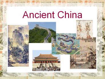
Ancient China
... near the border with Mongolia North China Plain Fertile farmland near the mouths of the Yangtze and Yellow Rivers in eastern China Geography of Ancient China ... – PowerPoint PPT presentation
Title: Ancient China
1
Ancient China
2
Geography of Ancient China
- Isolated
- Subcontinent ???
- Natural boundaries surround China
- seas to the east
- desert in the north
- mountains in the west
- massive mountains in the southwest
- more mountains in the south
- Only 10 of the country has descent farmland
3
Yangtze River (Chiang Jiang)
- Chinas longest river begins in the Himalayas
(Plateau of Tibet) and flows eastward to the East
China Sea
4
Yellow River (Huang He)
- Yellow because of clay Chinas second longest
river also begins in the Himalayas (Plateau of
Tibet) and flows eastward to the Bo Hai Bay /
Yellow Sea
5
Plateau of Tibet
- Southwestern China, north of Himalayas huge part
of western China
6
Tarim Basin
- A basin is a large area that is lower than the
surrounding land bowl-shaped area in western
China, just northwest of the Plateau of Tibet
7
Gobi Desert
- Cool, dry desert in northern China, near the
border with Mongolia
8
North China Plain
- Fertile farmland near the mouths of the Yangtze
and Yellow Rivers in eastern China
9
Geography of Ancient China
Gobi Desert
Tarim Basin
Yellow River
Plateau of Tibet
North China Plain
Yangtze River
PowerShow.com is a leading presentation sharing website. It has millions of presentations already uploaded and available with 1,000s more being uploaded by its users every day. Whatever your area of interest, here you’ll be able to find and view presentations you’ll love and possibly download. And, best of all, it is completely free and easy to use.
You might even have a presentation you’d like to share with others. If so, just upload it to PowerShow.com. We’ll convert it to an HTML5 slideshow that includes all the media types you’ve already added: audio, video, music, pictures, animations and transition effects. Then you can share it with your target audience as well as PowerShow.com’s millions of monthly visitors. And, again, it’s all free.
About the Developers
PowerShow.com is brought to you by CrystalGraphics, the award-winning developer and market-leading publisher of rich-media enhancement products for presentations. Our product offerings include millions of PowerPoint templates, diagrams, animated 3D characters and more.


