Mason Inlet Management Project - PowerPoint PPT Presentation
1 / 31
Title: Mason Inlet Management Project
1
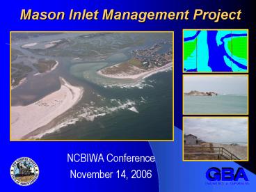
Mason Inlet Management Project
- NCBIWA Conference
- November 14, 2006
2
Mason Inlet - Project Purpose
- Primary Purpose
- Protect structures directly threatened by the
migration of the inlet. - Protect beachfront structures through associated
beachfill placement.
- Secondary Benefits
- Navigational use of Mason Creek
- Improve flushing of the Middle Sound Estuary.
- Provide beachfront erosion control through
beach nourishment.
3
Long Term Management Objectives
- Maintain the location of the Inlet within the
inlet corridor thru continuous periodic
maintenance of the inlet channel and
sedimentation basin and placement of sand on
adjacent beaches 2 miles north or south of the
Inlet. - Reduce the potential for Inlet migration and
shoaling in the AIWW by dredging Mason Creek and
placing the material on the adjacent beaches. - Maintain Adjacent Beach Widths by beach fill
placement to ameliorate sand losses that are
inlet related and exceed established sand loss
thresholds.
Inlet Management Plan Section 4.0
4
Project Purpose How Are We Doing?
Shell Island Resort
ATM 1999
Spring 1999
September 2006
Protect structures directly threatened by the
migration of the inlet.
5
Project Purpose How Are We Doing?
September 15, 2006
Maintain the location of the inlet within the
Inlet Corridor.
6
Project Purpose How Are We Doing?
Protect beachfront structures through associated
beach fill placement.
South End of Figure 8 Island
Erosion Hotspot
Post-Ophelia November 2005
7
Project Purpose How Are We Doing?
Protect beachfront structures through associated
beach fill placement.
South End of Figure 8 Island
Erosion Hotspot
February 2005
June 2005
Post-Nor'easter's
November 2005
September 2006
February 2002
165
Post- Nourishment
Post-Ophelia
Its an Ongoing Process
8
Mitigation Island and Flood Shoal Recovery
Recovery of Previous Inlet Channel
Dune Planting
Marsh Recovery
Inter-tidal Shoal Recovery
10.7 ac. Mitigation Island Completed April 2003
9
Maintenance Actions
Completed Sept 2002 Intracoastal
Waterway Dredging March 2003 Mitigation
Island Creation 90,000 cy of
Beach Fill Southern End of Figure 8 Feb 2004
Intracoastal Waterway Dredging April 2005
First Inlet Maintenance Event (Phase
1) 180,000 cy Truck-haul from Inlet
to Figure 8 Beaches April 2006 First
Inlet Maintenance Event (Phase 2)
78,000 cy Dredging from Mason Creek to Figure 8
Beaches 70,000 cy Dredging from
Waterway to Figure8 Beaches
10
First Maintenance Event
(As Permitted Winter 2004-2005)
New Hanover County contracted the Figure 8
Beach HOA to perform the First Maintenance Event
Broken into 2 Phases due to Banks Channel
Permitting Delays Phase 1 Inlet Shoal
Spring 2005 Phase 2 Mason Creek
Spring 2006
11
First Maintenance Event (Phase 1)
Objectives Relocate Northern Shoreline of
Mason Inlet to North side of the Inlet
Corridor. Protect Imminently Threatened
Structures on the Southern End of Figure 8
February 2005
12
First Maintenance Event (Phase 1)
Size 180,000 cy Cost 631,000
13
First Maintenance Event (Phase 2)
Objectives Reduce the potential for Inlet
migration and shoaling in the AIWW Maintain
AIWW for Navigation Protect Imminently
Threatened Structures on the Southern End of
Figure 8
Size 149,000 cy Cost 702,715
14
First Maintenance Event
(Actual Work)
DREDGED Inlet Shoal 05 180,000 cy Mason Cr.
06 78,600 cy AIWW 06 70,300
cy Banks Chl 06 219,000 cy
15
Inlet Changes During First Maintenance Period
16
Where Do We Go From Here?
Future Management Issues
17
Hurricane Ophelia
September 16, 2005
September 7-14, 2005
November 2005
18
Effects of Ophelia
Ophelia was a 7-day event with elevated tides and
6-10 ft NE seas. RESULTS Ebb-Tidal Delta
reconfigured Longshore Transport from Figure 8
into the Inlet Shoaling within the inlet system
and AIWW
19
Channel Characteristics
Cross-Sectional Area has changed less than 5
since 2004
Mechanism for Migration is shoaling on the North
Shoulder not Scour on the South Shoulder.
FIGURE 8
WRIGHTSVILLE
20
Mason Inlet Morphologic Changes
21
Mason Inlet Morphologic Changes
22
Mason Inlet Morphologic Changes
23
Mason Inlet Morphologic Changes
24
Mason Inlet Morphologic Changes
25
Mason Inlet Morphologic Changes
26
Mason Inlet Morphologic Changes
27
Mason Inlet Morphologic Changes
28
Mason Inlet Morphologic Changes
29
Mason Inlet Morphologic Changes
30
Mason Inlet Morphologic Changes
31
In Conclusion
- Project purposes have been consistently met over
last 4.5 yrs - - Shell Island currently safe from inlet
migration - - Beachfront homes have been protected with
beachfill but its an ongoing process - Inlet remains within the inlet corridor limits
- Maintenance exposed trends in sediment transport
- Future maintenance will focus on Mason Creek
AIWW


![Chronic Care Management: How To Do It Right? [Updated For 2022] PowerPoint PPT Presentation](https://s3.amazonaws.com/images.powershow.com/9683693.th0.jpg?_=202111150510)
