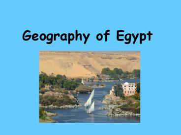
Geography of Egypt - PowerPoint PPT Presentation
Title:
Geography of Egypt
Description:
Geography of Egypt What can we learn from this image? What can we learn from this image? Where do you think the majority of the people lived? Describe what the Green ... – PowerPoint PPT presentation
Number of Views:792
Avg rating:3.0/5.0
Title: Geography of Egypt
1
Geography of Egypt
2
What can we learn from this image?
3
What can we learn from this image?
- Where do you think the majority of the people
lived? - Describe what the Green and Tan areas of the map?
- How could the location of Egypt help it grow into
a great civilization?
4
(No Transcript)
5
(No Transcript)
6
Ancient Egyptian Song
- Hail O Nile, who comes from the earth, who
comes to give life to the people of Egypt
7
What are the benefits of living near a river?
- Water to drink
- Water for farming
- Washing
- Transportation
- Fishing
- Hunting animals
- Mud for building
8
The Nile
- Longest river in the world
- 4145 miles
- Flows to the north from the Ethiopian high lands
to the Mediterranean sea. - Begins as two separate rivers-Blue and White Nile
- Lower Egypt-North Egypt near the delta
- Upper Egypt-South of Memphis
9
The Nile
- Lower Egypt-North Egypt near the delta. North of
Memphis - Upper Egypt-South of Memphis
10
The Delta
- A delta is the land at the mouth of a river that
is formed by mud and sand as it is deposited by a
large river.
11
Nile Delta from Space
12
Herodotus
Gifts of The Nile
- About 2,500 years ago, Herodotus, a Greek visitor
to ancient Egypt called Egypt the Gifts of The
Nile. - The gifts of the Nile were very important to the
Egyptians. - What are the Gifts?
13
HerodotusGifts of the Nile 1-Silt
- Black Soil/Silt that was left by the
floods.gtThe Silt recharged the soil - gt Allowed Farmers to grow a surplus of crops.
14
(No Transcript)
15
Kemet
- The Egyptians called their land Kemet or the
Black Land. - They called it Kemet because of the rich black
farm land (silt).
16
HerodotusGifts of the Nile 2-Papyrus
- Papyrus- Large reed that grew wild along the
river. - They used it to make mats, boats, baskets, ropes,
sandals - Strips glued together in sheets made paper. Long
sheet is a scroll.
17
Irrigation
- Each year the river would flood.
- Heavy rains and melting snow from central Africa
caused the floods - Nile floods were gentle and dependable compared
to Mesopotamia.
18
(No Transcript)
19
Irrigation
- To take advantage of the annual flooding of the
Nile, the people built irrigation channels to
carry water into fields
20
Shaduff- Irrigation tool
21
Natural Boundaries
- The Sahara Desert (Eastern and Western Deserts)
are located next to the Nile. - The Mediterranean Sea to the North
- Red Sea to the East.
- 6 Cataracts throughout the Nile.
- Cataracts are rapids, waterfalls. Made
transportation difficult in some areas.
22
(No Transcript)


