Cloudsat PowerPoint PPT Presentations
All Time
Recommended
... taking observations of clouds in tandem with other remote sensing instruments. ... Bright band. Increase dBZ as species changes. WRF Microphysics Cross ...
| PowerPoint PPT presentation | free to view
The CloudSat Mission CEE: 6900-Environmental Application of Remote Sensing Abel Tadesse Woldemichael Overview Clouds: are not just white things that break up the ...
| PowerPoint PPT presentation | free to view
This website shows vertical profiles of the atmosphere taken by the CloudSat radar. ... But it cannot see dust or. thin clouds. Interpreting the Image. Warning ...
| PowerPoint PPT presentation | free to view
GOES Imager, GOES Sounder, MODIS cloud top pressures. AIRS cloud top and separation pressures. ... GOES SOUNDER. MODIS. Satellite Products Validation. 19N. 27N ...
| PowerPoint PPT presentation | free to download
Microwave Limb Sounder (MLS:USA) Measures microwave limb emission of ozone destroying chemicals ... AIRS/HSB/AMSU and MLS - upper tropospheric water vapor ...
| PowerPoint PPT presentation | free to download
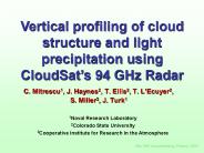
Nadir pointing, 94 GHz radar. 3.3 s pulse 500m vertical res. ... CPR is nadir-pointing providing only a 2D slice of the real world. 10/23/09. 3rd IPWG Workshop ...
| PowerPoint PPT presentation | free to view
A view of UT clouds and relative humidity using AIRS, CALIPSO, and CloudSat. by. Brian H. Kahn ... Jet Propulsion Laboratory, California Institute of Technology, ...
| PowerPoint PPT presentation | free to view
CloudSat Snowfall Retrievals: Potential, Status, and Challenges. Tristan S. ... Gander. Pr. Albert. Toronto. Montreal. Annual Mean Precipiation (1951-1980) 8/2/09 ...
| PowerPoint PPT presentation | free to view
Acknowledgements: Graeme Stevens, Bruce Wielicki, Chip Trepte. EOS 'A Train' ... HIRDLS 22.5 minutes behind- upper trop. down to cloud tops, 1 km vertical res. ...
| PowerPoint PPT presentation | free to view
1.1 km. Roger Marchand, U. Washington (rojmarch@u.washington.edu) Gerald Mace, U. Utah ... Graeme Stephens, Colorado State. CloudSat Measured Return Power ...
| PowerPoint PPT presentation | free to view
... of the boreal summer intraseasonal variability based on CloudSat observations and ERA-interim reanalysis Outline MJO(Madden Julian Oscillation) ...
| PowerPoint PPT presentation | free to view
CloudSat and the Atrain: A GEWEX and WCRP experiment1 Graeme Stephens Deborah Vane
| PowerPoint PPT presentation | free to view
Should flag data as suspect for ~70 seconds. ( 5-10 orbits per day) ... satellite, any data taken at least in Band 3 should automatically be flagged. as bad. ...
| PowerPoint PPT presentation | free to view
contributions from Chris Bretherton, Kim Comstock, Sandra Yuter, Peter Caldwell ... Pockets Of Open Cells (POCs) are frequently observed in otherwise unbroken Sc. ...
| PowerPoint PPT presentation | free to view
Jet Propulsion Laboratory, California Institute of Technology, Pasadena, CA ... Red: Cumulus. Dark Red: Nimbostratus. AIRS RHI & CloudSat IWC anti-correlated ...
| PowerPoint PPT presentation | free to view
A suite of radar-lidar-radiometer cirrus retrieval algorithms for the combined ... MOD06 Cloud Products compare with lidar-Radiometer retrievals. IV. Summary ...
| PowerPoint PPT presentation | free to view
Rainfall: 39.6 mm of rain at overpass (16 accumulated days) Rain gauge one hour prior to overpass: 0 mm. Rain is predicted for the evening. Contrails ...
| PowerPoint PPT presentation | free to download
... of environmental spacecraft including Aqua, Aura, Oco, and Parasol for a greater ... Aura's mission is to probe. the Earth's troposphere (launched July 15, 2004) ...
| PowerPoint PPT presentation | free to view
Cloudsat radar CALIPSO lidar Target classification Insects Aerosol Rain Supercooled liquid cloud Warm liquid cloud Ice and supercooled liquid Ice Clear No ice/rain ...
| PowerPoint PPT presentation | free to download
Global Cloud Characteristics (Cloudsat & CALIPSO) T. Global ... Global sea surface salinity (Aquarius) Improved space/time scales of ocean topography (OSTM) ...
| PowerPoint PPT presentation | free to view
The Orbiting Carbon Observatory: Sampling Approach and Anticipated ... OMI O3, aerosol climatology. aerosols, polarization. CloudSat 3-D cloud climatology ...
| PowerPoint PPT presentation | free to view
2. How do convective intensity and aerosol properties affect cirrus anvil properties? ... Good access to anvil cirrus for CALIPSO and CLOUDSAT cal/val. Why ...
| PowerPoint PPT presentation | free to download
Over the Sahara Desert from late spring to early fall, air moving across the ... formation with AQUA, CloudSat, PARASOL, and Aura around the earth to form the ' ...
| PowerPoint PPT presentation | free to download
The A-Train * * * * * * * * * * * * * * * * * * Presentation Schedule 11/25 (Tuesday): Clouds and Climate Nick Mangieri-- Noctilucent clouds using CloudSat (15 ...
| PowerPoint PPT presentation | free to download
John F. Kennedy Space Center. Kennedy Space Center ... PICASSO-CENA/ CLOUDSAT - 3/03** GPB - 10/30. AQUA (EOS-PM) NET 7/12. AURA (EOS CHEM) ...
| PowerPoint PPT presentation | free to view
Combinaison d'un radar 95 GHz bi-faisceaux Doppler. et d'un lidar ... plate-forme a roport e (et version sol) D monstrateur du tandem CALIPSO / CloudSat. Le ...
| PowerPoint PPT presentation | free to view
Constellations provide the opportunity to make coincident, ... 6x7 km POLDER. 5.3 x 8.5 km TES. Cloud. 0.5 km MODIS Band 3-7. 0.09 km CALIPSO. 1. 4 km Cloudsat ...
| PowerPoint PPT presentation | free to view
CALIPSO: Cloud profiler lidar 532, 1064nm Infra Red Imager. AQUA: radiometers MODIS, AIRS, CERES, AMSR-E. A-Train: 28th April 2006 ...
| PowerPoint PPT presentation | free to download
Using A-train observations to evaluate clouds in CAM. Jennifer Kay (NCAR/CSU) ... Thanks to Hugh Morrison (NCAR) Active instruments such as radar or lidar ...
| PowerPoint PPT presentation | free to view
Algorithm Refinement and Validation of Cloud and Radiation Products. Derived from MODIS and CERES Using Ground-Based and. Aircraft Data. Jay Mace, University of Utah ...
| PowerPoint PPT presentation | free to download
ECMWF Cloud and Radiation Parametrization: Recent Activities Richard Forbes, Maike Ahlgrimm, Jean-Jacques Morcrette, Martin K hler Evaluation of models ...
| PowerPoint PPT presentation | free to download
The time-dependent two-stream method for lidar and radar multiple scattering Robin Hogan (University of Reading) Alessandro Battaglia (University of Bonn)
| PowerPoint PPT presentation | free to download
Title: PowerPoint Presentation Author: Robin Hogan Last modified by: Robin Hogan Created Date: 8/29/2002 5:27:07 PM Document presentation format: On-screen Show (4:3)
| PowerPoint PPT presentation | free to download
Dr. John Gille, UC, NCAR. Dr. John Barnett, Oxford. Aura - MLS. Dr. ... Dr. Graeme Stephens, CSU. OCO. Dr. David Crisp, NASA JPL. Parasol. Dr. Didier Tanr , LOA ...
| PowerPoint PPT presentation | free to download
Project Title: A Merged Atmospheric Water Data Set from the A-Train Principal Investigator: Eric Fetzer, JPL Specific progress made towards IP: Delivered merged AMSR ...
| PowerPoint PPT presentation | free to download
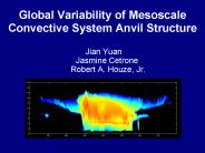
MODIS/Aqua Clouds 1km and 5km 5-Min L2 Wide Swath Subset ... Subdivide Cold and Warm by size. Selection of Mesoscale Convective Systems. Cold MCS (Smallest 30 ...
| PowerPoint PPT presentation | free to download
VARIATIONAL SYNERGISTIC ICE-CLOUD RETRIEVALS. Julien Delano , Robin ... 1st JADE Meeting ... particle concentration, but extinguished when cloud to thick ...
| PowerPoint PPT presentation | free to download
Two examples of the unique science from the Atrain
| PowerPoint PPT presentation | free to view
GOES-R AWG Product Validation Tool Development Nighttime Cloud Optical and Microphysical Properties (NCOMP) Patrick Heck (UW-Madison CIMSS) Patrick Minnis (NASA LaRC) *
| PowerPoint PPT presentation | free to download
Clouds and their radiative impact as examples of histogram (binning) methods Brian Mapes Global warming projections in terms of T Remember this from class 5?
| PowerPoint PPT presentation | free to view
Compare cloud climatology of type & height distribution from model with analyses ... Development of Australian Aerosol Climatology for inclusion in Climate Model ...
| PowerPoint PPT presentation | free to view
... latitude-longitude maps, time series diagrams, latitude-time and longitude-time Hovm ller diagrams, and animations. ... to process and generate the image ...
| PowerPoint PPT presentation | free to download
Title: PowerPoint Presentation Author: Robin Hogan Last modified by: Administrator Created Date: 8/29/2002 5:27:07 PM Document presentation format
| PowerPoint PPT presentation | free to download
Diagnostics for the Tropics:
| PowerPoint PPT presentation | free to view
Towards unified radar/lidar/radiometer retrievals for cloud radiation studies Robin Hogan Julien Delanoe Department of Meteorology, University of Reading, UK
| PowerPoint PPT presentation | free to download
Project title: An A-train Integrated Aerosol, Cloud, and Radiation Data Product ... Rose, David Winker, Graeme Stephens, Thomas Charlock, Paul Stackhouse, William ...
| PowerPoint PPT presentation | free to view
The A-Train is a group of Earth Observing Satellites (EOS) which. will fly in formation, each within minutes of each other, on polar. orbits. ...
| PowerPoint PPT presentation | free to view
Evaluating the NCEP GFS and NAM Model Clouds against Satellite Retrievals
| PowerPoint PPT presentation | free to download
Title: MODIS/GLAS Cloud Comparisons Author: Michael Pavolonis Last modified by: loan01 Created Date: 3/17/2005 7:01:47 PM Document presentation format
| PowerPoint PPT presentation | free to download
Links to Resources GLOBE AIM CLOUD S COOL MY NASA DATA CALIPSO NLC Differences between mesospheric and tropospheric clouds Limited to 60o to latitude for NLCs ...
| PowerPoint PPT presentation | free to download
3Cooperative Institute for Research in the Atmosphere ... (on Aqua), the lidar aboard CALIPSO, and the POLDER instrument aboard PARASOL ...
| PowerPoint PPT presentation | free to download
Microphysical Observations in Support of NAMMA. Andrew Heymsfield, NCAR. Aaron Bansemer, NCAR ... Characterization of precipitation processes in the West ...
| PowerPoint PPT presentation | free to view
Experimental retrieval of wind speed over ocean from emissivity catalogs ... Package, New features of Web site. MiRS 6th Release to OSDPD. MiRS DAP package to be ...
| PowerPoint PPT presentation | free to view
product (OMAERO) using the multi-wavelength algorithm ... MODIS AOT is interpolated at 500nm using Angstrom Exponent. Collocated OMI v.s. MODIS DT Ocean ...
| PowerPoint PPT presentation | free to download
s Clouds over Gymnasium Schlo Neuhaus The students working with the Weather Group at the GSN found out that the the sky above our school is more often
| PowerPoint PPT presentation | free to download
NASA Water and Energy Cycle Focus Area Review, May 27 ... SCARAB-1. ERBE. Future releases? Time. ERB. Missions. WRDC/NREL, NOAA CMDL, Field Experiments, misc. ...
| PowerPoint PPT presentation | free to view


