
Land Evaluation PowerPoint PPT Presentations
All Time
Recommended

Land Cover Analysis: Qualitative Land Cover, Quantitative Land Cover, Biometry
| PowerPoint PPT presentation | free to view

Land Use Planning in the OECS using the Automated Land Evaluation System (ALES) By L.M. Fletcher-Paul Integrated Natural Resources Management Officer, FAO, SLAC
| PowerPoint PPT presentation | free to download

... these two, thereby computing the physical suitability of a set of map units for ... conducted next to derive the suitability of the land unit for specific ...
| PowerPoint PPT presentation | free to view

Actual Trends concerning Land Management, Land Readjustment and Land Consolidation in Europe - possible fields of research - Joachim Thomas, M nster (Germany)
| PowerPoint PPT presentation | free to download

Land Use Permit Tracking: Monitoring and Evaluation of Land Use Regulatory Programs for Salmon Recovery Planning in Hood Canal Scott Brewer, Hood Canal Coordinating ...
| PowerPoint PPT presentation | free to view

The contribution of land evaluation and crop growth simulation to integrate ... Maize (temperate, silage) Maize (sub-tropics, grain) Highland Maize and Sorghum ...
| PowerPoint PPT presentation | free to view
Go on now, start planning your sale plan, follow a good marketing strategy and get your land off of your hands.
| PowerPoint PPT presentation | free to download
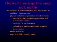
Chapter 8: Landscape Evaluation and Land Use Earth scientists as part of evaluation team provide info on: site history (previous use) physical and chemical properties ...
| PowerPoint PPT presentation | free to download
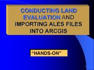
CONDUCTING LAND EVALUATION AND IMPORTING ALES FILES INTO ARCGIS HANDS-ON IMPORTING DATA INTO GIS One Method Import file into Spreadsheet Save as database file ...
| PowerPoint PPT presentation | free to download
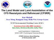
The Land Model and Land Assimilation of the CFS Reanalysis and Reforecast (CFSRR) Ken Mitchell Jesse Meng, Rongqian Yang, Helin Wei, George Gayno
| PowerPoint PPT presentation | free to download

Rural land in Alabama is valued ($1500-1900 per acre) about the ... 4. Pike. 4. Russell. 5. Chambers. 5. Clarke. County Median Family Income. Wilcox $22,200 ...
| PowerPoint PPT presentation | free to download

1. The MODIS Land Cover and Land Cover Dynamics Products. A.H. Strahler (PI), Mark Friedl, Xiaoyang Zhang, John Hodges, ... Increases accuracies, reduces speckle ...
| PowerPoint PPT presentation | free to view

DAILY LEVEL 3 PRODUCTS. FIRE MASK. LAND SURFACE REFLECTANCE. EVI AND NDVI. SNOW COVER ... mini-IDPS. PRODUCTS and. QUALITY ASSURANCE. NASA VIIRS Land Science ...
| PowerPoint PPT presentation | free to view

... To develop a 'GIS model' to evaluate the suitability of maize, sorghum and beans. ... Maize, beans and sorghum suitable growing regions ...
| PowerPoint PPT presentation | free to view

Land Cover and Land Use Change in Temperate East Asia: ... LSWI) will improve land cover characterization, e.g., phenology, classification. ...
| PowerPoint PPT presentation | free to view

UMD: University of Maryland land cover class labels. 14 classes without mosaic classes ... MODIS Map of Cereal Crops in the Continental United States ...
| PowerPoint PPT presentation | free to view

Forecast models are Coupled Land-Atmospheric Forecast Systems ... Make the LS perturbations consistent with Atmospheric perturbations used in the ...
| PowerPoint PPT presentation | free to download

UPA Package 3, Module 2 GOVERNMENT INTERVENTION IN URBAN LAND MARKET Land Management and Poverty Alleviation Government Intervention In Urban Land Market Government ...
| PowerPoint PPT presentation | free to view

Evaluation of land model simulations across multiple sites and multiple models: Results from the NACP site-level synthesis effort Peter Thornton1, Gautam Bisht1, Dan ...
| PowerPoint PPT presentation | free to download

Terrestrial Ecology and Land CoverChange Science Review: Basis of Successful Land Product Validation
| PowerPoint PPT presentation | free to download

Changing Landscapes: Anticipating the Effects of Local Land Use Decisions ... Changing Landscapes Workshop Structure. Ten decision support tools were demonstrated ...
| PowerPoint PPT presentation | free to view

Use of GENOPT and BIGBOSOR4 to optimize weld lands in axially compressed stiffened cylindrical shells and evaluation of the optimized designs by STAGS
| PowerPoint PPT presentation | free to download

Calibration year 2001, running 2001-2050 1-year time steps ... Land Cover Data (ha), reference year 1992: 7 land covers for 226 countries ...
| PowerPoint PPT presentation | free to view

Land Tenure for Dry lands Development: Continuing the Dialogue. March 7 to April 1 2005. ... in a final document to be produced after the end of the e-conference. ...
| PowerPoint PPT presentation | free to view

Land-Use Change in Temperate East Asia: Land Cover Changes Impacts on Carbon ... to 2003 to characterize vegetation phenology, seasonal dynamics and inter-annual ...
| PowerPoint PPT presentation | free to view

A Study of the Drainage as Based on an Evaluation of the Irrigated Land in the Flood Plain of the River Moustiques Etude de drainage en vu de la valorisation des ...
| PowerPoint PPT presentation | free to download

... and four point (column flux) sites spanning the range from tropical to arctic. ... flux evaluations are for a tropical forest site at Reserva Jaru (ABRACOS) ...
| PowerPoint PPT presentation | free to view


NASA Land Information System (Noah, ... Regional Models: WRF; RAMS-AROMA, COAMPS, and RUC (for evaluations) Supercomputing: Project Columbia (NASA), HPC2 (MSU) ...
| PowerPoint PPT presentation | free to download

Realty Shield offers Due Diligence & Diagnostic Review of Land parcelsand plots through Research based land Report Card. This can establish a 360 degree evaluation of the property in Hyderabad Telangana
| PowerPoint PPT presentation | free to download
Land Use Historic Trends and Future Projections
| PowerPoint PPT presentation | free to download
Land Data Processing and Collection 6 ... Final test results will be released for community evaluation. 1. C6 L1B, Land Cover, Cloud Mask Tests C6 L1B Test ...
| PowerPoint PPT presentation | free to download

Land is a scarce resource. essential to make best possible ... (Bunch of Old Guys/Gals Sitting Around a table Talking) MCE is good for complex spatial problems ...
| PowerPoint PPT presentation | free to view

NJ day care center built in a former thermometer factory. Spurred environ evaluation of ... Atmospheric fallout. Duds. Misfires. Sodium Hypochlorite. Blasting ...
| PowerPoint PPT presentation | free to view

Evaluation Theory & Program Theory By K.S. Calbick, B. Tech., MRM. Prepared for REM 356 Management Institutions, September 27, 2004 Goals 1. Review Evaluation Theory 2.
| PowerPoint PPT presentation | free to view

Invasion of the Star Wars' Clones: South Georgia. Plot the story tells of Star Wars' clones landing in a field outside Tifton ...
| PowerPoint PPT presentation | free to view

Systemic impact evaluation Evaluating impacts of agricultural projects The example of SOGUIPAH in Guinea AFD - J. Delarue What do we want ? Rigorously estimating ...
| PowerPoint PPT presentation | free to download

1. Land surveyors assess a particular area for the purpose of development, and to measure and map the area. 2. Land surveyors used advanced technology such as GPS, Robotic Total Stations (Theodolites), and aerial and terrestrial scanners. 3. Some of the tasks of a land surveyor is to make exact measurements and determine property boundaries and to collect and provide data on the location, contours, gravitation, elevation and features of an area for land evaluation, mining, construction, mapmaking and other purposes. 4. A surveyor verifies the accuracy of the survey data including the measurements and calculations conducted at survey sites. 5. He/she also writes descriptions of property boundary surveys which would be used in deeds, leases and other legal documents. Visit Yellowpages-UAE website to know more information about Best Land Surveyor and Engineers in Sharjah at http://www.yellowpages-uae.com/uae/sharjah/land-surveyors
| PowerPoint PPT presentation | free to download
![[DOWNLOAD]PDF Urban Land Use Planning, Fifth Edition PowerPoint PPT Presentation](https://s3.amazonaws.com/images.powershow.com/10052132.th0.jpg)
"14 minutes ago - DOWNLOAD HERE : share.bookcenterapp.com/powers/0252030796 READ [PDF] Urban Land Use Planning, Fifth Edition | This edition explores the societal context of land use planning and proposes a model for understanding and reconciling the divergent priorities among competing stakeholders. It explains how to build planning support systems to assess conditions, evaluate policy choices, create visions, and compare scenarios. "
| PowerPoint PPT presentation | free to download
![[DOWNLOAD]⚡️PDF✔️ Urban Land Use Planning, Fifth Edition PowerPoint PPT Presentation](https://s3.amazonaws.com/images.powershow.com/10051472.th0.jpg)
"14 minutes ago - DOWNLOAD HERE : .softebook.net/power/0252030796 READ [PDF] Urban Land Use Planning, Fifth Edition | This edition explores the societal context of land use planning and proposes a model for understanding and reconciling the divergent priorities among competing stakeholders. It explains how to build planning support systems to assess conditions, evaluate policy choices, create visions, and compare scenarios. "
| PowerPoint PPT presentation | free to download

Preparing for Collection 4. Summary of Land Issues 1 ... Hampered by privacy issue slow progress on DAAC workarounds. Chat room for MODIS Users ...
| PowerPoint PPT presentation | free to download

this is the evaluation for my Media
| PowerPoint PPT presentation | free to download
Land Report Back Chris Justice
| PowerPoint PPT presentation | free to download

Sustainable Land Use Principles
| PowerPoint PPT presentation | free to download

Land Development Experience
| PowerPoint PPT presentation | free to download

LAND APPLICATION SYSTEMS OUTLINE OF PRESENTATION Types of Land Applications: Brief Overview. Definitions: Basic Terminology 3. Subsurface, Shallow Systems: In Depth a.
| PowerPoint PPT presentation | free to download

Land Administration Systems
| PowerPoint PPT presentation | free to view

Find tax attorneys in Sugar Land, Texas with full contact information? We are a tax law firm with offices in Texas and Colorado and we advise clients on tax planning and tax controversy matters. Visit our website: http://www.irstaxtrouble.com/sugarland-texas-tax-help/
| PowerPoint PPT presentation | free to download

Chapter 10 Land, Public and Private
| PowerPoint PPT presentation | free to download

Soil and Site Evaluation
| PowerPoint PPT presentation | free to view
... with USDA soil survey. Soils grouped into land types based on soil & productive ... weigh value of additional time/money spent on development ...
| PowerPoint PPT presentation | free to download

CHAPTER 7 ENVIRONMENTAL PERFORMANCE EVALUATION Environmental Performance Evaluation (EPE) Goals An internal management process that provides information to ...
| PowerPoint PPT presentation | free to download

Refinancing your land loan can unlock significant financial benefits, from lower interest rates to better loan terms. This comprehensive guide will explore the critical advantages of land loan refinance and help you navigate the process for optimal financial planning.
| PowerPoint PPT presentation | free to download

Land loan refinance involves replacing an existing loan on a piece of land with a new loan, usually with more favorable terms.
| PowerPoint PPT presentation | free to download

Agricultural and Rural Land Use
| PowerPoint PPT presentation | free to view

Presentation to the. Portfolio Committee on Agriculture and Land ... Ms Vangile Titi. BRANCH: Planning, Monitoring, Evaluation & Communication. PROGRAMME 9 ...
| PowerPoint PPT presentation | free to download