Satellite applications for Tropical Cyclone TC - PowerPoint PPT Presentation
1 / 42
Title: Satellite applications for Tropical Cyclone TC
1
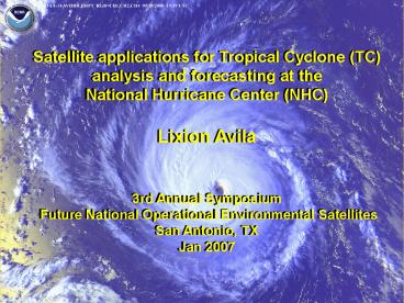
Satellite applications for Tropical Cyclone (TC)
analysis and forecasting at the National
Hurricane Center (NHC) Lixion Avila 3rd Annual
Symposium Future National Operational
Environmental Satellites San Antonio, TX Jan 2007
2
Satellite applications for TC analysis and
forecasting at the National Hurricane Center
- Senior Hurricane Specialist, NOAA/NHC
1990-Present - Meteorologist, NOAA/NHC 1987-1990
- PhD, Meteorology University of Miami, 1993
- MS, University of Miami 1984
- BS, Meteorology University of Havana, 1973
Lixion Avila, PhD Senior Hurricane
Specialist NOAA/NHC
3
Satellite applications for Tropical Cyclone (TC)
analysis and forecasting at the National
Hurricane Center (NHC) Lixion Avila 3rd Annual
Symposium Future National Operational
Environmental Satellites San Antonio, TX Jan 2007
4
NHC or World Meteorological Organization (WMO)
RSMC MIAMI
Regional/Specialized Meteorological Center
5
Useful websites http//www.fnmoc.navy.mil
http//cimss.ssec.wisc.edu/tropic/tropic.html
6
FORECASTER DILEMMA
- Lack of data over much of oceanic areas
- Inability to accurately assess strength of
tropical waves and circulations
7
Partial
solution Fill in surface wind field data gaps
over large ocean areas with qualitative and
quantitative satellite wind vectors and remotely
sensed wind data from microwave satellite
imagery Note while satellite low-cloud wind
drift data is available every 3 to 6 h, this
data is usually centered at least 3,000 ft/1000 m
above the ocean surface at the top of the
boundary layer
8
Monitoring the Atlantic, Caribbean Sea, Gulf of
Mexico and Pacific by satellite
9
(No Transcript)
10
Dvorak Technique
- Tropical cyclones have characteristic evolutions
of cloud patterns that correspond to stages of
development and certain intensities
11
Developing Cloud Patterns
Katrina (2005)
Rita (2005)
Rita (2005)
Katrina (2005)
12
Weakening Cloud Patterns
13
Dvorak Technique Output
Note Other warning centers and basins use
different pressures and wind averaging periods
14
Objective Dvorak Technique
- Automated pattern matching technique developed at
the Cooperative Institute for Meteorological
Satellite Studies at the University of Wisconsin - Generally run on 30 min interval imagery
- Algorithm includes all the Dvorak technique cloud
patterns and most of the rules - Works best on TCs with eyes, but can be used on
less-developed systems starting with disturbances
Katrina (2005)
Rita (2005)
http//cimss.ssec.wisc.edu/tropic/odt/
15
Where is the center?
16
Well-defined mid-level eye
17
0430 UTC 27 August 2004 GOES-10 IR
18
(No Transcript)
19
Tropical Prediction Center (TPC) Primary Use of
Scatterometer Wind Data
- Used in high seas forecasts
- Used to verify (or initiate) gale or storm
warnings - Used for identification of tropical waves,
fronts, and other sub-synoptic scale
circulations. - Used to help identify developing surface cyclonic
circulations and to upgrade tropical
waves/tropical disturbance to tropical depression
strength - Used to help identify radius of 34-kt winds
associated with TCs
20
- ZCZC MIATCDAT3 ALL TTAA00 KNHC DDHHMM
- HURRICANE HELENE SPECIAL DISCUSSION NUMBER
45 - NWS TPC/NATIONAL HURRICANE CENTER MIAMI FL
AL082006 - 800 AM EDT SAT SEP 23 2006
- THIS SPECIAL ADVISORY IS BEING ISSUED TO
UPDATE THE INITIAL AND FORECAST INTENSITY AND
WIND RADII FOR HELENE. THE TRACK FORECAST IS
UNCHANGED FROM THE PREVIOUS ADVISORY. A RECENT
QUIKSCAT PASS INDICATES THAT HELENE CONTAINS A
LARGE AREA OF HURRICANE FORCE WINDS SOUTHWEST OF
THE CENTER. THE ADVISORY INTENSITY OF 80 KT IS
BASED ON THE STRONGEST WIND IN THE QUIKSCAT
DATA...WHICH WAS OUTSIDE OF DEEP CONVECTION IN
THE SOUTHWEST QUADRANT. THE WIND RADII HAVE BEEN
EXPANDED ALSO BASED ON THE QUIKSCAT DATA.
Quikscat wind vectors
21
Hurricane Helene 545 AM EDT 23 Sep, 2006
22
(No Transcript)
23
Gulf of Tehuantepec gale area
24
Derived Products
25
(No Transcript)
26
L
27
(No Transcript)
28
Shear analysis
29
Shear tendency
30
SST Before Hurricane Dennis
July 8, 2005 0200 UTC
31
Hurricane Dennis Cool Wake
July 11, 2005 1400 UTC
32
SAHARAN DUST LAYER EASTERLY SURGE
33
Advanced Microwave Sounder Unit (AMSU)
Applications
- Temperature/moisture information for NWP
- Tropical cyclone retrieval algorithms developed
by CIRA and CIMSS - TC Warm core from AMSU provides intensity and
wind radii estimates - Complements Dvorak technique and QuikSCAT
T anomaly measured by AMSU for Hurricane Rita
(2005)
34
Future Satellite Data for Hurricane Prediction
- Next generation NOAA geostationary data (GOES-R)
- Advanced baseline imager
- Many new channels
- Improved spatial and temporal resolution
- Improved feature tracked winds
- Lightning mapper
- Next generation NOAA polar orbiting data (NPOESS)
- Advanced Imager (VIIRS)
- Hyperspectral IR sounder (CrIS)
- Advanced technology microwave sounder (ATMS)
- Possible microwave imager (MIS)
35
Hyperspectral IR Sounders
- Currently available from AIRS on AQUA
- Soon to be available on Met-Op (IASI)
- Planned for NPOESS
- Will provide vastly improved vertical resolution
for temperature and moisture soundings
36
Moisture Weighting Functions for Current GOES
and Typical Hyperspectral IR sounder
(From T. Schmit, CIMSS)
37
Hurricane Eye Soundings
- Combined IR and Microwave retrievals can provide
hurricane eye sounding - ATMS/CrIS on NPOESS
- Algorithm being tested using AIRS/AMSU
- 4 from Isabel 2003 (large eye)
IPO/IGS project to NESDIS/ORA
38
Hurricane Isabel (2003) Cases with AIRS/AMSU Eye
Soundings
39
Temperature AnomaliesFrom AIRS/AMSU Soundings
40
Minimum Pressure From AIRS/AMSU Sounding
Integration compared to Recon
41
(No Transcript)
42
THANKS


