Arcobject PowerPoint PPT Presentations
All Time
Recommended
So you need to start using ArcGIS, eh? ... ArcObject
| PowerPoint PPT presentation | free to download
Wow that's pretty obvious. What did they do before? Answer: Functional programming ... Microsoft lackey who wrote the Wikipedia article on Component Object Model ...
| PowerPoint PPT presentation | free to view
End Sub. Envelopes are the rectangular window that contain a specific element. ... In the Module 1 module, create a Sub procedure with the code such as the ...
| PowerPoint PPT presentation | free to view
Code organized in Procedures a procedure includes instructions. ... macro and click Run (make sure your macro settings is in Normal) (Alt F8) ...
| PowerPoint PPT presentation | free to view
... money and not a technician.. Logon to monster.com and type 'GIS programmer' ... http://jobsearch.monster.com/getjob.asp?JobID=25991128&AVSDM=2004-12-30 10 ...
| PowerPoint PPT presentation | free to view
Chief Cartographer. Virginia Economic Development Partnership. 2006 Virginia GIS Conference ... Application finds polygon and zooms to it. ...
| PowerPoint PPT presentation | free to view
As background, here is is a list: ArcGIS Desktop the collection of ESRI desktop applications. ... ArcMap ArcMap is the central application in ArcGIS Desktop. ...
| PowerPoint PPT presentation | free to view
Using ArcObjects and the ArcGIS Hydro Data Model in Application Development Tom Heinzer Chemical Engineer, GIS Developer U. S. Bureau of Reclamation
| PowerPoint PPT presentation | free to view
... new fields in attribute table ... the correct object model diagram (for creating a new field) ... Set thefeature = thefeaturecursor.NextFeature. Wend ...
| PowerPoint PPT presentation | free to view
Used for query and to hook up custom analysis functions. 15. Visualizing Raster data ... Can create custom renderers. 16. Georeferencing a Raster. Using ArcObjects: ...
| PowerPoint PPT presentation | free to view
ArcObject, VBA, COM and Custom Interfaces. Why Do We Want to Program GIS ... It is possible to create a custom interface but this is now easier with ArcObjects. ...
| PowerPoint PPT presentation | free to view
Title: PowerPoint Presentation Last modified by: hongjie.xie Created Date: 1/1/1601 12:00:00 AM Document presentation format: On-screen Show Other titles
| PowerPoint PPT presentation | free to download
Does not work in your computer. Add the toolbox. Create a new geoprocessor ... Final format: all values are stored at one *.txt file. Study Area. Exploring more ArcGIS ...
| PowerPoint PPT presentation | free to download
Title: 1. Intriduction to Java Programming for Beginners, Novices, Geographers and Complete Idiots Author: Stan Openshaw Last modified by: Linus Created Date
| PowerPoint PPT presentation | free to download
Title: 1. Intriduction to Java Programming for Beginners, Novices, Geographers and Complete Idiots Author: Stan Openshaw Last modified by: Andrew Evans
| PowerPoint PPT presentation | free to download
Extensions Classes that extend Arc functionality Custom feature renderers Custom geoprocessing tools : ... Combine other tools Installing Jar file placed in ...
| PowerPoint PPT presentation | free to download
... model correct for electrical engineering that enhances the ... WindMilMap teaches ArcGIS to use the electrical-engineering-quality Milsoft circuit model ...
| PowerPoint PPT presentation | free to view
Major upgrade. ESRI s what s new 177 pages! http://help.arcgis.com/en/arcgisdesktop/10.0/pdf/whats_new_in_arcgis_10.pdf. 1.) Direct support for PDS and ...
| PowerPoint PPT presentation | free to download
What types of geoprocessing tasks do you currently, or plan to, run in the ... 2-D and 3-D symbolization, numerical statistics, querys, labeling and annotation, ...
| PowerPoint PPT presentation | free to view
3D Analyst: An Introduction Jinwu Ma Deepinder Deol
| PowerPoint PPT presentation | free to download
Modelowanie hydrologiczne z wykorzystaniem technik teledetekcji Tomasz Berezowski Jaros aw Chorma ski Katedra In ynierii Wodnej, Szko a G wna Gospodarstwa ...
| PowerPoint PPT presentation | free to view
Configuration. Configuration on ArcGIS Server can be programmatic using IGeoPDFConfig. Configuration can occur via MAP2PDF for ArcGIS using stored and served .mxd ...
| PowerPoint PPT presentation | free to view
... GIS data collection and update,' Photogrammetric Week '99. Fritsch and R. ... from scanned thematic maps ,' Photogrammetric Engineering and Remote Sensing. ...
| PowerPoint PPT presentation | free to view
Engineers. Fees. Public Hearings. Fee Study ... VB. Methodology I ... Commercial-Industrial 3. Hotel or corporate office user chooses 4 or 5. Government Use 6 ...
| PowerPoint PPT presentation | free to view
XML Survey Document. Client ... This document can either be displayed to the screen or stylized to create a table. ... Co-ordinate Conversion ...
| PowerPoint PPT presentation | free to view
Automating Geodatabase Creation Through Model Builder Russell Brennan Geodatabase Product Engineer Ian Wittenmyer Holistic Test Product Engineer
| PowerPoint PPT presentation | free to download
Final exam - June 10th, 8:00-10:00 p.m. Grading. ArcGIS exercise (lab 1) - 10% Mid-Term - 25 ... expect bugs. First labs in ArcGIS ...
| PowerPoint PPT presentation | free to view
* * * * * * * * * * * * * * * * * * * * * * * * * Fine Tuning Locators Multiple Tables (continued) Locator style can be found in Esri Resource Center http ...
| PowerPoint PPT presentation | free to download
Esri International User Conference July 23 27 | San Diego Convention Center Python Map Automation Introduction to arcpy.mapping Michael Grossman
| PowerPoint PPT presentation | free to download
Digital Mapping Techniques 04 MIGRATING FROM ARCINFO WORKSTATION TO ARCGIS By Vic Dohar, Natural Resources Canada Scope Managing datasets in a map production ...
| PowerPoint PPT presentation | free to download
Building Map Books in ArcGIS Jeff Barrette Tom Bole Jeff Moulds ... strip maps, or feature based Use DDP or arcpy.mapping Types of Map Books (cont.) ...
| PowerPoint PPT presentation | free to download
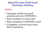
Raster calculation of wetness index. Raster calculation of TOPMODEL runoff ... Relative wetness at a point and depth to water table is determined by comparing ...
| PowerPoint PPT presentation | free to download
Arc: Getting Layers Dr Andy Evans
| PowerPoint PPT presentation | free to download
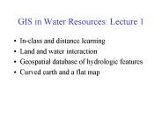
GIS in Water Resources Consortium GIS Water Resources CRWR David R. Maidment, University of Texas at Austin Dean Djokic, Environmental Systems Research Institute (ESRI)
| PowerPoint PPT presentation | free to download
Title: No Slide Title Author: maidment Last modified by: David R. Maidment Created Date: 6/30/1998 9:37:06 PM Document presentation format: On-screen Show
| PowerPoint PPT presentation | free to download
ArcMap Tool for Pre-processing SSURGO Soil Database for ArcSWAT Aleksey Sheshukov Prasad Daggupati Ming-Chieh Lee Kyle Douglas-Mankin Biological and Agricultural ...
| PowerPoint PPT presentation | free to download
Title: StreamStats National Implementation Plan Author: mnorris Last modified by: jdguthrie-pr Created Date: 4/3/2006 6:56:36 PM Document presentation format
| PowerPoint PPT presentation | free to download
Michael Young ESRI Senior Enterprise Architect Certified Information Systems Security Professional (CISSP) Version 1.2 Current Security Trends Recent Survey s ...
| PowerPoint PPT presentation | free to download
Powerful servers for data retrieval and batch processing. High capacity networks ... Servers: database, geoprocessing, web, terminal ...
| PowerPoint PPT presentation | free to download
Dissertation Defense. Turning Information into Action: Assessing and Reporting ... Increasing schism between data creation and its assessment ...
| PowerPoint PPT presentation | free to view
Conduct intelligence ops for commanders & decision makers ... Opus aircraft waypoints. Pg 9 of xx. AGI. www.agi.com. Netcentric geospatial intel sharing ...
| PowerPoint PPT presentation | free to view
Arc Hydro: GIS for Water Resources David R. Maidment University of Texas at Austin Arc Hydro Culmination of a 3-yr effort GIS in Water Resources Consortium
| PowerPoint PPT presentation | free to view
Obtain feedback on Arc Hydrology Data Model ... Source: Naiman and Bilby 'River Ecology and Management' Fig. 5.2, 1998. Riparian zone ...
| PowerPoint PPT presentation | free to view
Developing a GIS Portal Using the Flex API
| PowerPoint PPT presentation | free to view
ArcMap Tool for Pre-processing SSURGO Soil Database for ArcSWAT Aleksey Sheshukov Prasad Daggupati Ming-Chieh Lee Kyle Douglas-Mankin Biological and Agricultural ...
| PowerPoint PPT presentation | free to download
But provides only the basic control structure, mathematical operators, string ... Usually developed in MS Visual C , MS Visual Basic and Java ...
| PowerPoint PPT presentation | free to view
... K. Laurenson, C.D. FitzGibbon, D.A. Collins, S.M. Durant, G.W. Frame, B.C.R. ... Centre for Northern Forest Ecosystem Research, Thunder Bay, Ontario, Canada. ...
| PowerPoint PPT presentation | free to view
Efficient Transportation Decision Making Environmental Screening Tool ... services in planning, compliance, engineering, environmental and social sciences. ...
| PowerPoint PPT presentation | free to view
... box that appears, specify Chapter One Examples as the name of the new toolbar ... Types of map surrounds include Legends, NorthArrows, and ScaleBars. ...
| PowerPoint PPT presentation | free to download
Analysis and Geoprocessing Network Analyst Automating Workflows with Geoprocessing Deelesh Mandloi Patrick Stevens ...
| PowerPoint PPT presentation | free to download
Network connectivity, spatial distribution of population, capacity at ... Arlington, Virginia, United States, Society for Industrial and Applied Mathematics. ...
| PowerPoint PPT presentation | free to view
Visual Basic Programming of simple grid calculations. TauDEM Software Functionality ... Visual Basic for the GUI and ArcGIS linkage. Private TarDEM As New tkTauDEM ...
| PowerPoint PPT presentation | free to view
Explore rather than open to avoid autoinstallation of ArcGIS. In Python folder. ... single or double-quotes enclose string chars. name = moose_locations' type = '.shp' ...
| PowerPoint PPT presentation | free to view
IKONOS World Imagery Updates Project Scope 50 million sq. km. of imagery Select Best Of 2 million IKONOS scene archive Select - Ortho - Color Balance ...
| PowerPoint PPT presentation | free to download
StreamStats Data Prep Workshop Oct 21-22, 2003. Page 6-2. Managing large image collections ... StreamStats Data Prep Workshop Oct 21-22, 2003. Page 6-10 ...
| PowerPoint PPT presentation | free to download
Example: temperature, rainfall, Ozone, Housing price. ... Temperature distribution change raptly along with train loop. 30000 loops R2 = 0.3686 ...
| PowerPoint PPT presentation | free to view


