Geohazards PowerPoint PPT Presentations
All Time
Recommended
Geohazards List as many geohazards as you can Which geohazards are related to plate boundaries ? Which geohazards are related to plate boundaries ?
| PowerPoint PPT presentation | free to view
Issues in volcanoes. To know the structure of the magmatic plumbing system. ... Will precursors for 'super-volcano' eruptions be similar ? ...
| PowerPoint PPT presentation | free to view
... your WebCT ID (first initial of your first name and your last ... 1 for an example of introducing natural disasters. ... references used ( APA-format). Links are ...
| PowerPoint PPT presentation | free to view
satellite, in-situ and airborne data that is used for Geohazard mitigation ... in-field measurements building on already extensive work on satellite based data ...
| PowerPoint PPT presentation | free to view
... and magnitude of the shock and the timeframe (in days) of aftershocks. ... Commence capacity building through IGOS. Develop GARS as implementation mechanism ...
| PowerPoint PPT presentation | free to view
Local civil protection officials often have no experience with earthquake ... by international rescue agencies, until a day later, when help comes too late. ...
| PowerPoint PPT presentation | free to view
The Global Geodetic Observing System GGOS and how it relates to IGOS Geohazards International Associ
| PowerPoint PPT presentation | free to view
The Global Geodetic Observing System GGOS and how it relates to IGOS Geohazards International Associ
| PowerPoint PPT presentation | free to view
Magnetic Observatories Jeffrey J. Love Carol A. Finn Jennifer L. Gannon Geomagnetism Program GeoHazards Science Center geomag.usgs.gov Real-Time Dst Deadhorse ...
| PowerPoint PPT presentation | free to download
A2.2GZ2 Environmental Geology GEOHAZARDS SUMMARY Introduction Ground instability Seismicity Groundwater rebound Underground gas including Methane Hydrates Tsunamis ...
| PowerPoint PPT presentation | free to view
GEOSS: Services Supporting Hazard Assessments and Disaster Reduction Hans-Peter Plag(1), Francesco Gaetani(2), Stuart Marsh(1) (1) Co-Chair, Geohazards Community of ...
| PowerPoint PPT presentation | free to download
National Cheng Kung University. International Symposium on. Geohazards ... Cemented Behavior of Hydraulic Fill Materials. J.W. Chen, Department of Civil Eng. ...
| PowerPoint PPT presentation | free to view
Giorgio Cesari, Italian Agency for Environment - APAT. David Kendall , ... oceans, water, geohazards, carbon, coral reefs, coastal zone, atmospheric chemistry ...
| PowerPoint PPT presentation | free to view
National Cheng Kung University. International Symposium on. Geohazards Mitigation ... Cemented Behavior of Hydraulic Fill Materials. J.W. Chen, Department of ...
| PowerPoint PPT presentation | free to view
Are Building Codes Consistent with our Knowledge of Geohazards? Shelley Jules-Plag & Hans - Peter Plag Potential (Geo)hazards Tsunami Inundation (coastal) Earthquakes ...
| PowerPoint PPT presentation | free to download
Competence in observing and monitoring geohazards with the aim to reduce ... Create and maintain a catalogue of available tutorials and training ...
| PowerPoint PPT presentation | free to view
Engineers practice the art of problem solving to serve ... Three Biaxial Shake Tables. University of Nevada, Reno. Geotechnical and GeoHazards Engineering ...
| PowerPoint PPT presentation | free to view
Subsea Systems Flow Assurance ... Pipeline / Riser systems Project Services CAD Project Managers Project Controls Survey/Geohazards Subsea Hardware and Structures
| PowerPoint PPT presentation | free to download
Scientific targets and hydrocarbon industry relevance. Focused fluid flow systems ... Implications and recent advances ... Methane hydrate (clathrate) ...
| PowerPoint PPT presentation | free to download
Why is scientific work in geohazard important - where does Geohazard fit in ... Gas chimney. Wave generation. Earth-quake. Focus on underwater slope stability ...
| PowerPoint PPT presentation | free to view
Seabed Mapping Technology and Ocean Management
| PowerPoint PPT presentation | free to view
From EMT History to Disaster Medicine Wang, Tzong-Luen, MD, PhD Shin-Kong Wu Ho-Su Memorial Hospital Taiwan Society of Disaster Medicine EMT History CPR ...
| PowerPoint PPT presentation | free to download
the Magellan Seamount Trail
| PowerPoint PPT presentation | free to download
Department of Mines, Minerals and Energy Division of Mineral Resources Virginia s geological survey since 1835 Key Responsibilities Geologic Mapping Mineral ...
| PowerPoint PPT presentation | free to view
Research is presently underway a the Center for Marine Resources and ... The Gulf of Mexico Resource Evaluation section has reprocessed 3-D seismic data to look at ...
| PowerPoint PPT presentation | free to view
Space Geodesy Division, Korea Astronomy and Space Science Institute, ... Nevada Geodetic Laboratory, University of Nevada, Reno, USA - GGOS: A Brief Introduction ...
| PowerPoint PPT presentation | free to download
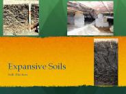
Expansive Soils Sally Blackner What are Expansive Soils? Vertisol Soils, or known as Shrink Swell Soils The Soil contracts due to its clay minerals and the structure ...
| PowerPoint PPT presentation | free to download
Ocean Sediments Importance of Sediments Economic Value Oil, fossil fuels Salt & Phosphorus deposits Determine shape & structure of Ocean bottom Strongly affect ...
| PowerPoint PPT presentation | free to download
PRIMIJENJENA GEOLOGIJA Prof.dr.sc. Blanka Cvetko Te ovi (Geolo ko-paleontolo ki zavod, soba 019) 2 sata - predavanja ( etvrtak, 12-14h) 1 sat - seminar ...
| PowerPoint PPT presentation | free to download
Research in Norway - Research Strategy for North America Hans M Borchgrevink MD MHA Senior adviser The Research Council of Norway
| PowerPoint PPT presentation | free to view
Slide 1 ... Natural Hazards
| PowerPoint PPT presentation | free to download
Seismic Eruption forecasting future earthquakes
| PowerPoint PPT presentation | free to download
More Data Center Tools Rick Benson IRIS DMC
| PowerPoint PPT presentation | free to download
Learning and innovation; through plan or market? Presentation by Knut Halvorsen Manager Oslo Teknopol IKS Osloregion as a learning region Sentrum Kongress og Scene
| PowerPoint PPT presentation | free to download
Worldwide association of oil and gas producers ... Meteorology & Oceanography (Metocean) Standards. Legal & Insurance. European Union (EUC) ...
| PowerPoint PPT presentation | free to view
An Introduction to Seismic Eruption software and an associated classroom activity ... Barker, J. (2005) Student-centered experiments with earthquake occurrence data. ...
| PowerPoint PPT presentation | free to download
Status and Future of Petroleum Research by Siri Helle Friedemann Program coordinator Olje og gass , RCN shf@forskningsradet.no FORCE seminar at NPD
| PowerPoint PPT presentation | free to view
Jeffrey Reid -- Minerals and Geographic Info. Systems ... Amy Keyworth Geological Technician II. Section Budget. Fund Sources. Appropriations $744,911 ...
| PowerPoint PPT presentation | free to view
Meeting Baker Hughes-NTNU Ingvald Str mmen Dean of Engineering Science and Technology, NTNU Shaping the future NTNU has shaped Norway. The technological and ...
| PowerPoint PPT presentation | free to download
JR 500 series bullet train can reach peak speed of 300 km/hr Existing Early Warning Systems UrEDAS SAS (Mexico) Taiwan (EWS) REIS (NIED, JMA) ...
| PowerPoint PPT presentation | free to download
... A PRE-SELECTED FLUID INSIDE THE WELLBORE' TO CONTROL THE PRESSURES OF THE ... OVER 100 WELLS TO DATE, ONE IN DEEP WATER HAS PROVEN UBD CAN BE SAFELY PRACTICED ...
| PowerPoint PPT presentation | free to view
5000 employees of which 3000 are academic staff. Rated 3rd (2nd) amongst the Nordic ... Dentistry. Social Sciences. Education. About 70 academic units ...
| PowerPoint PPT presentation | free to view
Forecasting Earthquakes Difference between Predictions and Forecasts Earlier Efforts in Earthquake Prediction Long-term Probability Estimates
| PowerPoint PPT presentation | free to download
50cm Forested or steep terrain. The only RS device to record multiple layers. Can record bare earth or vegetation layers. Mostly airborne but some spaceborne ...
| PowerPoint PPT presentation | free to view
... level-specific, in developing countries as much as in the developed world ... Use existing tutorials (e.g. RRCC www.cla.sc.edu/geog/rslab/rsccnew ...
| PowerPoint PPT presentation | free to view
We collect information about the weather and snow stability in the area. ... Phase 1 will have a yurt for a base area and two overnight huts ...
| PowerPoint PPT presentation | free to view
Nuclear Magnetic Resonance Permeability Estimation in Fine-Grained Sediments ... Synthetic samples -Measurement and quantification of permeability anisotropy ...
| PowerPoint PPT presentation | free to view
Medieval studies. Theoretical linguistics. Petroleum research ... Stem cell based. tumor therapy. Marine bioactives and drug discovery. Industrial. measurement ...
| PowerPoint PPT presentation | free to download
Concept & ESA Trial Geohazard objectives / requirements GEO Geohazard Members ... ICL International Association of Seismology and Physics of the Earth's Interior , ...
| PowerPoint PPT presentation | free to download
Computational Geodynamics and Earthquake Prediction
| PowerPoint PPT presentation | free to view
... for GSC was launched Important work was undertaken on the development and the accessibility of key ESS datasets e.g. geochronology and marine geoscience ...
| PowerPoint PPT presentation | free to download
Title: PowerPoint Author: mori Last modified by: choy Created Date: 4/27/2004 1:07:47 AM Document presentation format
| PowerPoint PPT presentation | free to download
... ( Hydrometeorological hazard) Extreme precipitation events and/or river flooding Coastal ... water allocations between stakeholders within ...
| PowerPoint PPT presentation | free to download
The Pleistocene / Holocene boundary in Amvrakikos Gulf seems to be a gas ... Holocene / Pleistocene boundary (HOL/PL); Enhanced Reflector (ER); Gas Plume (GP) ...
| PowerPoint PPT presentation | free to view


