Metocean PowerPoint PPT Presentations
All Time
Recommended
WAVES IN HURRICANE BONNIE. Scanning Radar Altimeter (NASA) North Panel. All panels: ~6x1 km. Extreme Met/Ocean Events. First measurements of the full wavefield in ...
| PowerPoint PPT presentation | free to view
Worldwide association of oil and gas producers ... Meteorology & Oceanography (Metocean) Standards. Legal & Insurance. European Union (EUC) ...
| PowerPoint PPT presentation | free to view
Ice mass balance buoy network: Coordination with DAMOCLES. Jackie Richter-Menge ... Collocate with atmosphere and ocean sensors. Technology transfer (MetOcean) ...
| PowerPoint PPT presentation | free to view
Yucatan Straits. U. Colorado Modeling. Numerous data sharing. TAMU reanalysis. Navy access ... Wave decay & breaking in shallow water? Rogue waves (Hmax/Hs) ...
| PowerPoint PPT presentation | free to view
Development of ISO 19900 series of offshore structures standards. Hurricanes. Ivan ... industry trend to give lower credence to industry standards than national or ...
| PowerPoint PPT presentation | free to view
Altimeter (Topex, etc.) Wave heights. Loop Current (Gulf of Mex.) Scatterometer - winds ... Indicates existing site, future site, Shell site ...
| PowerPoint PPT presentation | free to view
... Seismic Design RP 2GEO/ISO 19901-4 - Geotechnical * Developed by Parallel ISO/API Adoption process ... Marine Operations RP 2N 2nd Ed./ISO 19906 ...
| PowerPoint PPT presentation | free to view
The global marine telematics market was valued at $6.80 million in 2018, and is projected to reach $29.95 million by 2026, registering a CAGR of 21.3% from 2019 to 2026.
| PowerPoint PPT presentation | free to download
Peter Niiler and William Scuba, Scripps Institution of Oceanography. Andy Sybrandy, PacificGyre ... CBLAST Hurricane Science Meeting, Miami, April 2005 ...
| PowerPoint PPT presentation | free to view
Involving Inventors in the Technology Transfer Process
| PowerPoint PPT presentation | free to view
Hydrocarbons Recovery. Oil Exploration. Pipelines, Corrosion and Materials. Hydrocarbon Production Assurance. Processes and Reactors. Applied Mathematics and ...
| PowerPoint PPT presentation | free to view
According to the latest research report by IMARC Group, The global marine telematics market size reached US$ 16.5 Million in 2023. Looking forward, IMARC Group expects the market to reach US$ 76.4 Million by 2032, exhibiting a growth rate (CAGR) of 17.98% during 2024-2032. More Info:- https://www.imarcgroup.com/marine-telematics-market
| PowerPoint PPT presentation | free to download
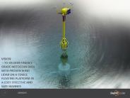
SeaZephIR Stability and testing. Lateral acceleration of the order of 0.3 g. with vertical accelerations of 0.1 g . Less than 5 Degrees heel 95% of the time
| PowerPoint PPT presentation | free to download
The different aspects of data on the market critical data are showcased intellectually through resources such as infographics, charts, and tables.
| PowerPoint PPT presentation | free to download
Coastal Land Loss and WaveSurge Prediction During Hurricanes in SouthCentral Louisiana: Implications
| PowerPoint PPT presentation | free to view
According to the latest research report by IMARC Group, The global marine telematics market size reached US$ 13.71 Million in 2022. Looking forward, IMARC Group expects the market to reach US$ 41.76 Million by 2028, exhibiting a growth rate (CAGR) of 20.60% during 2023-2028. More Info:- https://www.imarcgroup.com/marine-telematics-market
| PowerPoint PPT presentation | free to download
The Industry plans to install a lot of subsea equipment over the next decade. ... At 20m/min winch payout and 10m/min recovery speeds it takes 5 hours to deploy ...
| PowerPoint PPT presentation | free to view
The report discovers the market’s total sale that is generated by a particular firm over a time period.
| PowerPoint PPT presentation | free to download
Evolution of a. Coastal Ocean Observing System. LEO-15 LEO NJSOS ... Data Sharing: Hourly Radial Data Files via ftp. Products: Discretion of Individual Institutions ...
| PowerPoint PPT presentation | free to download
Sable Offshore Energy Project. 150 km. St. John. Hibernia ... Sable Offshore Energy Platforms. Sable Thebaud Central Facility. Deep Panuke Facilities Design ...
| PowerPoint PPT presentation | free to view
... P F* Q! ... 456789:CDEFGHIJSTUVWXYZcdefghijstuvwxyz GpSs tFTO ...
| PowerPoint PPT presentation | free to view
Scroby Sands Offshore Wind Farm Update 18 April 2002 Anne-marie Coyle Scroby Sands Update Scroby Sands Update Scroby Sands Update Scroby Sands Upadte Scroby Sands ...
| PowerPoint PPT presentation | free to view
New Jersey Shelf Observing System NJSOS
| PowerPoint PPT presentation | free to download
Create a SAR case when alerted. Gather data, estimate uncertainties ... Promulgate the search plan. Perform the search plan. Evaluate the completed search ...
| PowerPoint PPT presentation | free to view
Three, 'pancake ice' buoys deployed. Latitudes between 700N and 720N (1200W) ... 8 Messages / buoy / day. 9 buoy-months of data (so far) ~2000 messages in total ...
| PowerPoint PPT presentation | free to view
rtd-pasr@cec.eu.int. SUSTAINABLE DEVELOPMENT, GLOBAL CHANGE AND ECOSYSTEMS. 14 ... Tobias Fuchs, email: tobias-berthold.fuchs@cec.eu.int. 24 ...
| PowerPoint PPT presentation | free to view
DAP to netCDF Converter. NCO (NC operators) NCDUMP. Other. Programs ... { String Description 'Date/time'; String Timezone 'GMT'; DAP to NETCDF-4 Translation ...
| PowerPoint PPT presentation | free to download
Adopting the ISO 19115 metadata standard for all metadata directories ... Statistical output in NetCDF files, that are visible via WMS. Cross sector involvement ...
| PowerPoint PPT presentation | free to view
Carbon Trust s Offshore Wind Accelerator Driving down the cost of offshore wind Phil de Villiers Offshore Wind Accelerator Manager * * * * * * * Some developers ...
| PowerPoint PPT presentation | free to download
GMES-INSPIRE Collocation Meeting. ESRIN, Frascati, Italy, 8th ... MOTIIVE is an INSPIRE pilot project covering data harmonisation issues in the marine domain ...
| PowerPoint PPT presentation | free to view
... (subsea electrical equipment) ... Experience in design and use of SCADA systems Hydraulic actuators, valves, or other equipment.
| PowerPoint PPT presentation | free to download
MOBILE OFFSHORE BASE (MOB) ONR S&T Program Overview Office of Naval Research Concept Configurations MOB Topics Related to JLOTS Requirements Derivation Operational ...
| PowerPoint PPT presentation | free to view
iso standards for the oil and gas industry (and how it works) discussion points recap of yesterday awareness iso standards iso technical committees for oil and gas ...
| PowerPoint PPT presentation | free to view
iso standards for the oil and gas industry (and how it works) cheryl stark bp houston chair, iso/tc67 discussion points recap of yesterday awareness iso standards ...
| PowerPoint PPT presentation | free to view
JCOMM is organised in 4 programme areas; - observations, data ... challenge to build 'troika' service chains; connecting the forecast production to the target ...
| PowerPoint PPT presentation | free to view
forecasting weather and ice conditions, validation and forcing of climate models, ... 2 Ice Beacons deployed by Enviroment Canada north of Eureka. ...
| PowerPoint PPT presentation | free to view
... obtaining new information about the state of the environment (one cannot discover otherwise) ... Data Fusion information needs to be interpreted (ex: ...
| PowerPoint PPT presentation | free to view
Towards an Arctic
| PowerPoint PPT presentation | free to view
Examples of the use of MERIS data
| PowerPoint PPT presentation | free to view
Engineering Data Integration Across Cultures. DM. CRDL. Commodities. SRDL. Manufactured Items ... ISO TC184/SC4 - Industrial Data. ISO 15926 - Life-Cycle Integration ...
| PowerPoint PPT presentation | free to view
Transition of the GODAE IGST into Operations
| PowerPoint PPT presentation | free to download
Argo Profilers missions, sampling rates, accuracy etc
| PowerPoint PPT presentation | free to download
... 'O'P'Q' w w w w w w w w w w w w w w w w w w w w w w w w w w w w w ... wwwwwwwwwwwwwwwwwwwwwwwwwwwwwaw wGwpwSwsw wtwFwTwOwdwwfwewww wwwww ww ww ww nw ww ...
| PowerPoint PPT presentation | free to download
In Oct. 2003, the Industrial Opportunities Task Force of the ... Geology & Geophysics. Ice Design for Fixed and. Floating Systems. Environment. Offshore Safety ...
| PowerPoint PPT presentation | free to view
Development of a ShelfWide Observatory in the MidAtlantic Bight Oscar Schofield
| PowerPoint PPT presentation | free to download
Martin Fortier, Ph'D'
| PowerPoint PPT presentation | free to view
Acquisition of remotely sensed data depends on the project /mission objectives ... ASTER, or Advanced Spaceborne Thermal Emission and Reflection Radiometer; ...
| PowerPoint PPT presentation | free to view
NOPP project (NOAA-USACE-ONR) starting for improvement of physics in operational ... Modeling Framework (NCAR/CISL, NASA/GMAO, Navy (NRL), NCEP/EMC), NOAA/GFDL ...
| PowerPoint PPT presentation | free to view
Coastal workshop website available (Third announcement ... NOAA (Stan Wilson) contributions to be transferred via IOC expected funds 28,700 ($59,000) ...
| PowerPoint PPT presentation | free to download
by Petroleum Safety Authority Norway (PSA) at the Norwegian Continental Shelf ... 45 Manual fire-fighting and fireman's equipment. III-V ELECTRICAL INSTALLATIONS ...
| PowerPoint PPT presentation | free to view
la adopcion tecnica en pemex de las normas globales iso/iec como factor de xito en la explotacion y transportacion de hidrocarburos en aguas profundas
| PowerPoint PPT presentation | free to view
... of major national marine research institutes and based in 35 countries, ... A scheme of QC flags to be used in SeaDataNet.These flags are for assigning to ...
| PowerPoint PPT presentation | free to view
3 satellite data centres. 3 scientific modelling centres. 2 SMEs experts in software development ... free and open access, no registration required ...
| PowerPoint PPT presentation | free to view


