Zeiler PowerPoint PPT Presentations
All Time
Recommended
... marketing, and professional photography, I have had an extraordinary journey in ... programs, worked as a freelance photographer, and have learned to fly an ...
| PowerPoint PPT presentation | free to view
Clarifai was founded in 2013 by Matthew Zeiler and has been a market leader in artificial intelligence services ever since. For the entire AI lifecycle, the company provides an end-to-end solution for modelling unstructured data. Our cutting-edge image, video, and text recognition solutions are built on the most advanced machine learning platform and are easily accessible via API, device SDK, and on-premise, allowing businesses all over the world to build a new generation of intelligent applications. The company serves a variety of industries and sectors, including aviation, brick and mortar, digital asset management, e-commerce, insurance, manufacturing, media & entertainment, public sector, retail banking, tourism, and others. Furthermore, convolutional neural networks, which Zeiler studied for his PhD, are at the heart of Clarifai's technology.
| PowerPoint PPT presentation | free to download
Owen s Mental Cases Michelle Dow Marcia Kishida IB English SL (days 2/4) Ms. Zeiler Wilfred Owen British soldier in WWI suffered from shell shock (post ...
| PowerPoint PPT presentation | free to download
Hirnnerven-L sionen N. III, N. IV, N. VI Karl Zeiler, Christoph Baumgartner Univ.-Klinik f r Neurologie Wien N. oculomotorius Anatomische Grundlagen (1) Motorische ...
| PowerPoint PPT presentation | free to view
Hirnnerven-L sionen N. IX, N. X, N. XI, N. XII Karl Zeiler, Christoph Baumgartner Univ.-Klinik f r Neurologie Wien N. glossopharyngeus Anatomische Grundlagen ...
| PowerPoint PPT presentation | free to view
Managing GIS Longley Ch. 17 Information Sources Tomlinson, Roger Thinking about GIS: GIS Planning for Managers ESRI Press, 2003 Zeiler, M. Modeling our World: The ...
| PowerPoint PPT presentation | free to download
YEWHI-Study - A Comparison Between Blue Light Filtering and Ultraviolet Light ... B. Neumaier-Ammerer, S. Felke, F. Zeiler, S. Hagen, P. Haas, S. Binder ...
| PowerPoint PPT presentation | free to view
Use AI & Computer Vision to speed full motion video analysis for fast object detection & situational awareness. Use AI to reduce manual video review times. Know More: https://www.clarifai.com/use-cases/full-motion-video-analysis
| PowerPoint PPT presentation | free to download
Clarifai User Generated Content Moderation | Filter Out NSFW Images Use Clarifai for User Generated Content Moderation to protect your brand and online community. Screen images 100x faster with AI-automation.
| PowerPoint PPT presentation | free to download
Military-grade Facial Recognition Software is deployable in the cloud, on premise or at the edge. Clarifai's Face Recognition detects faces in images 100X faster.
| PowerPoint PPT presentation | free to download
National Nutrition Committee Update DES Leadership Forum May 2003 Eleeta Armit RD CDE DES Liaison to NNC earmit@youville.ca Committee Members Dr. Catherine Field ...
| PowerPoint PPT presentation | free to download
Greg Taylor. On September 19, 2003 our club lost a very special person. ... Tiffany. Papp. Greg with Nicole Craker and Tonia. ...
| PowerPoint PPT presentation | free to view
Machine Learning AI Prediction for Computer Vision Look inside your unstructured data with multiple machine learning prediction types.
| PowerPoint PPT presentation | free to download
Machine Learning Workflows pipeline architecture for advanced ensemble modeling and business logic.
| PowerPoint PPT presentation | free to download
Algal blooms are potentially dangerous events ... unnaturally increase these nutrients (Johnson, 2002, Klein, 2004) Plant populations increase (algal bloom ...
| PowerPoint PPT presentation | free to download
Cookbooks- Canada's Everyday Diabetes Choice Recipes by Kathy Younker ... Easy access through www.diabetes.ca. The link is under nutrition. ...
| PowerPoint PPT presentation | free to view
Software 2.0 is transforming the way software is being developed. It is very effective at working with data sources like images, video, text, and audio, and just about all important advancements in these areas have been possible due to Software 2.0 in recent years.
| PowerPoint PPT presentation | free to download
Problem with GIS Data Lots of different, related files Results in data that is: Hard to find and share and of questionable quality Need: Containers for datasets:
| PowerPoint PPT presentation | free to view
Identify gaps in instruction with respect to standards ... Ray Rozycki- rrozycki@pacyber.org. David Watson- dwatson@pacyber.org ...
| PowerPoint PPT presentation | free to view
Computer vision (CV) is a field of computer science that focuses on creating digital models to process, analyze and understand the image and video data. A sub-branch of AI, CV works with training computer systems to understand the visual world.
| PowerPoint PPT presentation | free to download
Machine learning tailors your feed to your precise interests and behavioral patterns. If you use a smartphone, machine learning is what lets you search for keywords in your photo app, allowing the device to know which pictures are of “trees” and which ones are of “cats.”
| PowerPoint PPT presentation | free to download
RISK AND SUSTAINABLE MANAGEMENT GROUP. Choice Modelling and laboratory experiments ... Cumming et al. 1995: hypothetical and real Dichotomous Choices (DC) ...
| PowerPoint PPT presentation | free to view
Built from USGS and National Weather Service data ... Time Series. Hydro Features. Hydro Network. Channel System. Drainage System. ArcGIS Hydro Data Model ...
| PowerPoint PPT presentation | free to download
Final exam - June 10th, 8:00-10:00 p.m. Grading. ArcGIS exercise (lab 1) - 10% Mid-Term - 25 ... expect bugs. First labs in ArcGIS ...
| PowerPoint PPT presentation | free to view
Introduction to DXing and Contesting Summerfest 2004 Austin, Texas Aug 7, 2004
| PowerPoint PPT presentation | free to download
draw a UML diagram, specify relationships, 'behaviors' (4) Match to geodatabase elements ... Human, dog, cat. Graphic courtesy of Maidment et al., ArcHydro team ...
| PowerPoint PPT presentation | free to view
... Glaukom Stark beschleunigte BSG Sepsis Ansprechen auf Kortikoide Klinische Diagnostik Neurologie Ophthalmologie HNO Dermatologie Rheumatologie Ggf. weitere ...
| PowerPoint PPT presentation | free to view
Graphic Vision of Environment Threat in New Orleans Area after Katrina Student: Ke Yang Mentors: Dr. Wendy Zhang, Dr. Ju Chou COMPUTER SCIENCE, COLLEGE OF SCIENCE ...
| PowerPoint PPT presentation | free to download
Interest in crossing boundaries between GIS and Atmospheric Science communities. ... Data retrieval on spatiotemporal characteristics of weather events. ...
| PowerPoint PPT presentation | free to view
what are the basic features needed ... Human, dog, cat. Example: Chicken Object Model ... the class of mountain lions linked to the class of wilderness areas ...
| PowerPoint PPT presentation | free to view
John Smith - human being. Harrison Blvd. - street. Corvallis - city ... an offramp is required if a street and a freeway intersect ...
| PowerPoint PPT presentation | free to view
Or Sacramento, California... Municipal Electrical Utility District ... DB can be extended with additional attributes. Can be joined/related to other DB tables. ...
| PowerPoint PPT presentation | free to download
They were designed to provide simple mathematical framework ... Attempts to influence the anchor (QVC home shopping, etc., 'for you just $59.95'). Advertising! ...
| PowerPoint PPT presentation | free to download
Summerfest 2004 Austin, Texas Aug 7, 2004
| PowerPoint PPT presentation | free to download
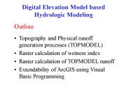
Raster calculation of wetness index. Raster calculation of TOPMODEL runoff ... Relative wetness at a point and depth to water table is determined by comparing ...
| PowerPoint PPT presentation | free to download
Surface of the Earth? 500,000,000 sq km. on average 100 sq m ... Simulated image from NASA's SRTM, Carrizo Plain, S. Calif. The Fading of Digital Earth, v. 1.0 ...
| PowerPoint PPT presentation | free to download
Final exam - June 7th, 6:00-8:00 p.m. Grading. ArcGIS Lab 1 and data model exercise - 10 ... expect bugs. Reworked labs in ArcGIS w/Oregon data ...
| PowerPoint PPT presentation | free to view
GEO 580 Advanced Applications of GIS in the Geosciences Monday/Wednesday 6:00 7:20 p.m. Wilkinson 108 4 credits Dawn Wright dawn@dusk.geo.orst.edu twitter.com ...
| PowerPoint PPT presentation | free to download
Functional Linkage of Watersheds and Streams (FLoWS) ... Typology of watershed-stream relationships ... Calculate Stream Order (Strahler) ...
| PowerPoint PPT presentation | free to download
use your ONID account with password 'temp 123' Use your SCIENCE account ... April 21-22 in Vancouver, WA. www.orurisa.org/events/gisinact/2009event ...
| PowerPoint PPT presentation | free to download
EXCITATION OF GEODESIC ACOUSTIC MODES BY. FINITE BETA DRIFT WAVE ... V. NAULIN AND J. J. RASMUSSEN. ASSOCIATION EURATOM RIS DTU, TECHNICAL UNIVERSITY OF DENMARK, ...
| PowerPoint PPT presentation | free to view
Thoracic and Lumbar Spine Fractures and Dislocations: Assessment and Classification Jim A. Youssef, M.D. Original Authors: Christopher Bono, MD and Mitch Harris, MD ...
| PowerPoint PPT presentation | free to download
Visual Basic Programming of simple grid calculations. TauDEM Software Functionality ... Visual Basic for the GUI and ArcGIS linkage. Private TarDEM As New tkTauDEM ...
| PowerPoint PPT presentation | free to view
... Central Texas DX and Contest Club. Big Gun or Little ... Contest exchange. Integrated 'point-and-shoot' DX cluster operation ... QSOs toward non-contest awards ...
| PowerPoint PPT presentation | free to download
http://www.teachervision.com/tv/resources/technology/evalsoft_chart.html. American web pages ... http://www.zdnet.com/reviews/ ICT5. Exercise. Use the Becta ...
| PowerPoint PPT presentation | free to view
17th IAEA FUSION ENERGY CONFERENCE, YOKOHAMA, JAPAN THEORY SUMMARY
| PowerPoint PPT presentation | free to download
... GIS data collection and update,' Photogrammetric Week '99. Fritsch and R. ... from scanned thematic maps ,' Photogrammetric Engineering and Remote Sensing. ...
| PowerPoint PPT presentation | free to view
... communication among designers, developers, and users ... in a completely rigorous and unambiguous fashion on which both user and GIS analyst agree ...
| PowerPoint PPT presentation | free to download
Lightning Detection: Events & Flashes* 12. Visibility. 2 ... Fire / Hot Spot Characterization. 8. Ice Cover/Landlocked. 2. Land Surface (Skin) Temperature ...
| PowerPoint PPT presentation | free to view
... (40 arc min) detector measuring integral solar EUV flux ... (G/T of 15.2 dB/K), however with ... DVB-S2 link characteristics and compatibility under consideration ...
| PowerPoint PPT presentation | free to download
Don't use a desktop picture. Minimize the number of icons on your desktop. Disable themes ... http://www.microsoft.com/downloads/details.aspx?FamilyID=1b286e6d ...
| PowerPoint PPT presentation | free to view
... SHARE, because they have proved to be of such optimal results in the recent past. ... our collective mind, or an impossible dream that we all aspire to live ...
| PowerPoint PPT presentation | free to view
Determine welfare effects of technological innovation and public policy ... found similar results; The only contrary result is in Jaeger and Harker (2005) ...
| PowerPoint PPT presentation | free to view
What does a burning plasma experiment need from the science of turbulence and transport? ... The transport & turbulence community speaks consistently of a ...
| PowerPoint PPT presentation | free to download
1. GISC 6383 GIS Management and Implementation Dr. Stuart Murchison UT-Dallas ... Dirt flies. concrete poured. Move in. Living there. Maintenance. Home improvements ...
| PowerPoint PPT presentation | free to view
GIS is used to model complexity. full representation of reality? ... representation of information about the process. grid or layer (field) isoline (object) ...
| PowerPoint PPT presentation | free to view


